
II. A pared-down land: the Otago Peninsula
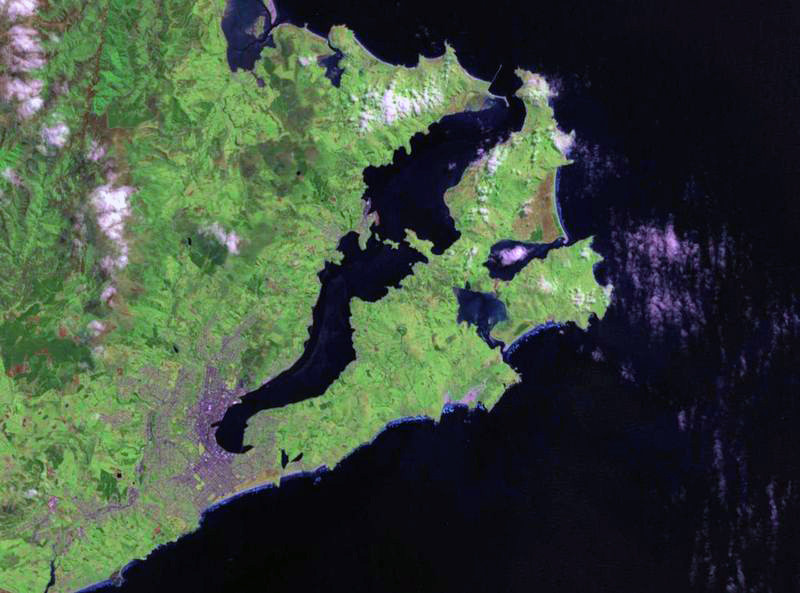
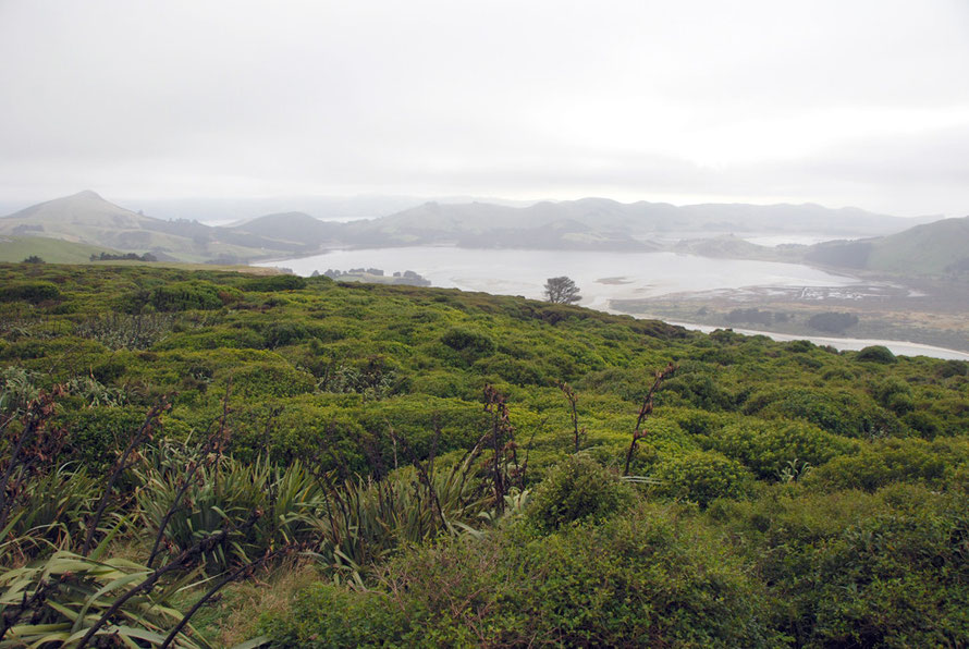
The Otago Peninsula is not really a peninsula because it forms one arm of Otago Harbour by running for 20km parallel to the mainland. It is may be better described as ‘a long, hilly indented finger of land.' Or perhaps, the fat and punctured lower lip of the mouth that surrounds Otago Harbour (see Landsat image above).
Otago Harbour is a flooded valley and Dunedin sits at its western end. Halfway along its the north side is Port Chalmers, Dunedin's container and cruise-liner port.
The Peninsula has a maximum width of 9 km and is joined to by a narrow 1.5 km wide isthmus to the mainland.
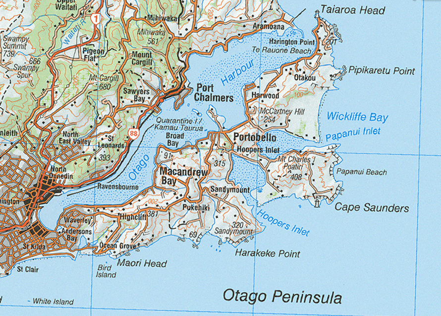
In contrast to much of the east coast of the South Island, which is exposed to the full force of the Pacific and close to main communications routes, the Otago Peninsula is sheltered on its northern side by the Otago Harbour and on the southern side has two deeply-incised narrow-mouthed tidal inlets.
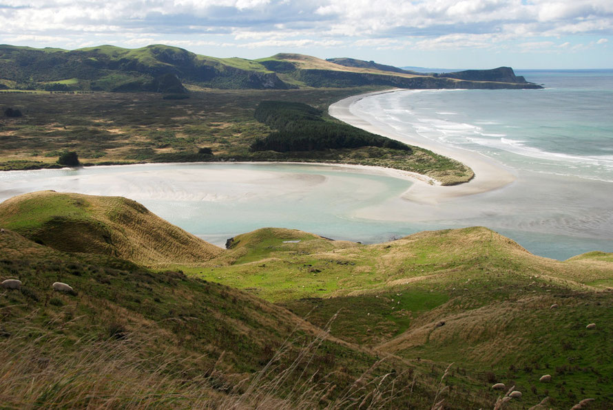
And although close to Dunedin (pop. 127,000) the rugged southern coast beaches and headlands are not easily accessible and are protected by marshland, dunes or steep hills.
This inaccessibility has helped the Peninsula to become a rich haven of marine and estuarine wildlife and, as such, it is sometimes referred to (usually by eco-tourism companies operating on the Peninsula) as the ‘wildlife capital’ of New Zealand.
It packs a lot into a small and now more accessible area and although close to Dunedin is relatively sparsely inhabited, particularly on its southern – Pacific - side.
Ironically, Dunedin was an early centre of the 19th century whaling and sealing industries and the Right Whales that used to calf in the harbour were entirely wiped out. (See my linked page here on the Early Settlement of Otago.)
However, New Zealand Fur Seals and Sea Lions have staged a remarkable comeback and it is now the only continual breeding ground on the New Zealand mainland for sea lions.
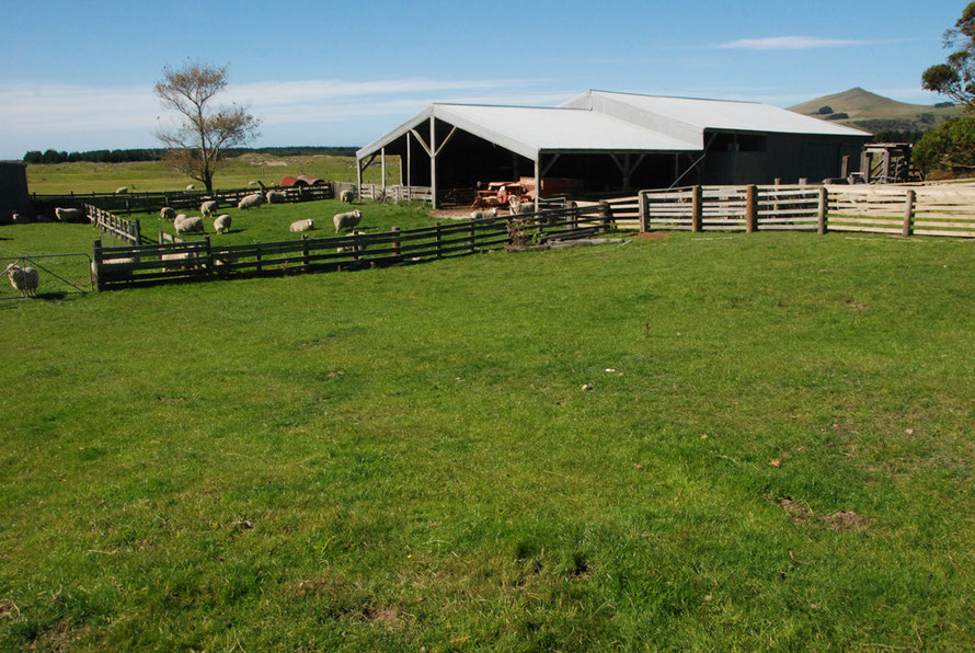
In another strange twist of fate what was once an important, if probably marginal, area of dairy farming suffered as farmers moved away to the richer lands of the newly drained Taieri Plain to the south-west of Dunedin. Sheep replaced cattle on the Peninsula’s steep hill country.
Having first been stripped of its native scrub “the re-made, Europeanised landscape [of the Peninsula] now took on an air of mellow decay, and started to look 'natural'”.
Apparently 'one of the manly sports for city axemen at one time was to visit the Peninsula for tree-felling excursions' (Johnson, 2004, Otago Peninsula Plant List for Save The Otago Peninsula p.8).

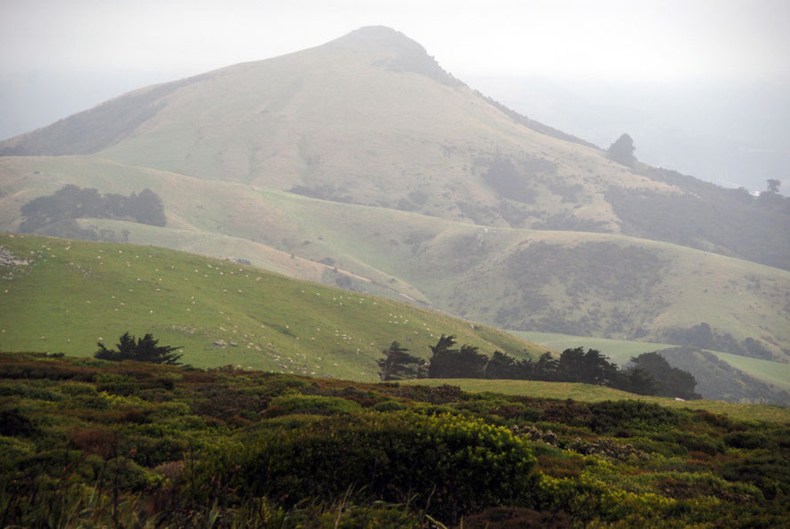
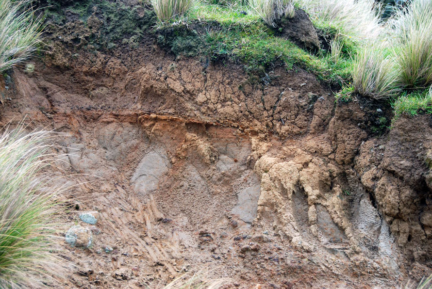
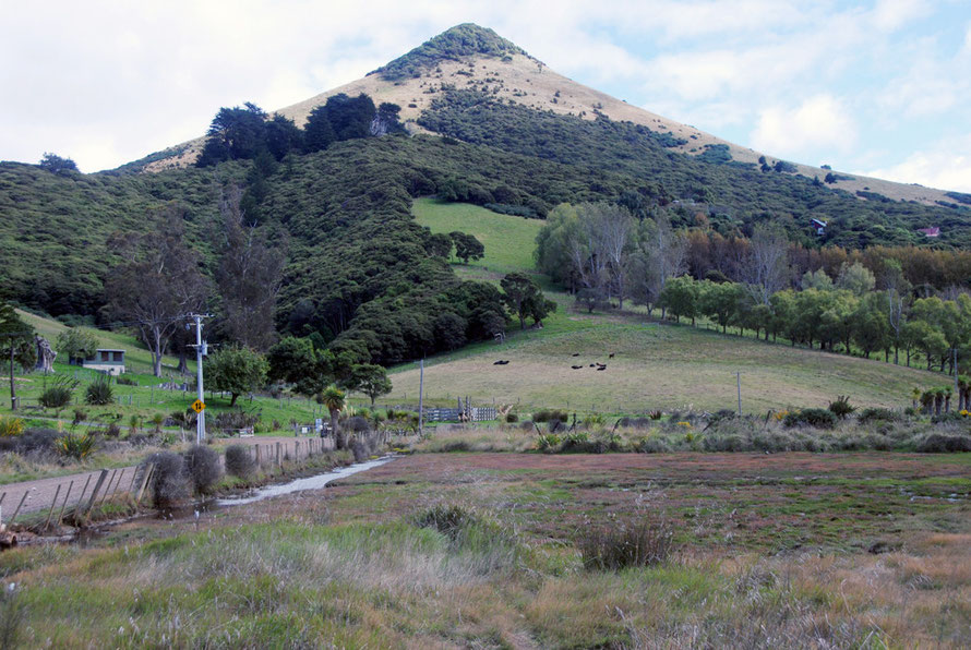
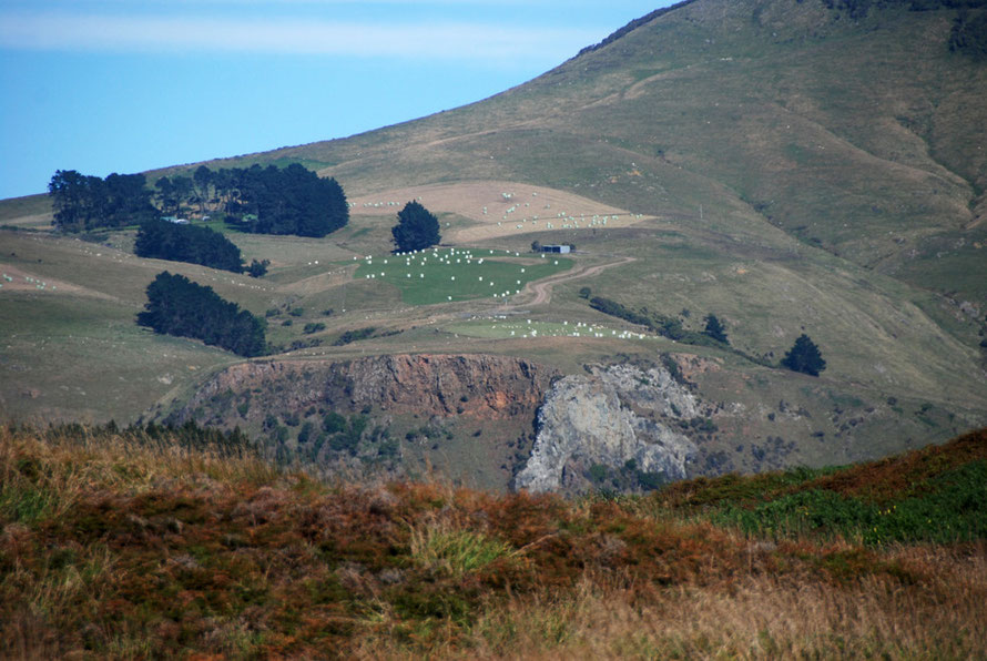
The topography of the Peninsula is based on igneous rock laid down by volcanic activity 10-13 million years ago (MYA). This has been lifted and eroded by tectonic activity, the Ice Ages, rising and falling sea levels and the sea itself. Several volcanic cones and basalt vents are still clearly visible.
Large deposits of sand occur at Nelson Beach and Sandfly beach, the latter having some of the tallest dunes in New Zealand.
Soils on the volcanic rocks are predominantly mafic melanic and are well structured and fertile according to soil maps.
Johnson (2004) says the soils of Otago Peninsula are derived mainly from mixtures of loess and the weathering of volcanic rocks. These materials form unstable hillsides and lead to frequent landslides.
The loess-derived soils, although moderately fertile and mostly deep enough to provide root space for plants, become hard and cracked in dry weather and waterlogged when wet (P. Johnson, 2004, Otago Peninsula Plant List for Save The Otago Peninsula p.7).
The Otago Peninsula is also where Colin McCahon, New Zealand's most celebrated painter, further developed his particular approach to representing the pared-down farming landscapes of New Zealand.
In describing his work, McCahon said, ‘I saw something logical, orderly and beautiful belonging to the land … My work has largely been to communicate this vision and invent a way to see it.’

Elsewhere, talking about 'Takaka: Night and Day' (1948 below) he says that he stripped the valley he was painting of its people, fields and farms to 'uncover the structure of the land' (Auckland Gallery).
The semi-abstract, sculptural quality of both these paintings reminds me of the best Henry Moore sculptures where his reclining bodies are increasingly reminiscent of the features of British chalk landscapes and coasts.

The order and serenity of McCahon's landscapes are reminiscent of bodies asleep, unseeing and at ease with themselves. (Here for the online catalogue to his work.)
One of the things that has struck me about much of the New Zealand landscape is indeed its stripped down nature. That is, its original natural covering has been stripped away through bush clearance and the replacement of indigenous plants by imported European grasses and trees.

The landscape is also often unencumbered or bare of the accretions of a human agricultural presence over time. There simply are no quaint stone farmhouses and farmyards, crutch barns, drovers tracks, ancient hedges, stone walls or centuries old chalk or wetland pastureland.
The skin of the land still seems incredibly new, fragile, prone to slump, slippage and collapse. The farmhouses modest beyond belief, single-storey, formulaic houses surrounded by sheltering imported pines and corrugated iron sheds.
This starkness and simplicity, this lack of a layered human presence is both exciting and dispiriting.
It excites by its apparent lack of ownership; it is not imprinted with the field patterns and landholding rights of an ancient aristocracy or the post-Enclosure exclusion and marginalisation of the rural poor.
It speaks to the 19th century possibility of land ownership by both the downtrodden poor and the buccaneering rich.
But it is also strangely dispiriting because that starkness, the exposing of the underlying structure of the land also represents a narrative of despoliation, of logging-out the great forests, clearing the remnant bush and burning the native tussock to produce the great homogeneity of sheep paddock and dairy land.

And this Europeanisation came at great cost to the indigenous people, themselves only relatively recently arrived with their own narrative of the hunting to extinction of the giant flightless birds (see my page on the Moa) in their many varieties before themselves being deceived out of their land and hounded and decimated by settlement and disease.

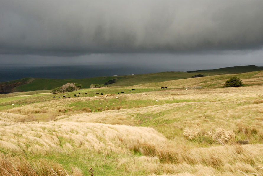
These features all figure large on the Otago Peninsula. In many ways its steep and interlocking green hills reminded me of some of the barer parts of the mid-Wales' borderlands.
Ironically, the peninsula has some of the few field stone-walls in New Zealand which of course soon became hideously expensive in terms of human labour compared with the increasing availability of galvanised fencing wire.
(Fencing wire and the no.8 British Standard wire gauge has become something of a New Zealand institution. It epitomises the "kiwi bloke" as,
'someone who can turn their hand to anything, most commonly found in the phrase "a number 8 wire mentality", meaning the ability to create or repair machinery using whatever scrap materials are available to hand' (Wikipedia: Number 8 wire).
Those mid Wales landscapes towards the Brecon Beacons and the Berwyns are also echoed in the isolation and exposure of some of the farmhouses.

There are farms on the high gravel road to Cape Saunders on the Peninsula that to me at least were almost terrifyingly exposed to vastness and ferocity of the Pacific.
They stood, or rather squatted, on the bare backs of bare hills with nothing between them and the sea.
And the farms have this stripped-down bareness, as if the vagaries of New Zealand's agricultural economics never a left a moment to relax, to ease up on the over-extended and tired-beyond-belief control of the land.

