
The Mighty Clutha/Mata-Au River (single page)
The Clutha/Mata-Au River is the longest in the South Island and the biggest in New Zealand by volume. (The name of the river was changed to a dual name by the Ngai Tahu Claims Settlement Act
1998). An Clutha is the Scottish gaelic for the river Clyde that flows through Glasgow.
New Zealand novelist, Janet Frame (1924-2004), 'changed her name to Nene Janet Paterson Clutha by deed poll in 1958. She chose the name Clutha because of the river’s
significance to her creative imagination' (Te Ara).
The distance from the Makarora river's headwaters to the mouth of the Clutha is 338 km. This is slightly shorter than the North Island’s Waikato River (354 km), but the river discharges almost twice the volume of water.
The river has the largest catchment in New Zealand 21,960 square kilometres (8,480 sq mi) discharging a mean flow of 614 cubic metres per second (21,700 cu ft/s) (Wiki Clutha River).
To get a sense of the flow imagine a pipe one metre square. Out of that there flows every second a metric cube of water. Now multiply that pipe into 614 metre square pipes. That is a lot of water every second.
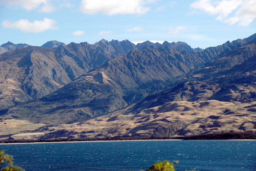
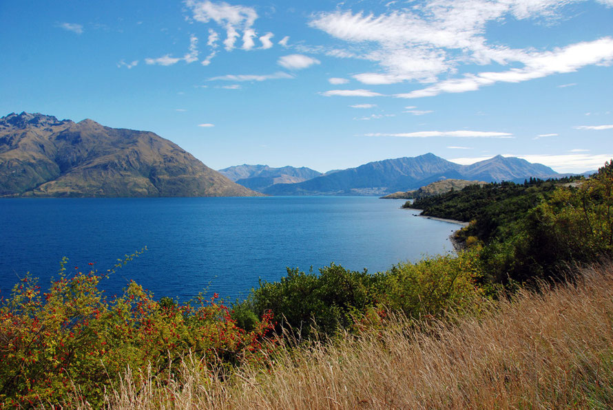
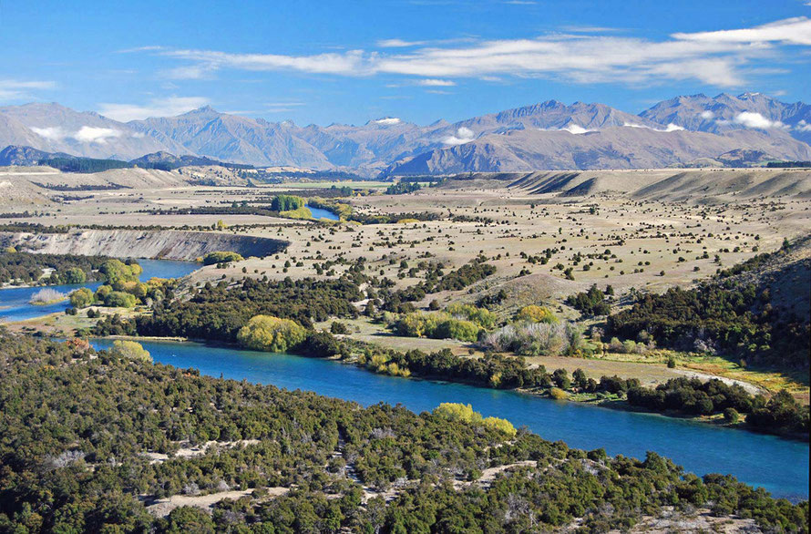
The Clutha/Mata-Au is one of the fastest flowing rivers in the world and the waters of the Upper Clutha are clear turquoise, the result of the filtering of glacial and snow-melt water through Lake Wanaka, Hawea and Wakatipu. This is a rare characteristic of a high volume river and the Mata-Au changes colour when the silt-laden Kawarau, which links to the Shotover River which is not filtered by any lake, enters it below Cromwell.

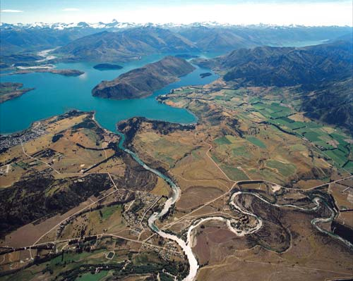
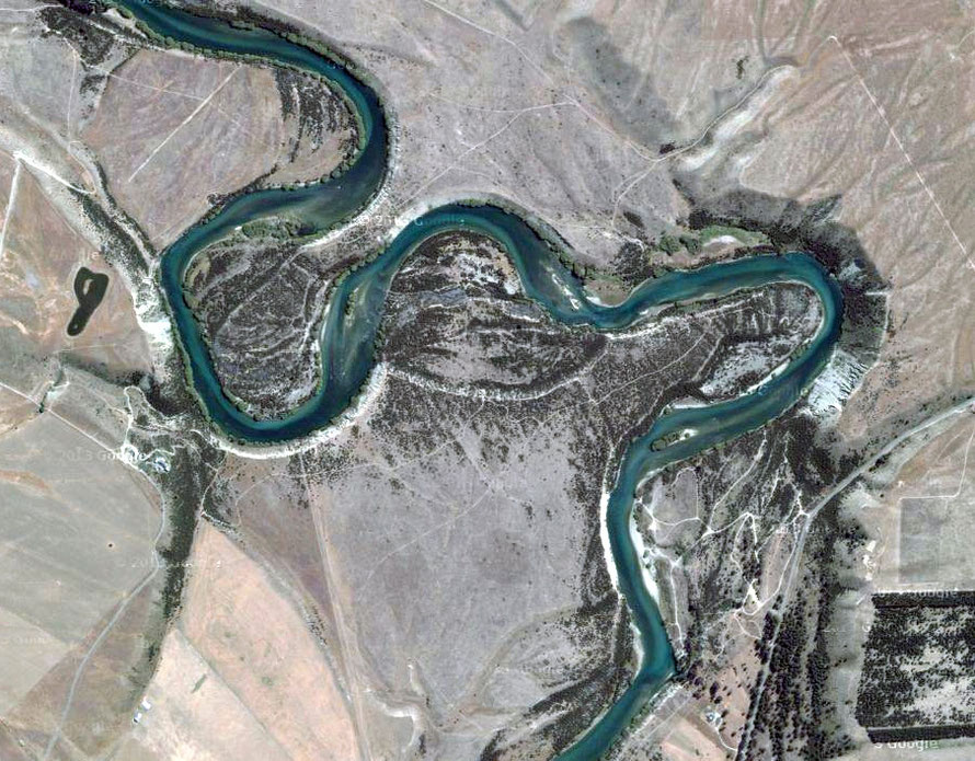
Below is a relief map showing the catchment area of the Clutha/Mata-Au. Please ignore the graphs as these are incomplete and were simply part of the original image I borrowed.
The catchment is relatively limited in its southern half but in the north it spreads out due to the way in which the river and lake systems flow together.
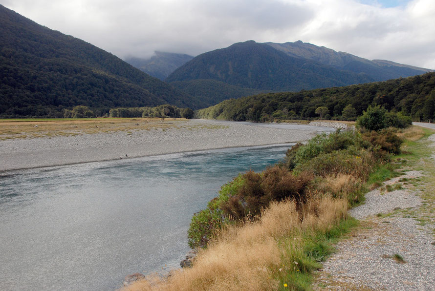
The red 'x' on the map is the location of Shotover Saddle. The photographs in the You Tube video below the map were taken here.
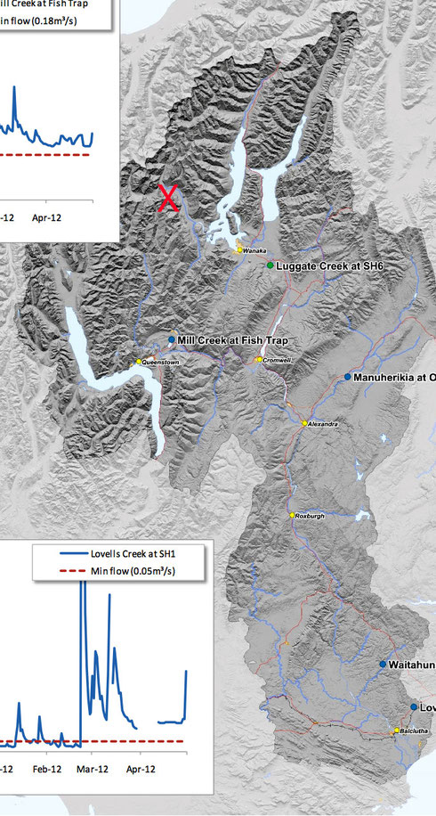
The video below includes photos from the Shotover Saddle south (the source of the Shotover River) views over the the Matukituki River West Branch and Rob Roy peak and glacier to the north.

The catchment has three areas-
- the alpine and subalpine accounting for 125km of the Southern Alps,
- a central block of moderately high mountains with arid valleys and gorges
- and the rolling country of the lower river including the delta lands to the east of Balclutha.
About 43% (9,300 square km) of the catchment area is above 1000m and provides much of the spring and early summer seasonal snowmelt runoff. (The permanent snowline is at 2400m and accounts for only 90 square km).

The three lakes of the Wanaka, Hawea and Wakatipu contribute 75% of the flow at Balclutha and act as regulators and filters of the seasonal snowmelt and summmer rainfall.
Annual rainfall varies between 3870mm at Haast Pass and 339mm at Alexandra in the hot dry area of Central Otago. Rainfall on the Southern Alps in the catchment is probably higher than the Haast figure.
Seasonal snow accumulation and melt dominate the annual water balance and streamflow pattern p.37
Major tributaries include the following rivers; Hawea, Kawarau, Shotover, Nevis, Arrow, Roaring Meg, Bannockburn, Cardrona, Lindis, Fraser, Manuherikia, Teviot, Pomahaka, Waitahuna.
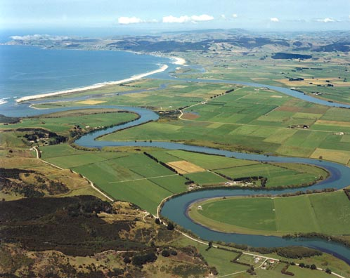
Inch Clutha, a fertile delta formed between the two branches of the Clutha River below Balclutha, is famed for its production of vegetables, dairy products, and meat.
Mining and dredging operations in the interior of the province have deposited large quantities of tailings in the river scheme. The Clutha and its tributaries were a rich source of alluvial gold.
Flooding has plagued the Clutha/Mata-Au.(see here)

The spring thaw gives maximum flows from the high country in November and December. A second period of higher flow occurs in late summer early winter. The central uplands give extreme flows in spring usually before the meltwater peaks. Summer flows are very low.
In the flood season - late spring to mid summer - the river flood average flow is normally of some 2,000 cumsecs.
For comparative purposes the River Tay, the UK's largest river by discharge has a catchment area approximately 5,200 km2 and an avereage flow of 175 cumecs - cf the Clutha/Mata-Au's catchment of 21,960km2 and mean flow of 614 cumecs.
The Clutha/Mata-Au's peak flood flow was in 1878 at 5,700 cumecs compared to the Tay's 2,269 cumecs in 1993 when the river rose 6.5m above its normal level.
The Tay has a catchment that is about a quarter and a flow that is about 28% of the Clutha/Mata-Au.
Floods
Floods are New Zealand's most prevalent natural disaster.
Floods and rapidly rising rivers from heavy mountain rainfall caught out early settlers. By 1870 1,115 drownings had been recorded. Drowning became known as ‘the New Zealand death’.
The greatest flood ever observed on the Clutha River occurred in 1878 and resulted from a succession of weather systems that brought warm rain, together with warm winds that melted the winter snow cover. At the height of this flood the flow reached 5,700 cumecs. (Teara)
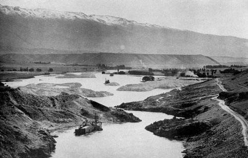
Gold mining created an insatiable demand for timber in treeless, dry Central Otago. In 1862 a log-rafting enterprise was started by George Hassing and Henry Hill to supply timber from the western forests. The rafts could just about safely negotiate the river until the Cromwell Gap, which concentrated the full force of the water into a series of rapids.
'They were navigated to a landing-place between Lowburn and Cromwell, but it was frequently a most difficult procedure to catch the landing-place. Once past it, there was absolutely no choice but to allow the raft to shoot through the roaring, rocky gorge above Cromwell.
The raftsman had the alternative of either abandoning ship or of taking his chance aboard his craft.'
The Wanaka Story, by Irvine Roxburgh (quoted by Lowburn by Clutha blog)
Hydroelectric schemes, dams, dredges and sediments
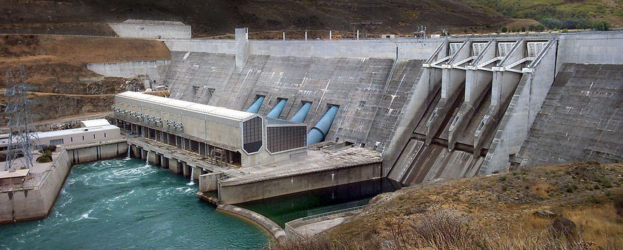
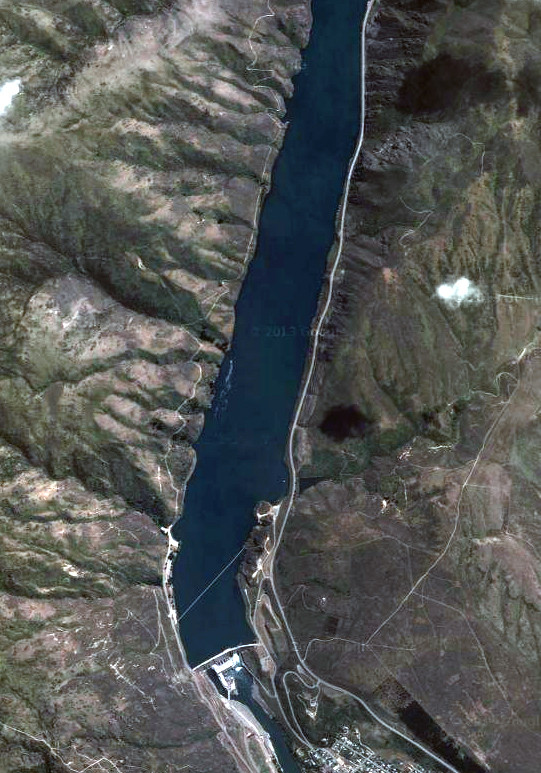
The river has two large dams for hyrdroelectric power - the Clyde (completed 1993) and Roxburgh (completed 1957).
The Clyde was particularly controversial and ran into trouble when it was discovered it was underlain by an earthquake fault and fractured rock. The cost overrun was 50% and the generating capacity was reduced from 612 MW to 432 MW.
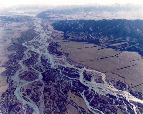
Before the dams the river would normally carry an annual average of 1.5 million cubic metres of sediment out to sea. Majority of this sediment comes from the Shotover catchment where magnetite ("black sand") is common via the Kawarau River joining the Clutha at the Cromwell Junction.
The building of the Roxburgh Dam put an end to this and now it only has 56% of its storage capacity due to siltation.
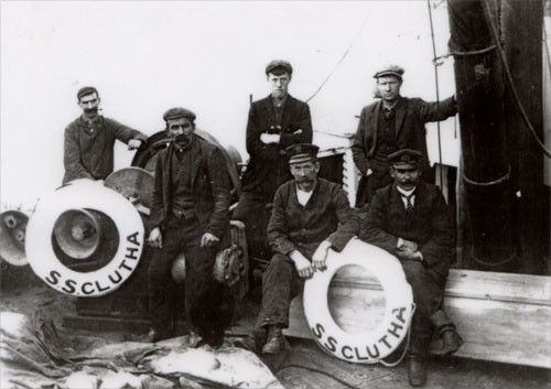
Gold Dredging
In the 1890s the Chinese entrepreneur Sew Hoy discovered a system of dredging that 'made it possible for large-scale mining to be carried out on the river-flats for the first time' with a new generation of paddock dredges.
This gave rise to the dredging boom, which exploded across Otago and Westland. (DCC). The first steam-powered dredge, the Dunedin, worked the gravel beds of the Clutha/Mata-Au for 20 years from 1881 and extracted 530kg of gold.

At the peak of dredging in the early 1900s some 100 dredges operated on the Clutha/Mata-Au, 15 on the Manuherikia, and 33 on the Kawarau and Nevis. The last dredge stopped working at Alexandra in 1963 (Teara).
The dredges led to massive disruption of the river bed.
In 1920 the Rivers Commission estimated that 300 million cubic yards of material had been moved by mining activity in the Clutha river catchment. At that time an estimated 40 million cubic yards had been washed out to sea with a further 60 million in the river. (The remainder was still on riverbanks). This had resulted in measured aggradation [uplift] of the river bottom of as much as 5 metres. (Wiki: Central Otago Gold Rush)
(For more on the Orago Gold Rush and dredgers see my page Gold: The Otago Rush)
This has given rise to silting at the river mouth and flooding of farmland on Inch Clutha. Flood defences were put in place in 1972 but some believe that continued silting through erosion and flushing silt from the Roxburgh Dam is raising the lower Clutha/Mata-Au riverbed.
There is also concern that Dunedin and Otago beaches no longer receive the huge dumps of sand they used to get from ocean currents and wave action pushing the Clutha/Mata-Au silts northeastwards.
Floods tend to be caused by snowmelt. The three lakes moderate this until they are full. Once overfull they can feed the floods for weeks.
Murray 1975 Regional Hydrology of the Clutha River and (alexflood.org.nz)
In the 1980s proposals emerge to build another four dams on the Clutha/Mata-Au river. In 2008 Contact Electricity revisited some of these schemes but in 2012 the Contact hydro projects manager,
Neil
Gillespie confirmed,
"Contact has decided not to proceed with any of the options being investigated for hydro-generation development on the Clutha at this time and has ceased all work pertaining to it."
Riverside Towns
The Clutha/Mata-Au passes through the following towns - from source to sea.
Albert Town - a small settlement on the confluence of the Clutha/Mata-Au and Hawea that is growing rapidly as a suburb of Wanaka, which has grown by 50% in the last ten years as a winter and summer resort and retirement town
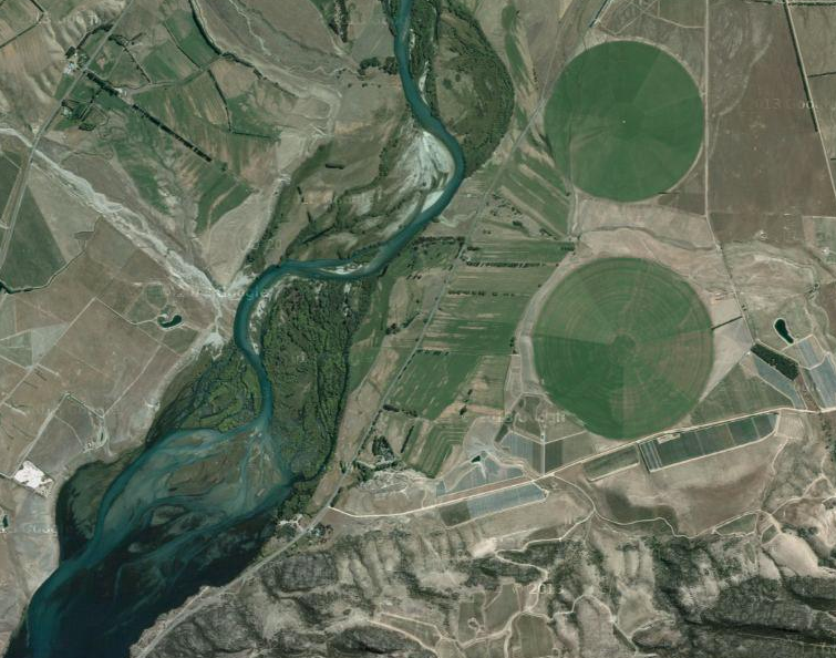
Cromwell (pop. 4,146 2013) - the 'Fruit Bowl of the South' - was known as "The Junction" because it was at the confluence of the Clutha/Mata-Au and Kawarau Rivers and was noted for the difference between the colours of the rivers, the former being turquoise, the latter being muddy. The Junction was drowned by the waters of Lake Dunstan, created by the Clyde Dam.
Gold was discovered in 1862 and a brief but intense gold rush took place for alluvial gold. When the gold ran out agriculture and fruit growing took over.
The construction of the dam and new lake occasioned the rebuilding of a third of the town.

Clyde (pop. 918 2006) a gold-rush town Clyde now produces stone fruit and wine and is a tourist haven, being at the end of the Otago Central Rail Trail and having hot dry summers without sandflies.
Alexandra (pop.4,827 2006) is the service centre for an important stone fruit and wine growing district. It is one of the town's in New Zealand furthest from the sea and has hot dry summers and cold dry winters with a total annual rainfall of only 359.4mm (14.15 inches).
Roxburgh (pop. 600 2006) is an important apple, apricot and cherry growing centre.

Kaitangata's (pop. 810 2006) Coal mining was the bedrock of the town's economy from 1870 until 1972. Several open-cast mines remain as does the Kai Point lignite mine.
An early industrial disaster occurred at the Kaitangata mine in 1879 when 34 miners lost their lives in an underground explosion.
It is remarkable how few people live along this long river. It is probably not much more than 20,000 people.
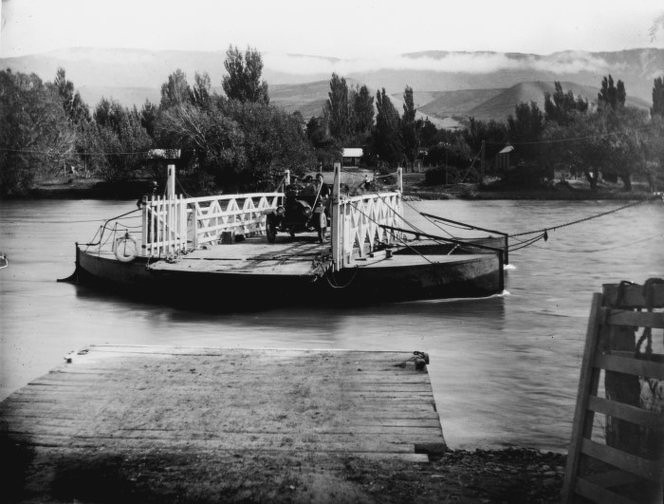
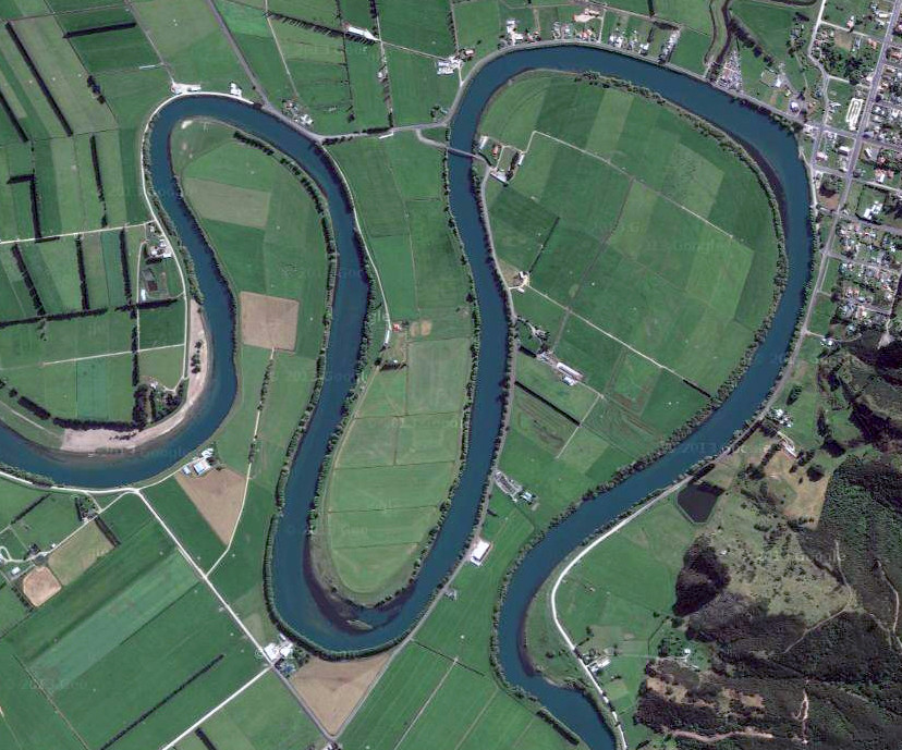
Balclutha (pop 4,062) is from the Scottish Gaelic Baile Cluaidh - 'the town on the Clyde' (Clutha is also the name of the pub - the Clutha Vaults - in Glasgow that was crushed underneath a crashed police helicopter in 2013.)
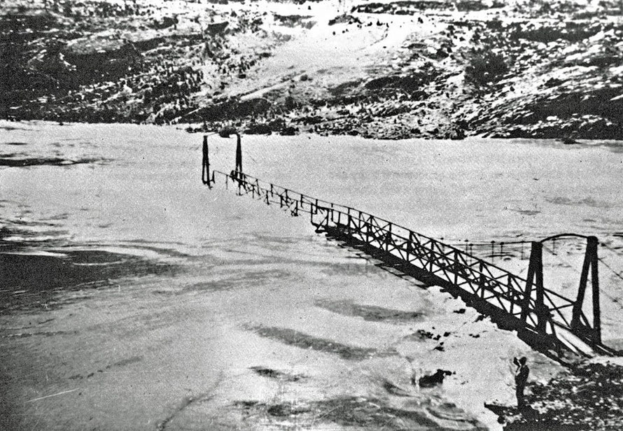
It was a funny looking place, divided by the river and a six-span concrete built in 1935 to replace a wooden bridge and before that a ferry. The town seemed drawn away from the power of the river on one side and completely exposed to it on the flat on the other.
I stopped and took a photo of the bridge next to the rugby club. A big double rig truck came roaring down the street. We wended along some of the grid-plan's back streets and then along a main street. It was pretty grim.

The town was almost devoid of life or perhaps we were missing the bit of town with life in it. A group of teenage girls passed and I wondered what you did for amusement in Clutha.
A dead New Zealand Swamp Harrier (Circus approximans) lay in the greywacke chippings of the roadside. Its talons were tightly clenched in what looked like its death agony, the plumage on its back parted to reveal white downy underfeathers. Its head was propped up on the sharp, hooked beak almost dug into the road.

The weather didn't help. Rain had fallen and there was a leaden sky. Perhaps under a ravishing South Island high blue the town would have been ravishing. But I doubted it.
The Natural History section of the Balclutha Wikipedia entry ends with the hopeful, 'These are only a few examples and anyone interested will find many more'.
See here for early Scottish settler recollections of clearing land and farming at Inch Clutha - apparently the land gave fine harvests of wheat and potatoes for 16 years without the application of fertiliser.
There are some nice aerial photos of Inch Clutha here.
The story of the Clutha/Mata-Au does not end where its waters disperse into the Pacific Ocean.
A series of submarine canyons extend 100km south towards the edge of the continental shelf. These were probably formed during New Zealand's ice ages when the sea level was c.118m lower than at present.
This was due to the locking up of vast volumes in water as ice. At this time the landmass of New Zealand was considerably larger than its present extent.
The Clutha/Mata-Au is also a transporter of vast quantities of sediments from the rapid erosion achieved in those of its headwaters that do not flow one of the three lakes - in particular the Shotover River. Amounts of sediment were five times greater during periods of glaciation when the three lakes were occupied by glaciers. It was only as the ice retreated that they began to function as traps and filters for bedload and suspended sediments.
'Basement rocks are predominantly greywacke/argillite and schist, all of which were metamorphosed from the same suite of sands, silts and gravels, deposited 260 to 195 Ma. Metamorphism is timed at 130 to 110 Ma. The basement rocks are the principal sediment sources in the catchments.' (New Zealand Margins below)
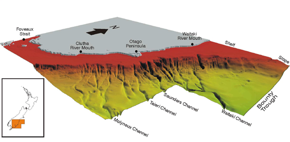
Most of the Clutha/Mata-Au sediments have been deposited in Molyneux Bay below the river's mouth which is protected from predominant currents by Nugget Point. However, over the millenia lighter elements have been transported up to 190km northeast of the river mouth by the Southland current and storms.
Deposition on east coast beaches and spits has been responsible for the development of important coastal features. The blocking of this sediment flow by the Roxburgh and Clyde Dams may be contributing to the erosion of some of these beaches as rates of deposition fail to keep up with those of erosion.
(Sources: Clutha/Mata-Au River, Wikipedia; Carter and Carter (1986) Holocene Evolution of the
nearshore sand wedge, South Otago, New Zealand New Zealand Journal of Geology and Geophysics Vol 29; Fulthorpe et al. (1999) MARGINS: NEW ZEALAND FOCUS AREA).
The Roadside Story of the Clutha's bridges and floods is told below from the Ministry of Culture and Heritage.