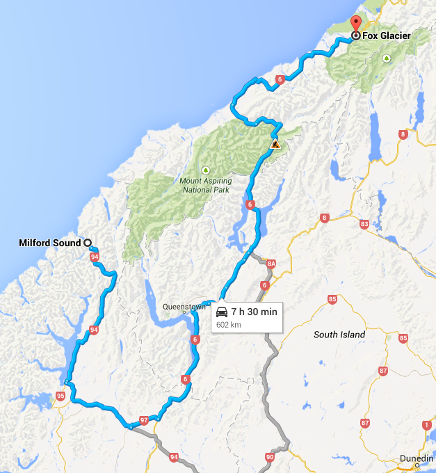
From Milford Sound to the Fox Glacier

This turned into a ridiculously long day of driving. The distance from Milford to Fox is 602km and timed by Google Maps at 7 hours and 30 minutes. AA NZ puts the time at 9 hours and 41 minutes. With stops and frequent camera calls both on the Milford Road and between Te Anau and Fox it took us getting on for 12 hours. 


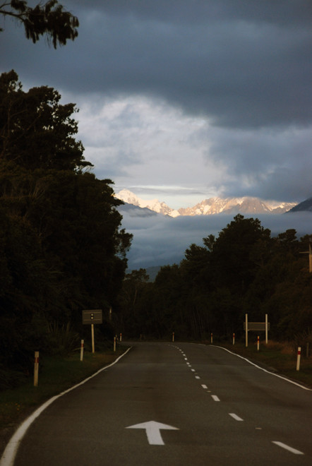
After the first grey misty weather as we woke on board in Milford Sound (for Milford Sound and the Milford Road see previous section) the sun shone brilliantly for the entire day. As we rolled into Fox exhausted and frazzled the darkness was thickening. For the last three hours of the drive we saw not more than ten vehicles. It was bloody marvelous. At one point, as dusk fell, the snow covered peak of Aoraki/Mt Cook (3,724m) appeared  like a beacon above the clouds, driving us on through the close packed forest.

As dusk fell, the snow covered peak of Aoraki/Mt Cook appeared like a beacon, driving us on through the close packed forest (from the Haast-Fox Glacier road).

The route from Milford to Fox is spectacular and tortuous. The first leg goes almost due south in the opposite direction of Fox. The second is a big U-turn and the third by-passes Queenstown and humps up over the dry Pisa Range and the Cadrona Valley before skirting lakes Hawea and Wanaka. It then climbs into the dark forests of Haast up to the pass - only opened in 1966 and only completely  tarmacked  in 1995. It is one of only three crossings of the Southern Alps.


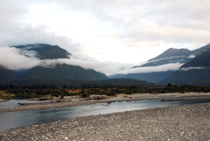
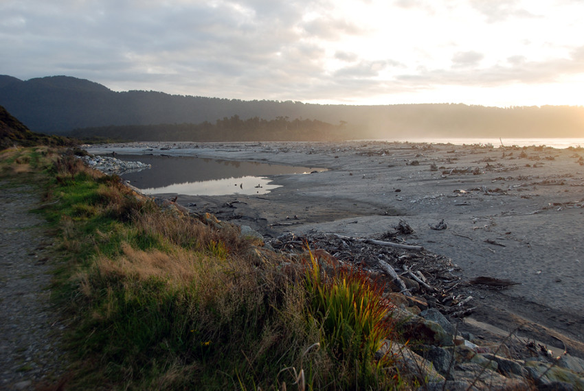
The last stretch follows passes and rivers out of Haast before hitting the coast and heading north-east by beaches festooned in tree-avalanche driftwood and marshy backwoods combed by the prevailing westerlies.

The 603km route from Milford Sound to Fox Glacier with an AA NZ drive-time of 9 hours and 41 minutes.
Takitimu Mountains, from NH94 east of Te Anau, Southland, New Zealand.
Takitimu Mountains I: from NH94 east of Te Anau, Southland, New Zealand.
Takitimu Mountains II, from NH94 east of Te Anau, Southland.
Takitimu Mountains II: from NH94 east of Te Anau, Southland.
Red tussock grassland on the way to Mossburn, Southland, New Zealand.
Bracken Hall Cafe at Mossburn. Good coffee and sandwiches, Southland, New Zealand.
Eyre Mountains, between Mossburn and Five Rivers, Southland, New Zealand.
Old homestead in the Matuara river valley near Kingston near the south end of Lake Wakatipu, Southland, New Zealand.
The southern end of Lake Wakatipu and the Eyre Mountains near Mt Dick (1805m), Southland, New Zealand.
Fairlight Station near the southern end of Lake Wakatipu. The Kingston branch line - originally built with wooden rails - linked Invercargill to Queenstown via a steamer service on the lake.

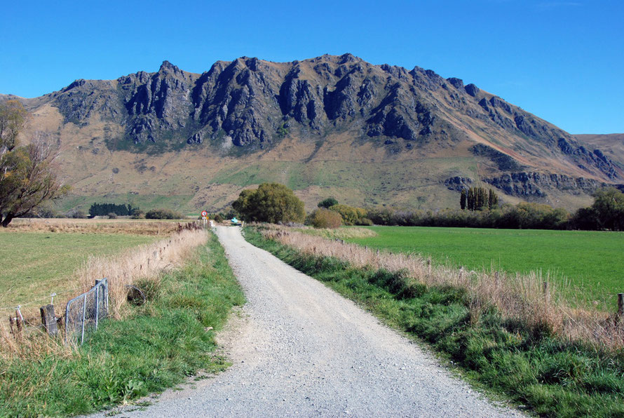
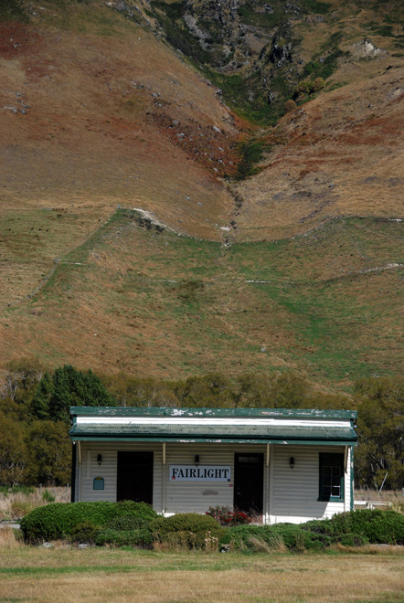
The Kingston branch line from Invercargill was opened in 1878 and in 1879 linked with a steamboat connection to Queenstown. The line closed in 1979 after flooding disrupted the dwindling freight and mixed services to Kingston. The Kingston Flyer, a heritage train - still runs on the 14 km section of track between Kingston and Fairlight. Two AB class 4-6-2 locomotives, AB 778 and AB 795 were restored specifically for the Kingston Flyer.


One curiosity of the branch line was the initial decision to use wooden rails although 'the unsuitability of the wooden tracks became obvious quickly'.

The southern end of Lake Wakatipu looking north towards Queenstown and Vangaurd Peak (1768m).
Deer farm under the backdrop of The Remarkables, Otago.

Fairlight Station is also the name of an 2,000ha Otago high country deer, sheep and cattle station bought up by Canadians. This has caused some controversy as they have planted large blocks of Douglas Fir plantation. This has been opposed due to the 'wilding' problems associated with Douglas Firs: their seeds are wind dispersed and easily take root in the scrub and tussock country of the Otago high country (see my page Arthur's Pass to Dunedin for more on this issue).

The northern end of The Remarkables, Otago with parched hills and early autumn colours.
Looking east-south-east from above Arrowtown towards the Carrick Ridge Ranges.

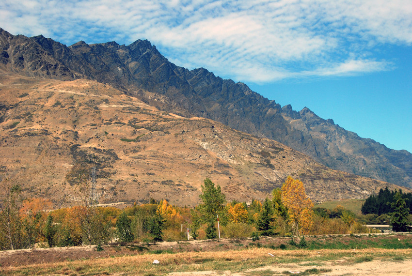
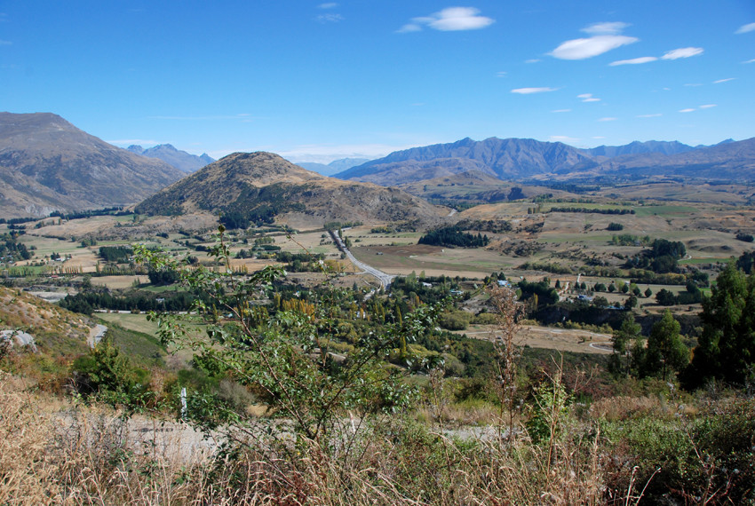
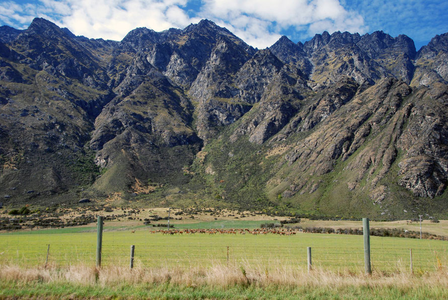
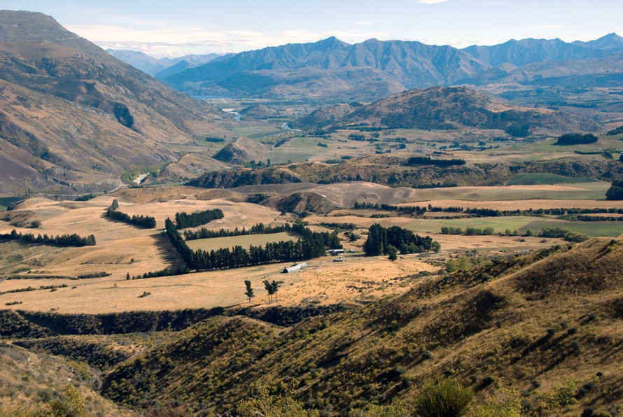
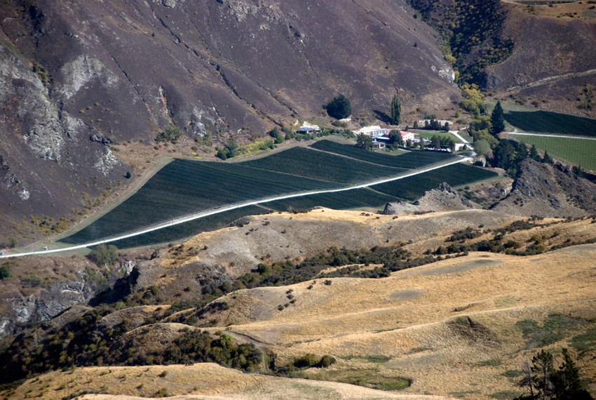
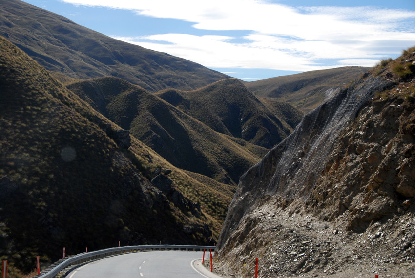
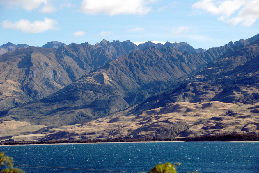
The road that climbs from the valley bottom of the Kawarau River on the outskirts of Queenstown up onto the Crown Ranges is spectacularly steep and gives fantastic views across the dry country of Central Otago. On the day we climbed up it the surface was being relaid which added to the fun.

The dry hills of Central Otago from Crown Terrace above Arrow Town. The contrast between these bare hills and the west coast forests is remarkable.
Looking back towards Queenstown, Lake Wakatipu and the Livingstone Mountains (Moffat Peak 2085m), Otago.
Another view looking towards Queenstown from the Crown Range with Vanguard Peak and the bends of the Kawarau River, which joins the Clutha/Mata Au at Cromwell.
The Gibbston wine subregion of Central Otago from the Crown Range I.
The Gibbston wine subregion of Central Otago from the Crown Range.
Bird protection of grape vines near harvest time in the Gibbston wine subregion of Central Otago from the Crown Range.

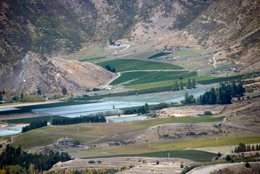
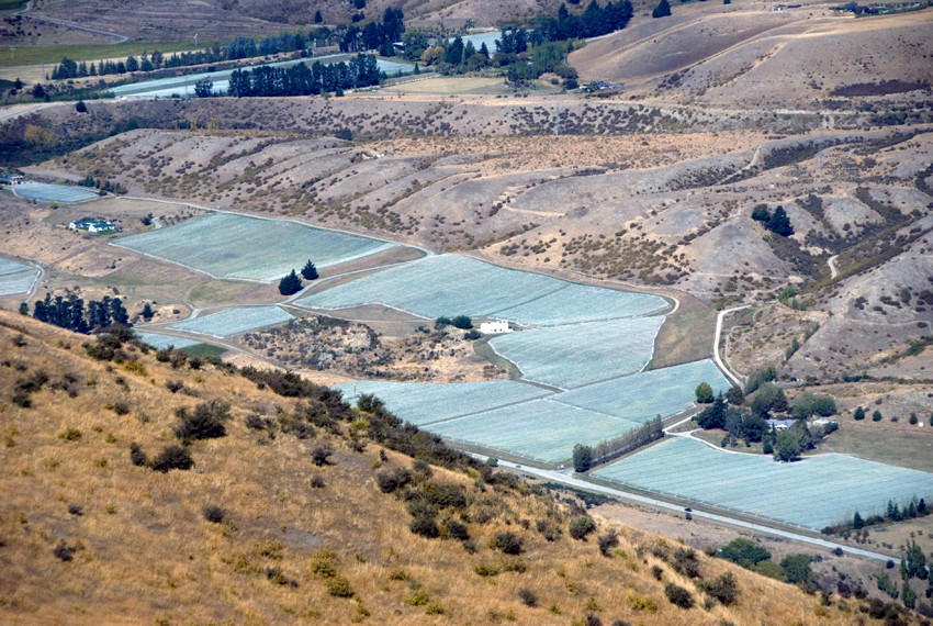
The Central Otago vineyards are the most southerly in the world at 45° South. Central Otago has long warm summers followed by reliably cool nights and long dry autumns as it stands in the rain shadow of the Southern Alps. Pinot Noir is the predominant grape grown. The Vineyards here are small - for example Brennan Wines has just 10 hectares of vines - and the schist soils vary from alluvial gravels to lean, stony soils of raised river terraces.


A winery in the Gibbston wine subregion of Central Otago from the Crown Range. Gibbston is the coolest and highest of the Central Otago sub-regions with vineyards between 320 and 420m altitude.
The fantastic serpentine road over the Crown Ranges to the Cardrona Valley with Mt Allen (1492m) on the right.
The fantastic serpentine road over the sub-alpine Crown Ranges to the Cardrona Valley with Mt Allen (1492m) on the right.
The southern end of the Cardrona Valley and the steep descent to the valley bottom through the tussock hills.
The increasingly rare tussock grasses of New Zealand's sub-alpine landscapes. Here on the slopes of the upper Cardrona Valley in Central Otago.
The celebrated 'bra fence' in the Cardrona Valley of Central Otago, New Zealand.

The Cardrona Bra Fence has attracted some controversy since it first appeared in 1998 and has regularly disappeared. The photo above was taken in March 2014. In July 2014 all the bras were cut down. Cardrona residents have warned that 'there would be a road accident if the fence was not relocated or signs installed to warn drivers'. The mind boggles at the signs that would be installed - uneven surface/chausee deformee?

Cardrona church in the old gold mining settlement in the Cardrona Valley.
Cardrona Church and Hall in the old gold mining settlement in the Cardrona Valley.

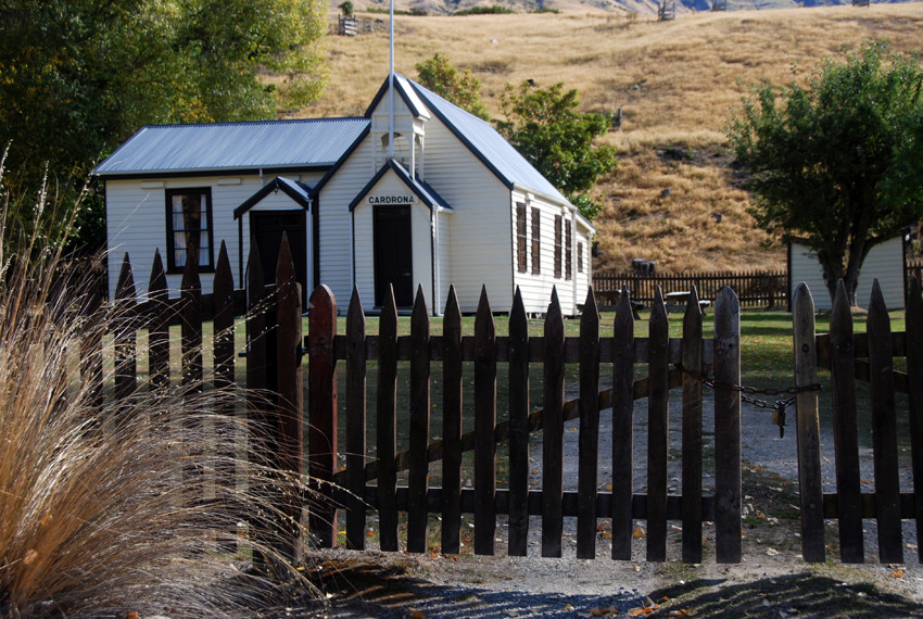
Cardrona was a centre of the Central Otago gold rush in the 1860s (see my page here). It now hosts a ski run and 'alpine village' in the winter and forms part of the Pisa Range Conservation Area.

Lake Wanaka from the Wanaka water front, Otago, New Zealand looking towards Mt Aspiring.

We had thought to stop for the night in Wanaka, a new tourist town on the shores of Lake Wanaka.  But we didn't much like the feel of the place and as the afternoon was still relatively young we decided to push on for Haast - some 142km of mountain roads distant. We knew that the Haast Pass was going to close for the night due to the roadworks that were being undertaken after a huge rockfall. We also knew that between Wanaka and Haast there was nowhere to stop for the night.


I don't know what it was about Wanaka. It just felt too new, too idyllic, too resorty. It wasn't really the New Zealand we were after.

Lake Wanaka, Ruby Island and Mt Aspiring (3027m) from the waterfront at Wanaka.

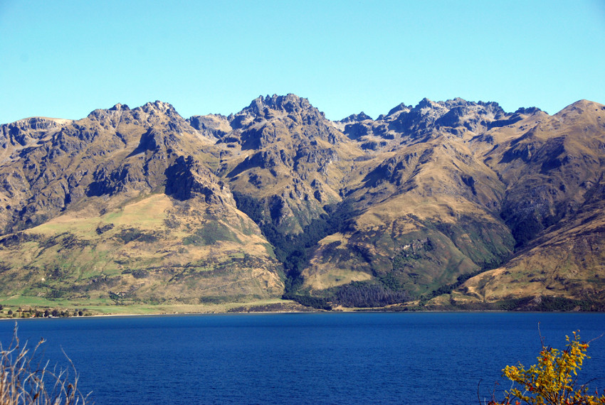
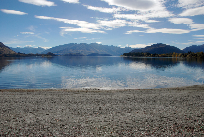
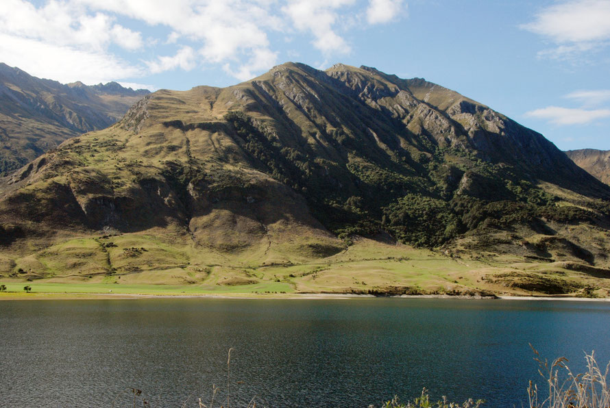
We were kind of in a hurry not wanting to get turned back from Haast Pass but kept stumbling across one beautiful scene after another. A short distance after Wanaka the road runs along the shore of Lake Hawea. The sun continued to shine and the air was still and limpid.

Lake Hawea, a deep glacial lake that feeds the mighty Clutha/Mata-Au river.
Lake Hawea in Central Otago. The lake is part of the Clutha/Mata-Au catchment and the level has been raised to control flow to the river hydro-electric schemes. This is it at low water in the summer.
Lake Hawea in Central Otago. The lake is part of the Clutha/Mata-Au catchment and the level has been raised to control flow to the river's hydro-electric schemes. This is it at low water in the summer.
The ranges of the Southern Alps from the western shore of Lake Hawea. The McKerrow Ranges stand in front of the main spine of the Southern Alps rising to Mt Brewster at  2423m.
The ranges of the Southern Alps from the western shore of Lake Hawea. The McKerrow Ranges stand in front of the main spine of the Southern Alps rising to Mt Brewster at 2423m.
Lake Hawea near the isthmus with Lake Wanaka and the layered formation of Sentinel Peak (1811m).
One of the deeply incised torrents that run off the McKerrow range near The Neck between Lakes Hawea and Wanaka.
Looking west from the north end of Lake Wanaka to the Minaret Peaks. Forest beginning to appear on the mountain slopes as the annual rainfall increases.

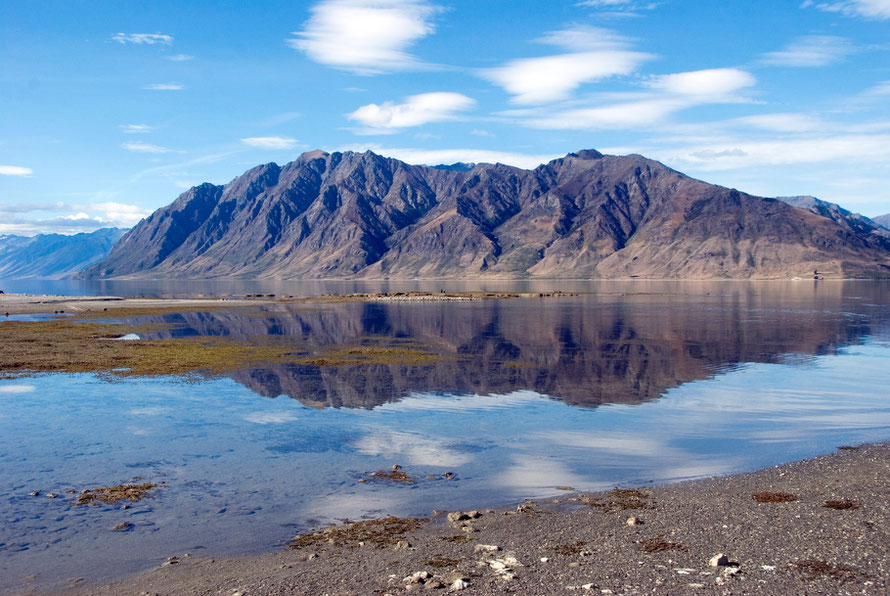
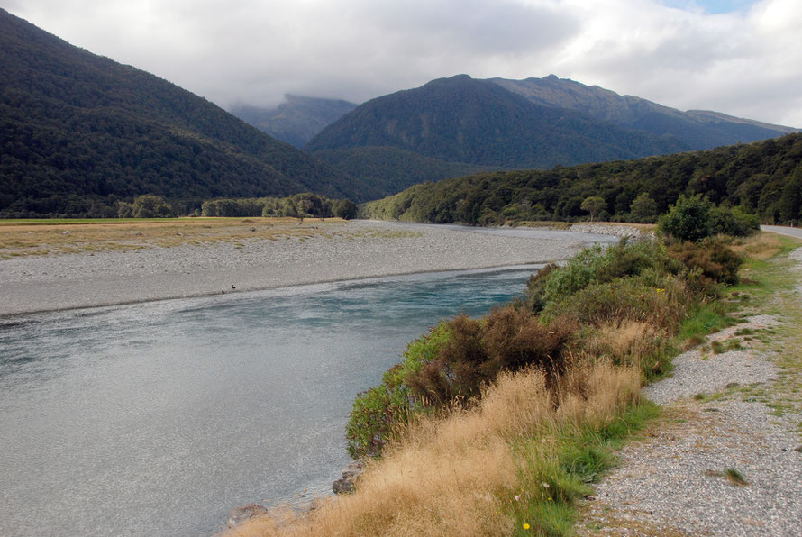
We must have passed by the tiny settlement of Makarora  near the northern end  of Lake Wanaka, with its sheep stations - the Markarora and the Mount Albert - but after that there is nothing. Not even an unmetalled side road until Haast Towship 80km away. Except Pleasant Flat Campsite.


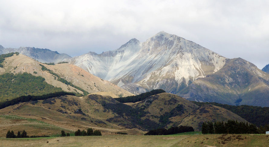
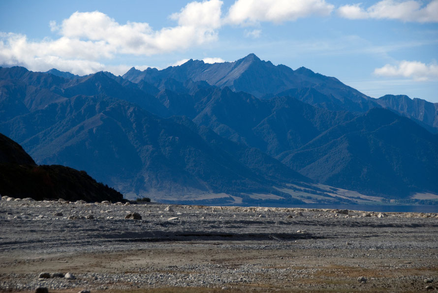
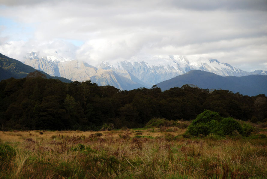
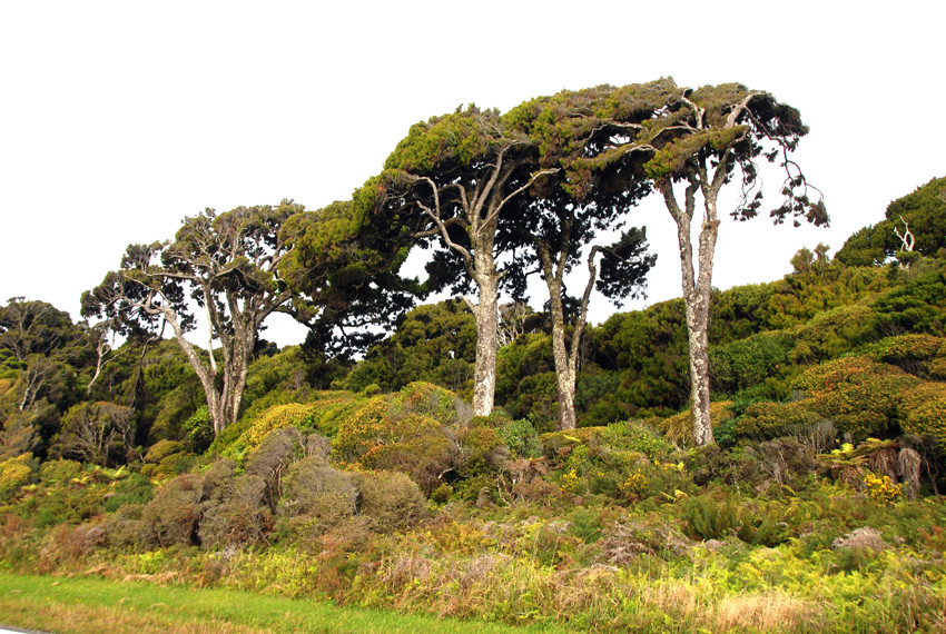
It is real wilderness. Densely wooded, steep-sided lower hills and true mountains dotted everywhere which rise to above 2000m on the main Southern Alpine divide.  There are plenty of tramping routes and hut refuges but the NZ Topo map shows no permanent habitation in a vast area of country.

The road to the Haast Pass running alongside the Makarora River, one of the headwaters of the Clutha/Mata-Au.
Clouds gathering over the Southern Alps: the road to the Haast Pass running alongside the Makarora River, one of the headwaters of the Clutha/Mata-Au.

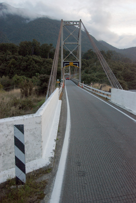
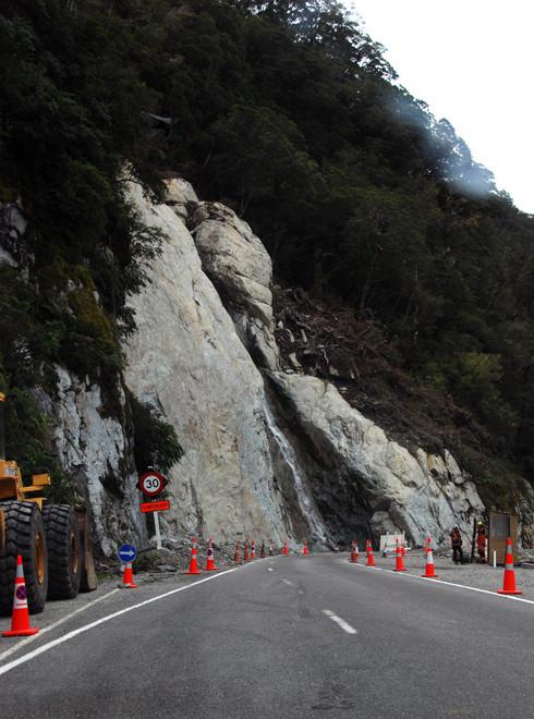
The landslide at the pass itself - called Tioripatea in Maori - was stunningly awful. A huge gash punctured the dense beech forest where a giant strip of trees, mud and rock had been levered from the mountainside. We waited at traffic lights by ourselves to squeeze through the single carriageway that had been restored past two blokes outside a little sentry box. They were none too impressed when I stopped briefly and took a photo, waving me impatiently through. As if there were other traffic.

The giant scar left by a massive landslip on the Haast Pass/Tioripatea, March 2014. Two Canadians were swept to their death in a camper van.

The rainfall in the Southern Alps is savage and falls with staggering intensity. The night two Canadians (10 September 2013) were killed the driver of a car saw a camper van heading up the Pass from Haast Township. Eventually the car had to turn back as a landslip blocked the road. There was no further sign of the camper van. It is thought it was either swept or plunged into the Haast river which was six metres above its normal height. Debris from the van was found in the river and the petrol tank was washed up on the coast 7km from the Haast river mouth.

The Gates of Haast Bridge below the Haast Pass.

Haast mechanic, Eamond Johnston, told the New Zealand Herald,


"There have been lots of road closures over the years, that type of slip isn't new. But never in my memory has anyone been caught in one like that. It's very much that the holes in the cheese lined up. It was a freak incident."


Joanna Lam's body was eventually found washed up on North Haast beach. The body of her fiancee, Connor Hayes, has not been found.

The giant schist boulders in the Haast River stripped clean of moss and lichen after huge floods.
The giant schist boulders in the Haast River stripped clean of moss and lichen after huge floods in September 2013 when the river ran 6 metres above its normal level.
On to the Haast valley floor and glimpses of Shattered Peak and Mt McFarlane (possibly).
On the Haast valley floor and glimpses of Shattered Peak and Mt McFarlane (possibly).
The broad braided river bed of the Haast beyond the Haast/Landsborough confluence. The steep thickly wooded hills rising up to Mt Awkward, Hassing Peak (2088m) and Mt Maitland (2270m).
The broad braided river bed of the Haast beyond the Haast/Landsborough river confluence. The steep thickly wooded hills rising up to Mt Awkward, Hassing Peak (2088m) and Mt Maitland (2270m).

It was pretty amazing to arrive at Haast after all those hours on the road. But it was a pretty bleak looking place of a few motels and the general ambiance was given a heavy feel by a big bunch of blokes swigging drinks from a balcony. We swung the car round saying, 'There's bound to be somewhere between 'Haast and Fox Glacier to stop.' But there wasn't. The very few places there were all seemed to be shut up tight.

The long, single carriageway bridge over the Haast River near its mouth.
The long, single carriageway bridge over the Haast River near its mouth with Mosquito Hill on the left.

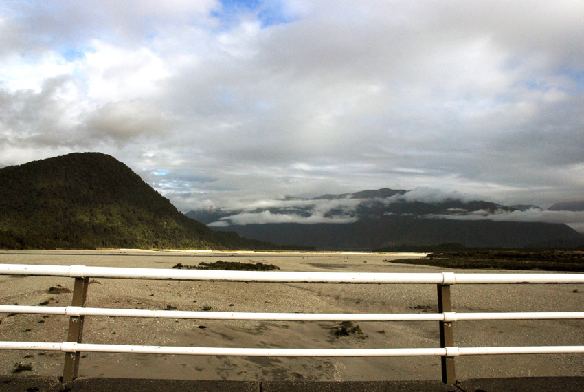
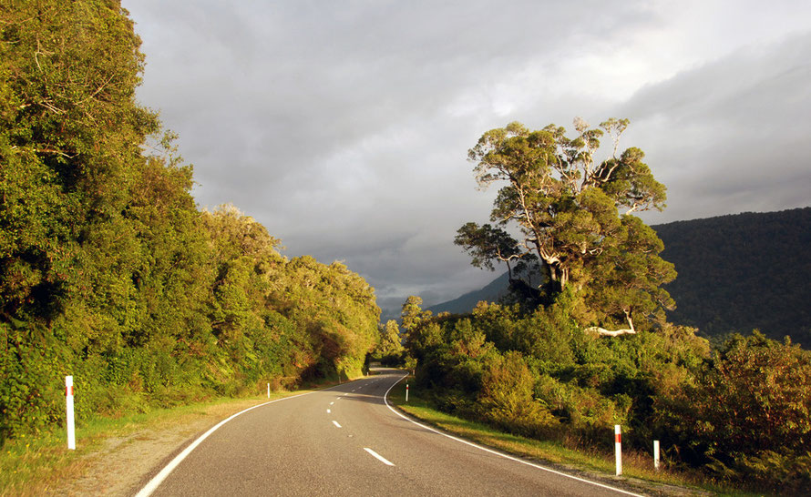
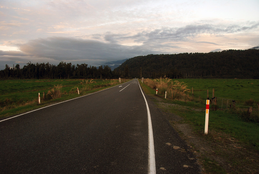
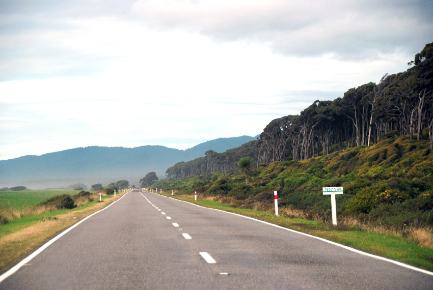
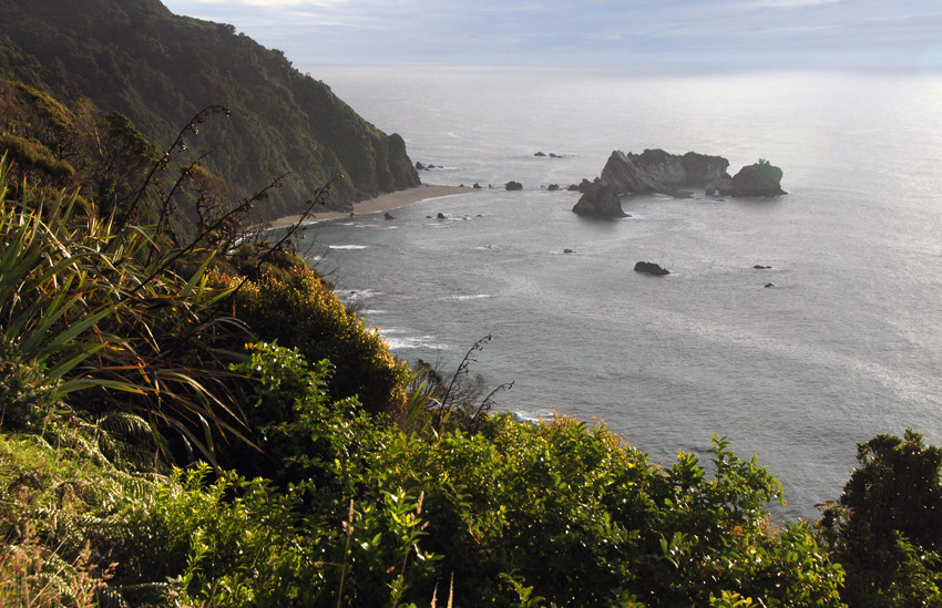
The road between Haast and Fox Glacier is remarkable for its emptiness, its forests and the occasional sweeps of windswept, driftwood strewn beach. We charged along the sun ever lower in the sky. Other cars had now become a novelty. With the Haast Pass road closing for the night there waere really very few places to be heading for - Haast and the tiny communities of Hannah's Clearing and Jackson Bay to the south where the road comes to a final halt.

Rimu forest and coastal scrub on the road beyond Haast.
The open and empty road near the Waita River on the way north to Fox Glacier.

We stopped at the lookout at Knights Point, raised up above the Tasman Sea. Here we bumped into an English couple from Brighton in a big rented camper. Their two kids were having a play on their pushbikes in the deserted car park.


We had a chat and it turned out they too were slightly freaked out by the sheer emptiness of the country and 'Deliverance' vibes they'd picked up on at one of the places they'd stopped. None of this was helped by the recent kidnapping of two women hitching along the road, their subsequent escape and the standoff between the kidnapper - who subsequently pled guilty to murdering a woman the day before - and West coast police units and armed squads choppered in from Christchurch.

Knights Point on the West Coast of New Zealand's South Island.

We pushed on by now decided to run for Fox Glacier whatever. We continued to pass through spectacularly empty country with a few fields of pasture on the river bottoms.


We did eventually reach Fox Glacier and found a room with no trouble in the Fox Glacier Lodge. We stumbled around as the darkness fell and found a great restaurant nearby.


It had been an exceptional day.

Low sun on the forest bounded empty road to Fox Glacier near Lake Moeraki, the cloud closed in over the Southern Alps behind.
Crossing the Whakapohai River on the road between Haast and Fox Glacier on the West Coast of New Zealand.
Maori Beach as Bruce Bay strewn with tree roots and trunks washed down from the steep wooded slope of the Southern Alps.
Coastal forest at Bruce Bay on National Highway 6 from Haast to Fox Glacier in New Zealand.
With darkness gathering in the lowland forest we began to catch glimpses of the Southern Alps through the low cloud.
More empty road on New Zeland's west coast south of Fox Glacier. We'd been on the road now for 11 hours. This is at Manakaiaua River.
Nearly there and the novelty of another car on the road - at Karangarua single carriageway bridge.