
Cyprus Critical Issues VI. Seismic Activity in Cyprus
I'm not sure if this page qualifies as a 'critical issue' or not. But I was unsure where to place it and I personally find the whole plate tectonic thing fascinating.
Cyprus sits on a slice of continental crust about 35 km thick and the island is moving to the west across the Mediterranean, like 'a seed being squeezed between two fingers' in extremely slow-motion.
The island sits just to the north of the meeting-place between the African tectonic plate and the small Anatolian microplate, which is an outlier of the huge Eurasian plate. To the east the Sinai-microplate and the Arabian plate are moving northwards in tandem with the African plate. The pressure of this northward movement is forcing both Cyprus and the Anatolian microplate, which are caught between the hammer of these plates and the anvil of the Eurasian plate, to the west through a process of strike-slip faulting.

A strike-slip fault is usually a vertical fault where the plates move against each other horizontally.
In the past 5 million years plate tectonics in the eastern Mediterranean have been dominated by this strike-slip faulting along major plate and microplate boundaries. In the process Cyprus has experienced continuous uplift, which is greatest in the southwestern part of the island and on the off-shore Eratosthenes Seamount.
The area between Cyprus and the seamount is seismically active and known as the “Cyprean arc” or the Cyprus arc.
(See Harrison, R., et al. (2008) Bedrock Geologic Map of the Greater Lefkosia Area, Cyprus U.S. Geological Survey pp.27-29.)

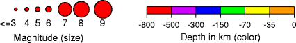
Seismic activity is frequent and over millennia violent and destructive earthquakes have caused immense damage. From the maps of historical seismic activity on the Cyprus Geological Survey Department website it seems that much of this activity is concentrated in the areas behind Limassol and Paphos District and out at sea to the south west of Cyprus at the Eratosthenes Seamount. The last destructive magnitude 6.0 earthquake hit on September 10th 1953.
This is a description of the 1953 earthquake,
A destructive double earthquake in the district of Pafos. It killed 40 and injured about 100 people leaving 4000 people homeless. Damage was reported from all of the 158 villages of the Pafos district. The villages of Stroumpi, Axylou, Kithasi, Lapithiou and Phasoula were totally destroyed. Damage was mainly caused by landslides and ground cracking. Within a few seconds 1600 houses were totally ruined and 10,000 buildings suffered serious damage. Causalities were limited because most people were out in the fields at the time the earthquake occurred. In Lemesos the shock caused extensive damage, where it triggered soil liquefaction of beach deposits on the seashore. The earthquakes were associated with a small tsunami along the coast of Pafos. The shocks were strongly felt in Lebanon, Israel, Egypt, Kastellorizo, Rhodes and Turkey. About 26 aftershocks continued for over a year (see Cyprus GSD).
The last earthquake to cause fatalities - two - was in 1995.
For global real time earthquake reports see the US GSD map here. For Cyprus earthquake monitoring see the Cyprus GSD map here.