
V. The Temperate Rain Forest of the Fox Glacier Region
This page looks at the temperate rain forest of the Fox Glacier Region.
We had walked and driven through a lot of this stuff from our trip and walks on Stewart Island and our drive to the Milford Sound.
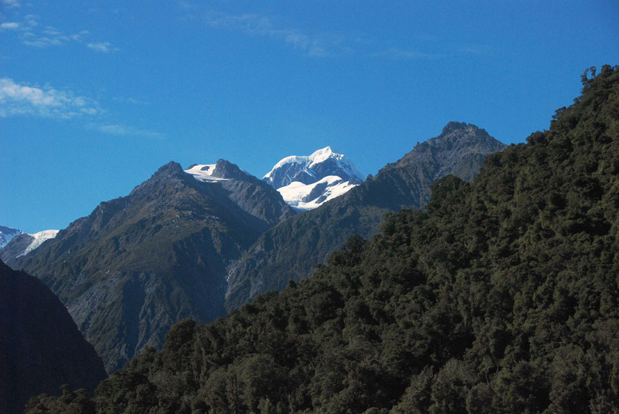
The temperate rain forest of the Fox Glacier and Westland is quite distinct in its climatic and topographical features.
It is very very wet and mild with rising temperature extremes with height, and characterised by slip-prone precipitous slopes, glacial debris and flat marshy coastal edges.
It also differs from much of the West Coast and sub-alpine forest in New Zealand because beech trees are absent.
Indeed, there is a so-called 'beech gap' that extends up the west coast and over the main divide between Knights Point and the Paringa Valley, north of Haast and Greymouth (see more below).
The forest that characterises the Fox River valley area is known as rata-kamahi forest and, as the name suggests, is made up of two predominant tree species: the Southern Rata (Metrosideros umbellata); and the Kamahi (Weinmannia racemosa).
Two conifers are associated with this forest type - Hall's totara (Podocarpus hallii Kirk) and at higher altitides Kaikawaka/Mountain Cedar (Libocedrus bidwillii Hook. f.).

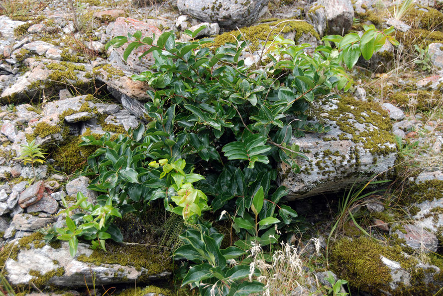
Southern rata (Metrosideros umbellata) and kamahi (Weinmannia racemosa) grow on younger moraine surfaces that have retained some nutrients in the soil cover.
Rata and kamahi are also dominant on the steep, slip-prone mountain sides along with a variety of common small trees and shrubs like Wineberry/Makomako (Aristotelia serrata) and Mahoe (Melicytus ramifloris).
(See the WWF entry on the Westland rain forests in the Encyclopedia of the Earth.)
Rimu (Dacrydrium cupressinum) is more tolerant of poor soils and dominates older moraines, and drier river terraces. The silver pine (Lagarostrobos colensoi), yellow pine (Halocarpus biforme), and bog pine (Halocarpus bidwillii) can grow on the oldest, most infertile, and acidic moraine surfaces.
From the WWF entry on the Westland rain forests in the Encyclopedia of the Earth.
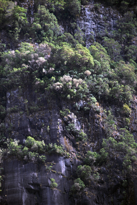
On the mountainsides at altitudes above 400 to 500 metres, the forests lose their characteristic lowland components, namely rimü, mirö, tree-ferns ponga and abundant lianes and epiphytes.
Montane forests dominated by rätä, kämahi, Halls tötara and at high altitudes by kaikawaka, form a broad belt up to 800 to 900 metres. Above that, dense subalpine scrub of leatherwood and other hardy shrubs extends to an extreme upper limit of 1150 to 1500 metres.
Tall grassland of snow tussock occupies a low alpine belt up to about 1400 metres with upward extensions on north-facing slopes as high as 1950 metres. Sheltering beneath the snow tussocks, which may grow up to one metre tall, are many alpine herbs.
Mountain daisies, spear grasses, mountain lilies and buttercups, mountain foxgloves and gentians add diversity and splashes of colour amongst the tawny tussocks. Turpentine shrub perches on rocky, steep north- and west-facing slopes at these high altitudes.
From the Westland Tai Poutini National Park Management Plan2001-
2011
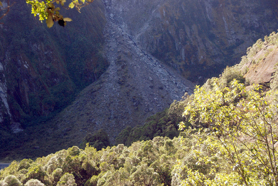
Earthquakes and Westland Forests
In the last 650 years, these episodes [major earthquakes] have occurred often enough (every 100-200 years), relative to the longevity of the major canopy trees, that they exert a dominant influence on the present forest structure.
Consequently, over 50% of the study area comprises simple-structured, even-aged forests composed of first-generation trees established after major erosion or sedimentation events.
(From Wells, A. Duncan, RP and Stewart, GH (2001) Forest Dynamics in Westland, New Zealand: The Importance of Large, Infrequent Earthquake-Induced Disturbance. Journal of Ecology, Vol. 89, No. 6 p. 1015.)
This helps explain to characteristics of Westland forests - the stands of mature conifers without younger and middle-age trees - (large scale even-aged cohort regeneration takes place after major earthquake events) - and the rata and kamahi stands on steep front ridges of the mountains. It is likely that a lot of these stands developed after a major Alpine earthquake.
With regard to the latter this may help explain widespread dieback recorded in Westland forests.
Trees growing in a regionally extensive, even-aged cohort that developed after major region-wide disturbance would senesce at about the same time, thus becoming susceptible to widespread synchronous dieback from a triggering factor such as possum browse (p. 1016).
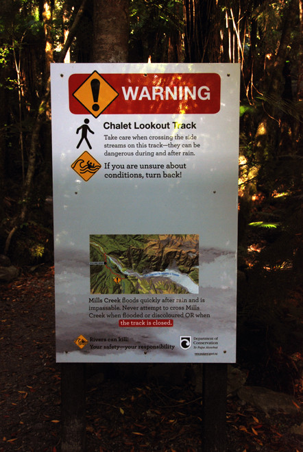
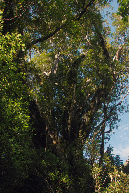
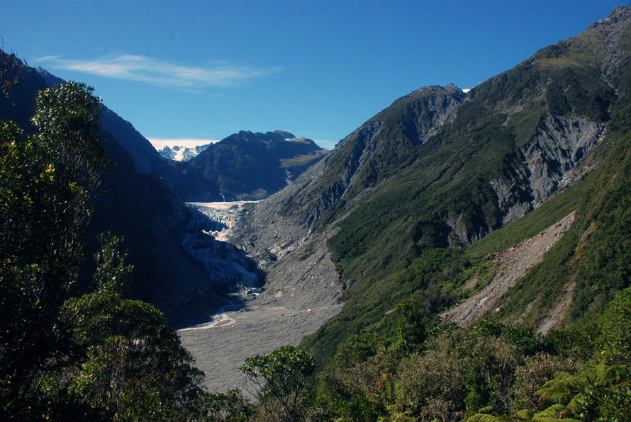
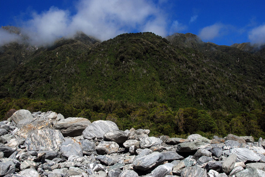
The next part of this page is a series of photographs taken whilst walking up the path to the Chalet Lookout in the Fox Glacier valley.
This is a great path because it is much less visited than valley path to the glacier terminus - in part because it is inaccessible to campervans, minibuses and coaches and in part because it is slightly further from Fox Glacier Village. It has an altitude of 280-440m.
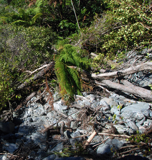
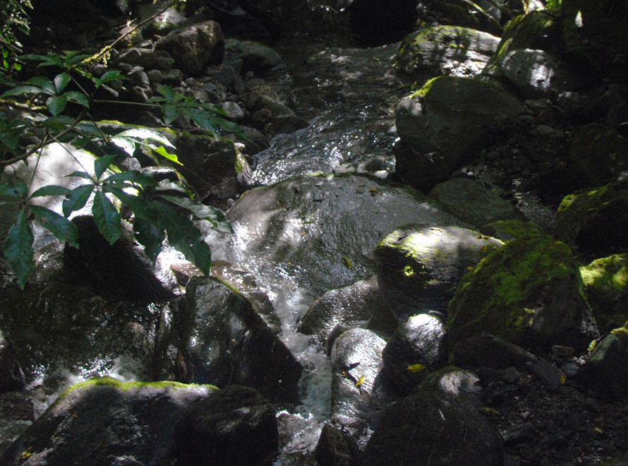
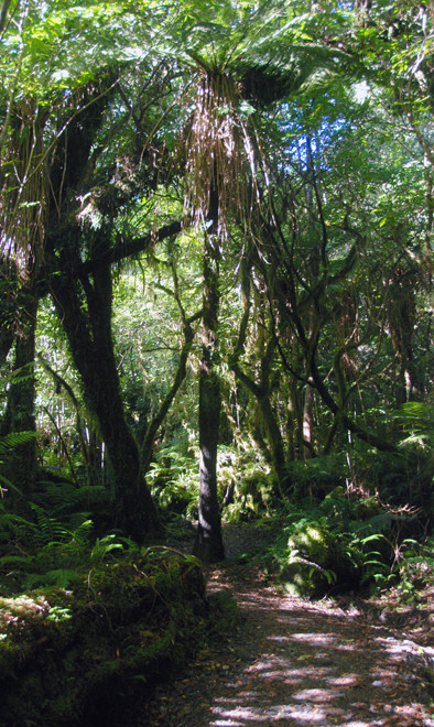
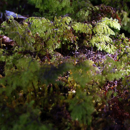
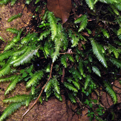
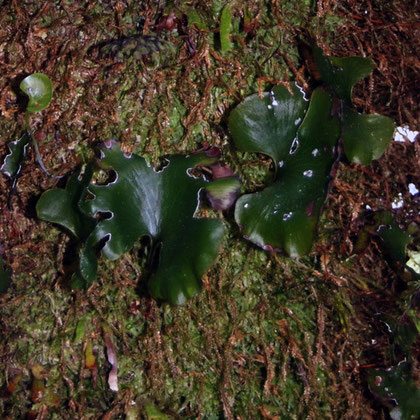
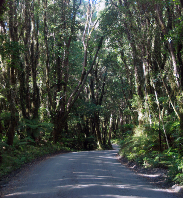
It is steep and winds up behind Cone Rock alongside of Mills Creek through dense scrubby low-canopy forest. Light levels are low and water seems to flow, ooze and creep everywhere. I was amazed by the mosses, lichens and forest floor plants growing on the trees and rocks.
I wonder now if this forest had been logged out in the early 20th century. There was an absence of specimen trees but this could have been due to the terrain, flooding and landslips as much as logging. However, the presence of the Mills Creek would have provided a means of rushing timber to the valley floor.
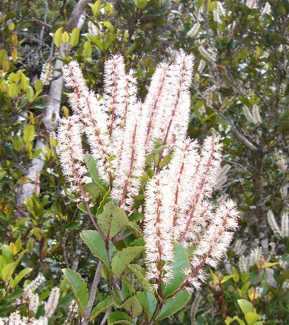
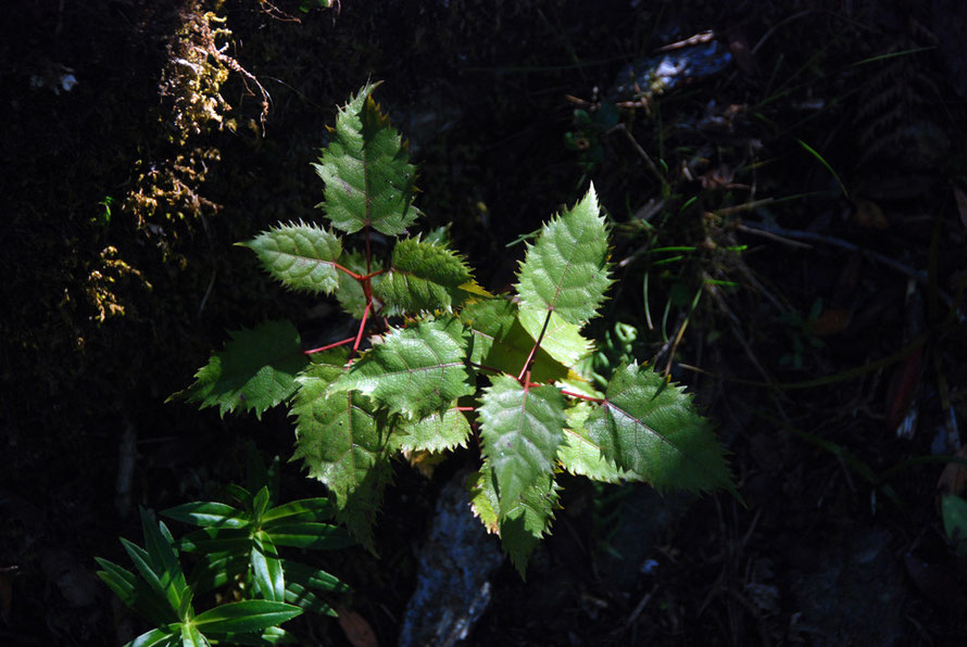
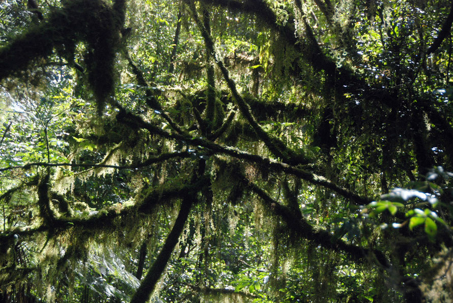
The photos below are but a selection of the mosses, liverworts, lichens and ferns growing on the forest floor on the walk up to the Chalet Lookout. New Zealand has huge diversity in its mosses (over 500), liverworts (over 600) and lichens (2,000 species and counting).
The temperate rain forest understory along the Chalet Lookout Path at Fox Glacier


Water, water everywhere...


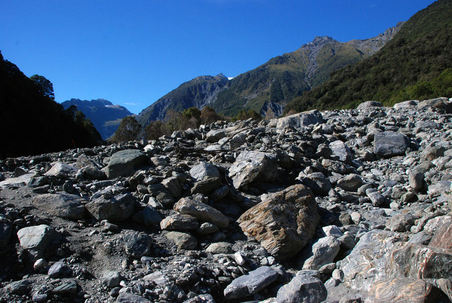
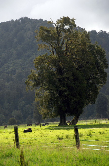
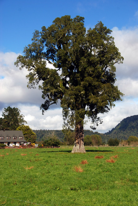
The Cook Flats below Fox Glacier Village
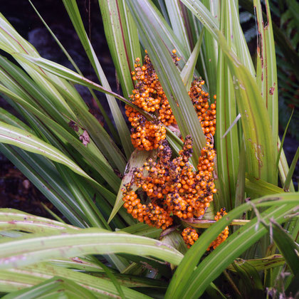
We passed by a majestic matai tree 'Black pine' (Prumnopitys taxifoliatree) on the Whataroa Flats. It has a thicker, fluted trunk that the kahikatea and is part of the podocarp family.
Its seeds are dispersed by the Kereru/New Zealand Pigeon (Hemiphaga novaeseelandiae). It feeds on the matai berries and thus disperses them. It is a different genus from the European Wood Pigeon.
The hard timber of this tree was used extensively for flooring during the mid-20th century. Very few intact Matai-dominated forests remain (Te Ara).
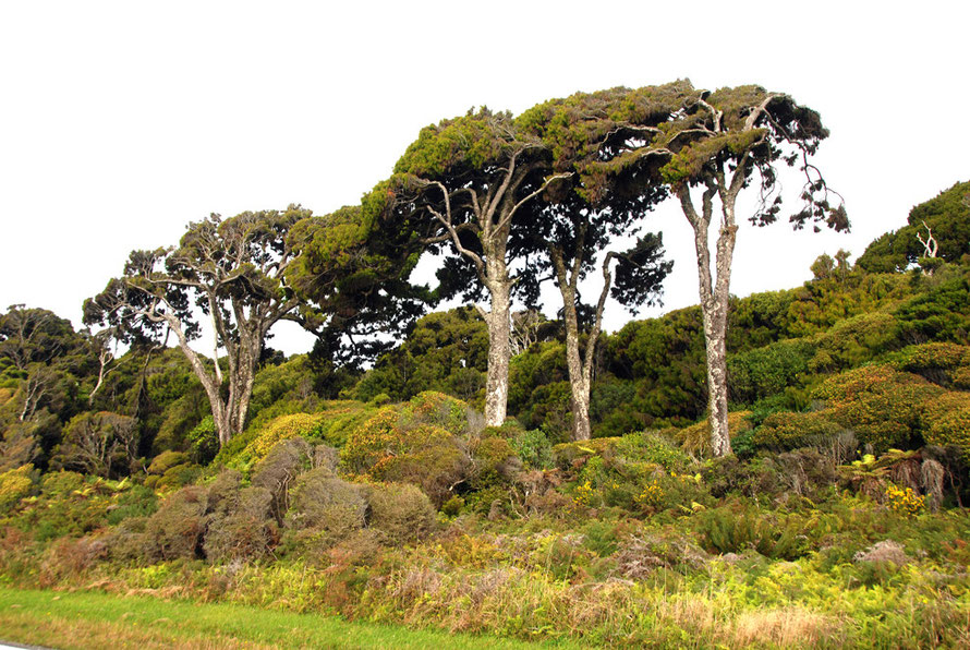
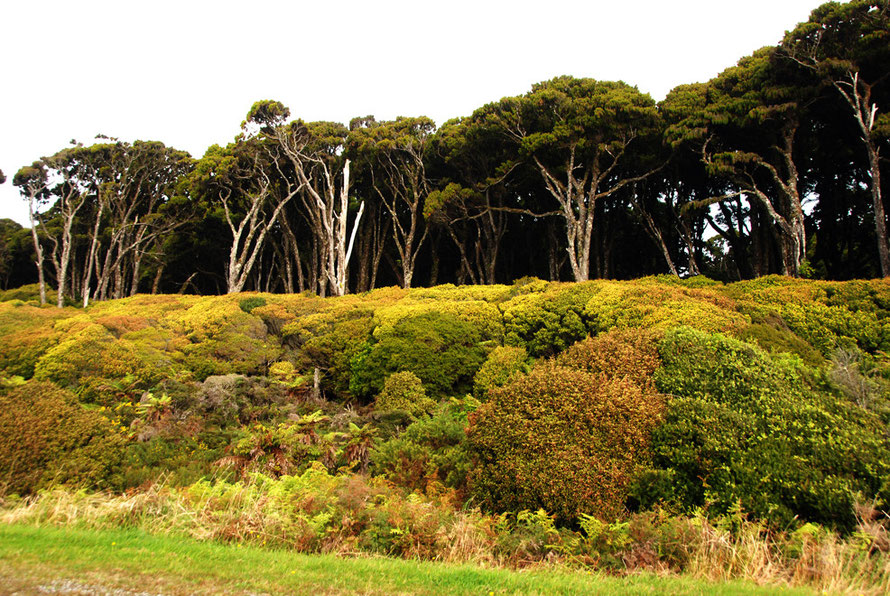
The West Coast forests
Near Heretaniwha Point the podocarp forests of Westland change dramatically to the beech forest of south Westland and Fjordland. The hills inland are dominated by silver beech.
The swamp forests behind Bruce Bay and Hunts Beach are dominated by and kahikate.
The absence of beech forest in the central part of the region – known as the ‘beech gap’ – is thought to be due to the extent of glaciers during the ice ages, which destroyed the vegetation in this area.
When the glaciers melted, 15,000–10,000 years ago, the bare land was quickly colonised by conifer and broadleaf trees, because their seed is rapidly spread by wind and birds. In contrast, beech seeds are slow to spread.
Conifer–broadleaf forest covers the area between the Taramakau and Paringa rivers


For history of logging in Westland see Te Ara
From the Westland Tai Poutini National Park Management
Plan 2001- 2011
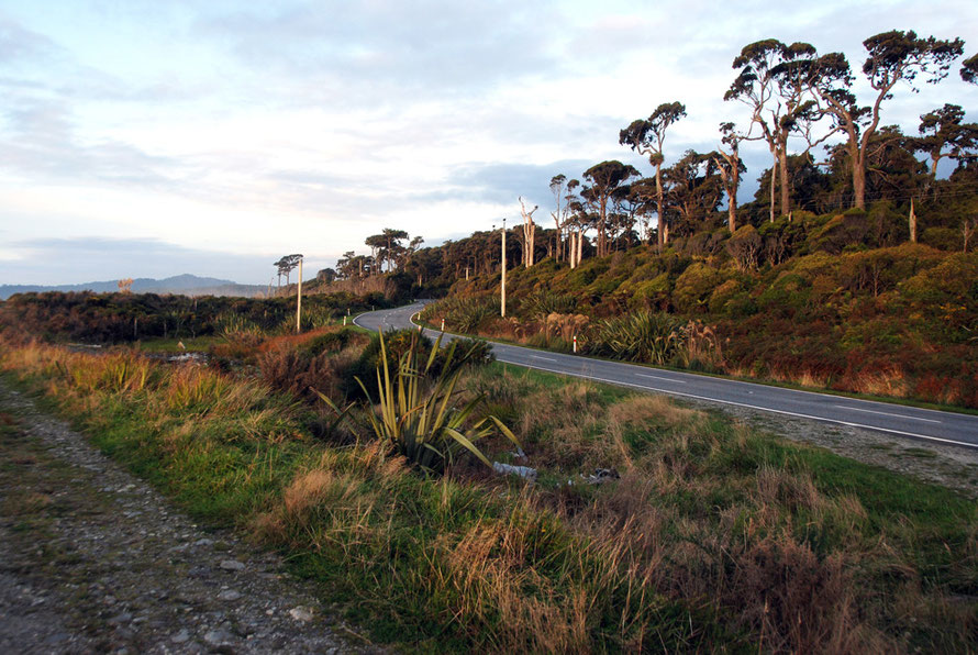
Near the coast extensive saltmarshes occur around the coastal lagoons, and sand dune communities occur along the main beaches. The coastal vegetation reflects both the scarcity of suitable niches along the gravel beaches and bouldery headlands and the high rainfall which washes away salt deposits. The shore korimiko/kokomuka, Hebe elliptica, is the only common true coastal shrub. Dense flax and shrubland, often fire induced, clothes the coastal cliffs, dunes and headlands. Gorse extends right along the coast and is locally abundant. Pïngao, an endemic sand-binding plant now rare in many places, is present on the dunes but so too is its major exotic competitor, marram grass. The coastal lagoons are backed by infertile coastal swamps with abrupt transitions to forested hills and swamp forest.
Aquatic vegetation is largely confined to the lakes, lagoons and smaller streams as the main rivers are too unstable. Owing to their infertility, the open water bodies are sparsely vegetated. One of the more abundant aquatic plants is the naturalised Canadian pond weed, which is well established in Lake Mäpöurika and Lake Wahapö.