Coromandel Day Trip
The Coromandel Peninsula was my objective on Day 4 of our Auckland stay. Having trekked out to the West Coast beaches the day before it only seemed right to do a punishing day of driving to the south and east.
The Coromandel Peninsula is a relatively remote area on the eastern side of the Firth of Thames that extends 85km northwards into the Pacific Ocean owards the islands in the Hauraki Gulf to the east of Auckland. It is named - like Miranda - after another ship of the British navy, the HMS Coromandel, that called into the port - now called Coromandel - on the northern part of the Peninsula to collect kauri spars in the 1820s. The ship itself was named after the Coromandel Coast of India.
The AANZ drive time calculator puts the distance from Central Auckland to Coromandel at 168km and 2 hours and 30 minutes. The drive is a bit of a pig because you have to drive south and east to skirt the Gulf of Thames before climbing onto the base of the Peninsula at Thames.
The day dawned fine and after making a proper breakfast for The Principal I gathered my numerous bits and pieces together, got the car from the valet - always a slightly embarrassing procedure - and headed out onto National Highway 1.
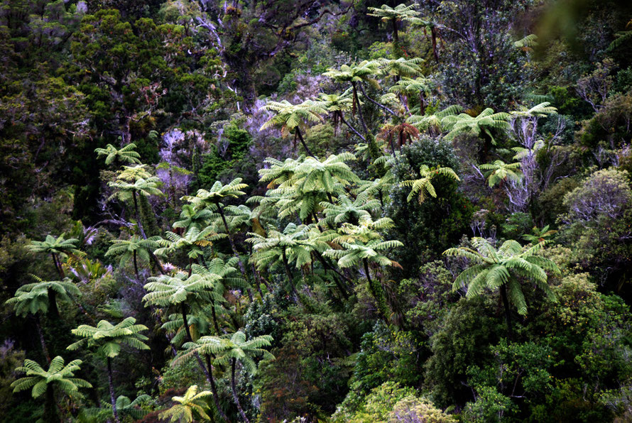
Coromandel was once an area of goldmining and timber extraction. It is mainly made up of steep-sided hills covered in second growth temperate rain forest and the roads are fairly tortuous -
either winding around the highly indented coast or through the hills and mountains that rise to 892 metres in the Moehau Range in the north.
My plan was to head for Thames on the fastest roads and then make my way up the west coast to Tapu and then head east up over the Coromandel Range on a gravel road to descend to the east coast and proceed further north and west to reach the village of Coromandel. In all that probably worked out at 6-7 hours of driving.

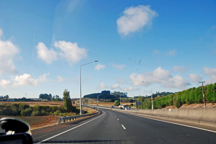
I deployed the old, 'You'll only probably ever be here once' mantra to gee myself up and headed south out of Auckland on roads that quickly quietened down after piling through the southern suburbs and satellite towns of Papatoetoe, Manurewa and Papakura. I had to make enough south to skirt the Hunua Ranges and left NH1 near Pukekohe for NH2 which goes to Tauranga at the top of the Bay of Plenty.
I have little recollection of the drive - it was just 'space inbetween' - and I was slightly anxious at the amount of road I had bitten off to chew, so to speak. After the NH2 crossed the low Hapuakohe Range I turned due east onto NH25 to cross the dead flat Hauraki Plains for Thames.
Later I learnt that the course of National Highway 1 from Auckland follows the route of the Great South Road, built under the aegis of Governor Thomas Gore Brown in 1862 as a military infrastructure development in the looming war against Maori iwi in the North Island that became known as The New Zealand Wars.
The road was built to the Mangatawhiri River, which formed the border with Waikato to the south (which was where I turned off the road to head east to Coromandel). At the end of the road Brown
had a redoubt built with telegraph and strong supply lines back to Auckland (see King, History of New Zealand, p.214).
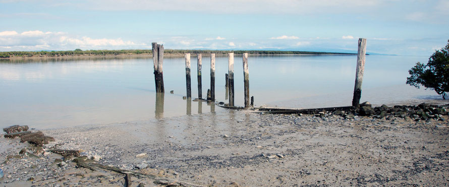
Feeling a little punch drunk I crossed the Waihou River near Thames and pulled into a little industrial estate so that I could stop and maybe get a few photos. (The big national routes are not so easy to stop on and I was pretty much in a hurry to 'get there' - wherever that quite was.)
I pulled up over a flood defence burm and got a view of the broad Waihou river mouth, the mudflats, some piles driven into the flats, the distant mangrove and a kingfisher perched on one a fence post.
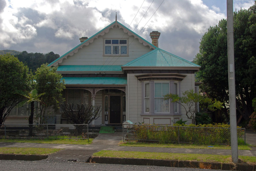
In my hurry I had just set the Satnav for 'Thames' and the nice lady took me to an area to the south of the town centre. It was made up of colonial style tin-roofed houses. I drove up and down a street or two and then got onto the main drag and stopped for a cup of strong coffee.

Thames was once a ferociously busy gold mining town with a population of 15,000 in the nineteenth century but it seemed pretty sleepy in end-of-season March 2014 (pop 5,000). There was a main drag and not a lot more. I climbed back into the Bluebird, eschewed the Satnav and drove north up the winding coast road.
Once beyond the town and its low factories a vista opened up across the Firth of Thames with rusty-orange sand in the foreground, wading birds feeding in the mud flats and the sparkling sea and sky beyond.

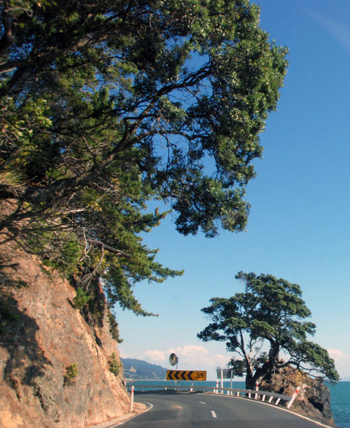
It was a spectacular enough road, hugging the coast when not threatening to pitch onto the beach and lined with a procession of pohutukawa trees hanging out from the low cliffs
and outcrops. I had quite a way to go and thought I'd take some photos on the way back.
The traffic was sparse and the day was fine and I was at Tapu quickly. Here I turned off the coast road and up along the bed of the Tapu River that drains out of the steep hills of the Coromandel Range. Short intensely green bush covered the hills with outlying straggly pines. The river was low and very clear. I passed a sign that made me laugh. On an irregular offcut of ply above a rusty letter box someone had written, 'No dogs, trespassing, shooting, hunting, theft or anything else that pisses me off. Welcome friend.'
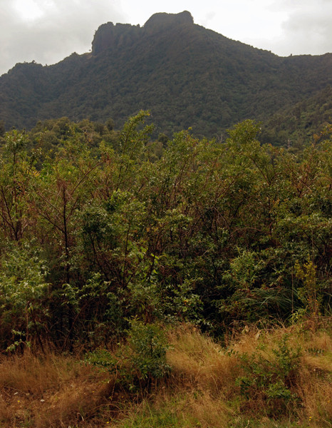
Shortly after that the surfaced road went to gravel and began to climb. Ahead I could see a fist like summit that reminded me of the Pentadaktylos Mountains in Cyprus. This was Maumaupaki or the 'Camel's Back' at 822 metres.
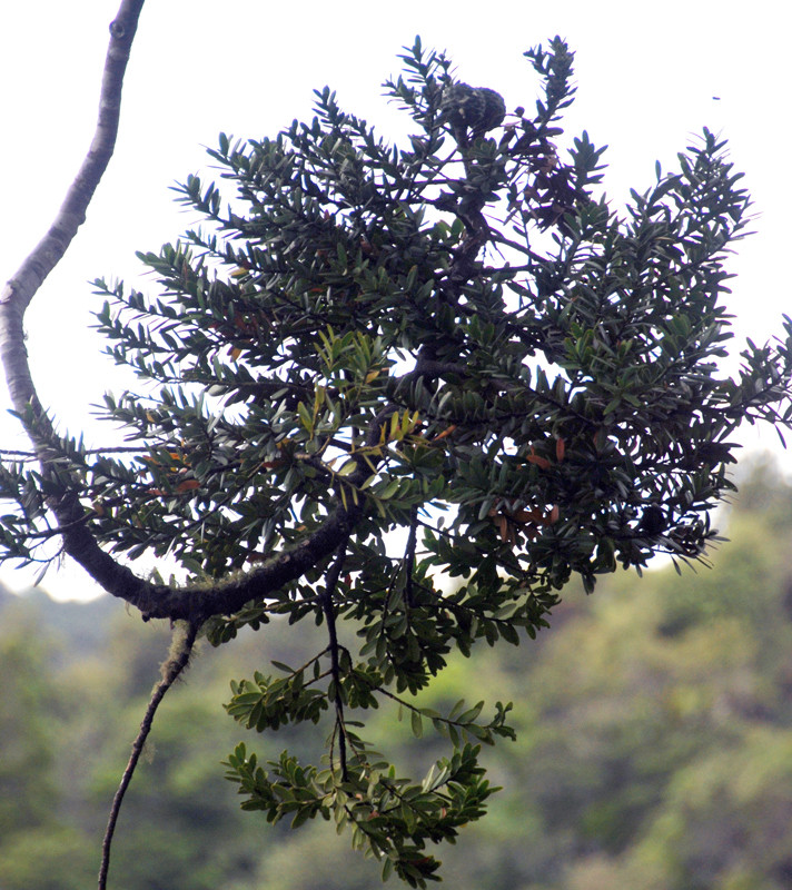
The bush looked pretty impenetrable with few mature trees - they all having been logged out. I came across a video of a group who climbed Maumaupaki - the 5.3km and 800m of ascent took 'a staggeringly long 7 hrs 15 mins ... crashing, bashing, climbing, hauling and grovelling ourselves to the summit of this beast to bag a geocache and sign a logbook that has been up there since 1973'.
It looked arduous going through the dence low bush of rewarewa, kamahi, kanuka and manuka.
The Coromandel is an area of dynamic volcano activity from distant geological periods - the Miocene and Pliocene - 10 to 20 million years ago. Lava was spewed out on the already uplifted
greywacke basement. Maumaupaki is one of the few volcanic plugs left from this activity. Later volocanic activity spread large sheets of lava from cladera-type volcanoes. There are still some hot
springs - at Hotwater Bay needless to say.
My reason for cutting across the peninsula was twofold. One was to create a circular route to follow rather than having to tail back on myself. The other was to experience the hills and bush and a giant kauri tree - the Square Kauri - that somehow escaped the clearance of the European kauri loggers.
I pulled up in a gravel layby not far from the top of the range just as a bunch of raucous laddos was leaving. Silence reigned and a fairytale set of steps led into the steep, dark, dense bush. I walked up and around a valley side that took me to a viewing platform.
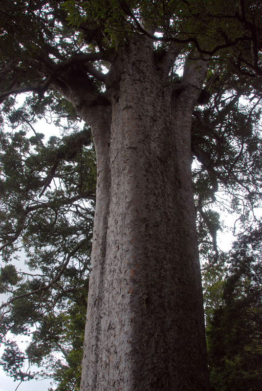
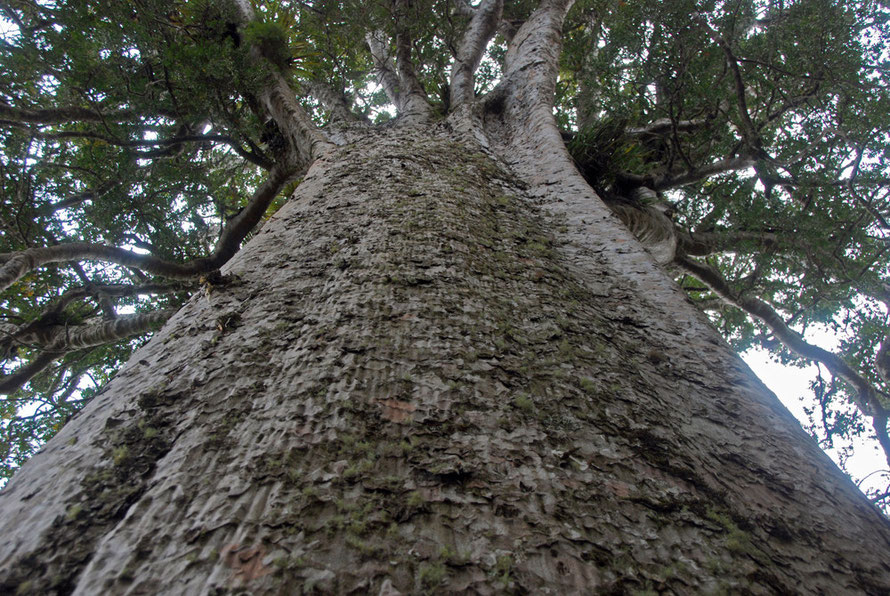
The kauri tree (Agathis australis) was really quite incredibly impressive - its ramrod straight elephant-grey rectangular trunk was huge and rose imperiously above the surrounding bush. At the top of the trunk branches sprang out at the same level like a boabab tree.
The tree had a girth of 8.76m and a clean trunk of 12.8m which was estimated to contain 70 cubic metres of timber in 1975.
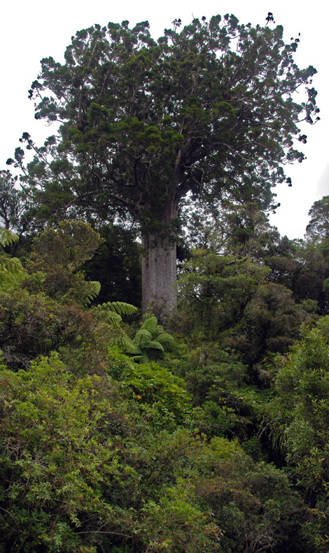
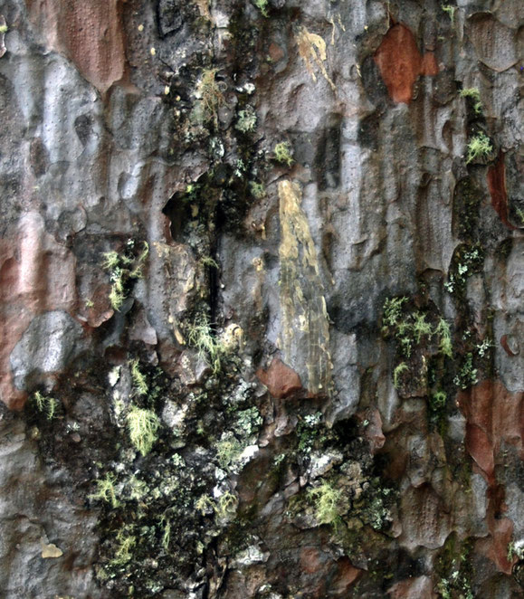
Closer up the bark had a hammered and ridged texture. It was also variegated between the matt grey and lighter rusty brown patches where pieces of bark had fallen away. This is a clever
evolutionary ploy to repel tree climbing plants and creepers. The bark in turn was splotched with dried patches of kauri gum that had fallen from higher up the tree and
solidified.
It really was a remarkable beast. I climbed over the barrier to feel the tree and to gaze up into its distant crown. Irregualar scales of fallen bark littered the ground like leaves. I picked one
of these up and have it still.
Coromandel's kauris were first exploited for their maritime uses - for both the British Navy's visiting and on-station ships and for locally built craft. They were also used for local building
and the expansion of Auckland - less than 50km away by sea.
The abundant rainfall and steep-sided valleys were utilised by building dams to wash the giant kauri trunks down to the coastal sawmills. Huge quantities of timber were wasted and by the 1920s
the trade and the forests were gone but for a surviving 400 hectare block too remote to attract the attention of loggers.
The Sqaure Kauri is the Coromandel's 15th largest kauri tree and is estimated to be 1200 years old.
I descended the 187 steps of the bush path back to the car and got on my way. By now clouds had rolled in over the hills.
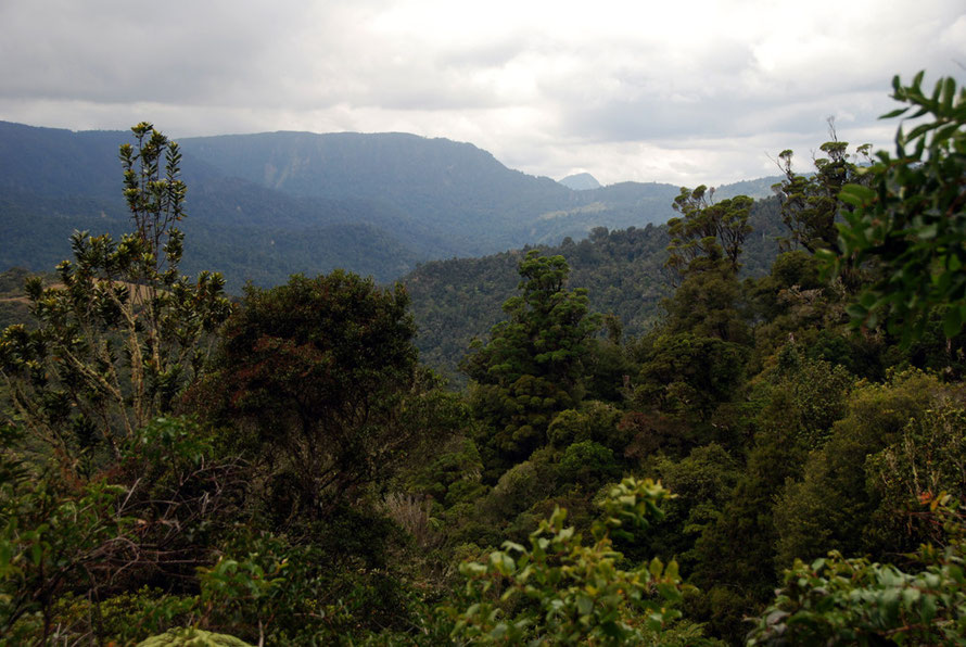
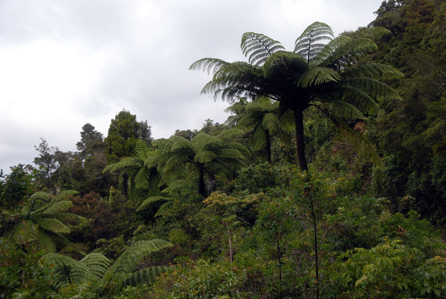
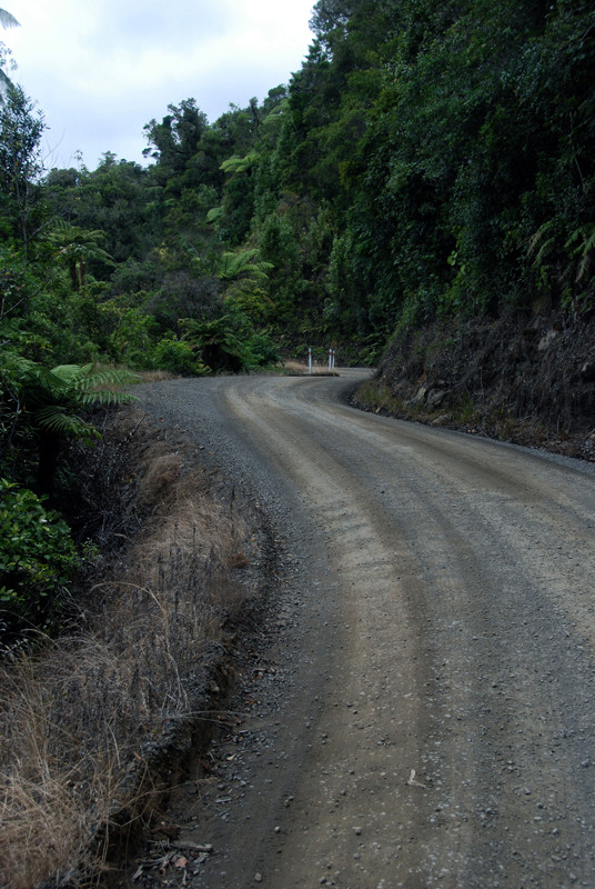
Higher up on the gravel road (that reaches 448m) more of the temeperate rainforest was visible stretching away across the Coromandel Range. Even here in the North Island the rainfall in the hills is 2.5m a year. Temperatures are moderate but frosts occur and wind exposure can further lower temperatures.
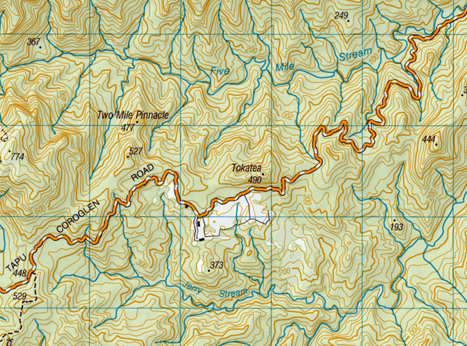
The Tapu-Coroglen Road is full of curves and blind bends. Not really two track it calls for vigilance even though the traffic on the day I drove it was very light. Some people tear along and it's easy to be lulled out into the middle of the gravel road as you follow the ruts of the traffic.
The views at the top of the range were spectacular as the hills stretched away, ridge after ridge cloaked in dark forest.
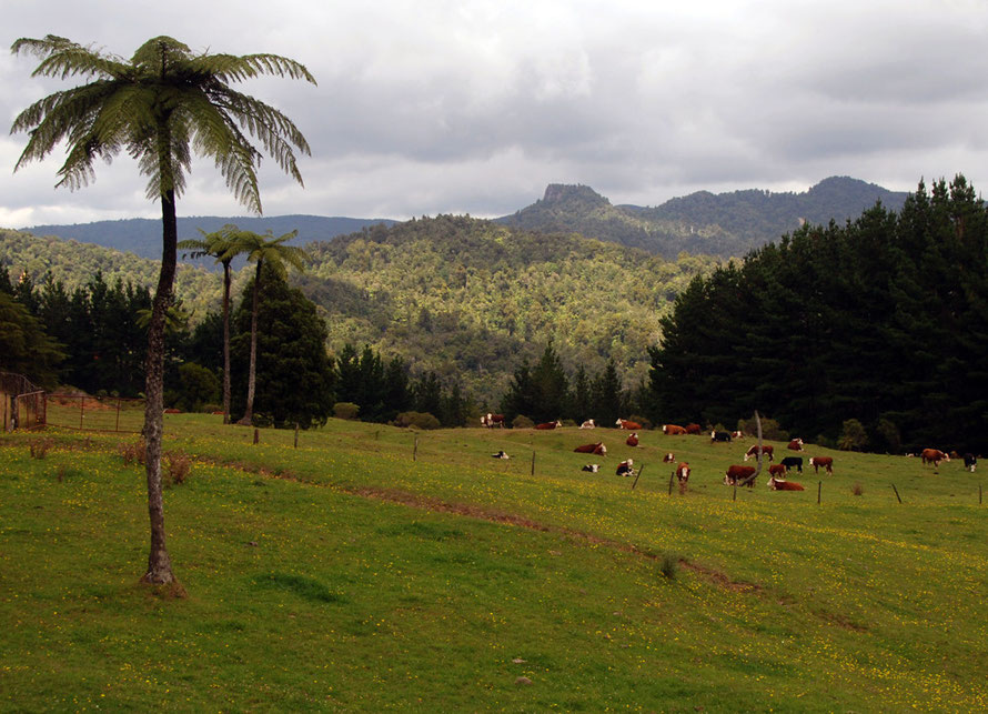
The clouds were lower now and I pushed on, suddenly coming to a break in the bush where a herd of Hereford cattle were grazing in bright green paddocks scattered with buttercups and a single tree fern.
The road soon dropped away and down eventually past sheep paddocks and a big tree nursery before rejoining the coast road on the east side of the peninsula.
I drove by the flooded, mangrove filled river valley - ria - near Whitianga and up over some other hills before dropping back down to the coast again.
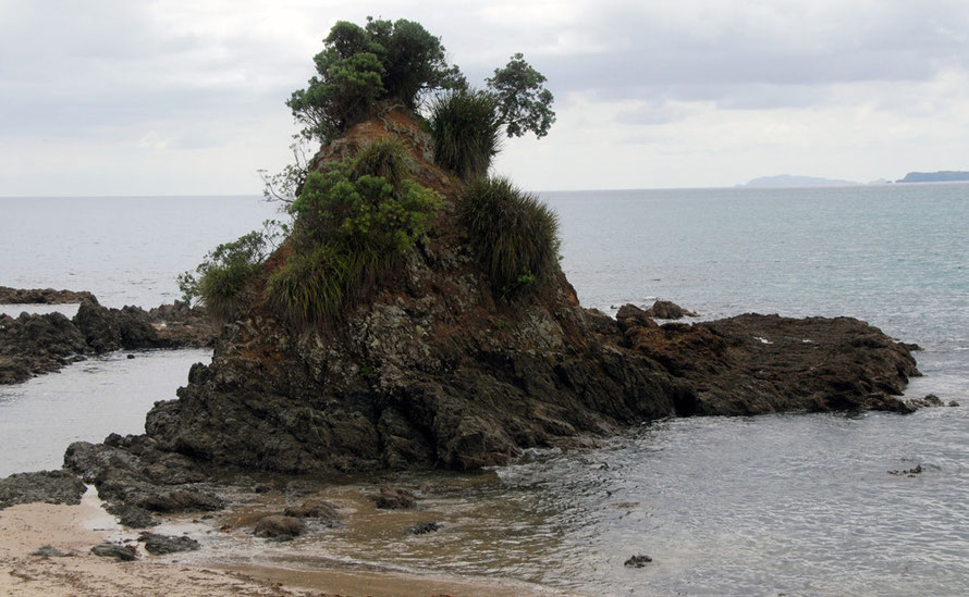
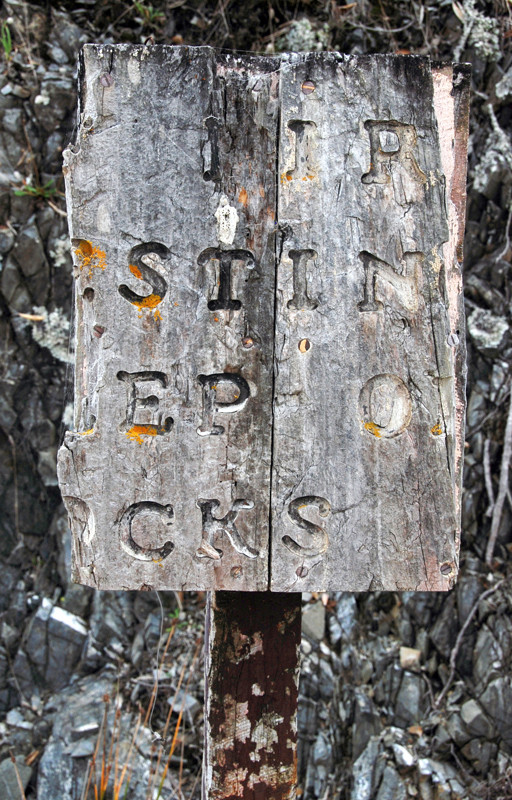
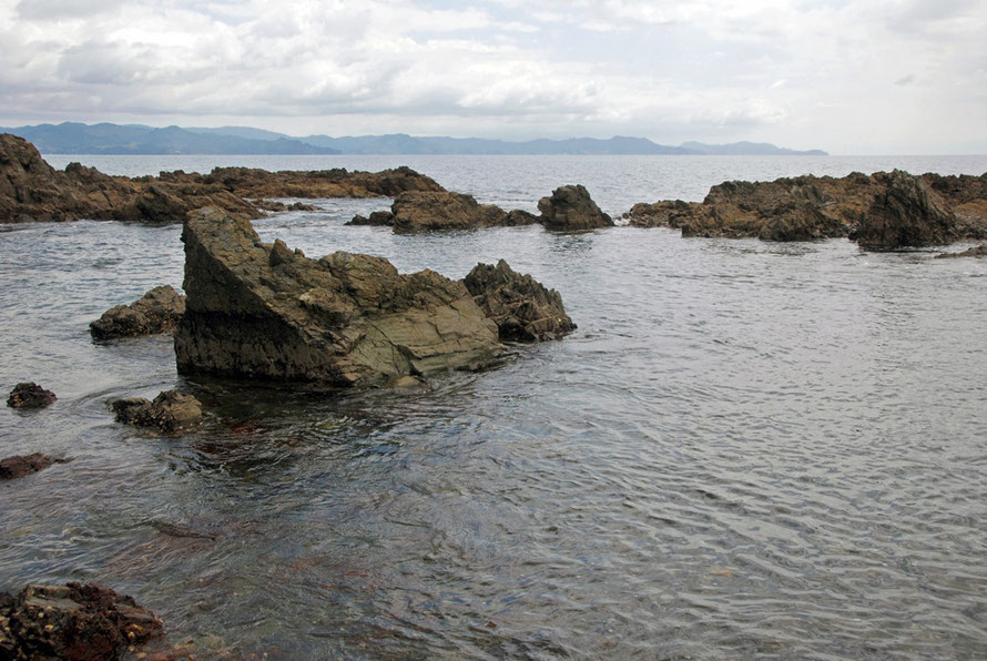
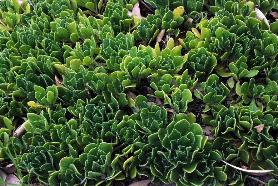
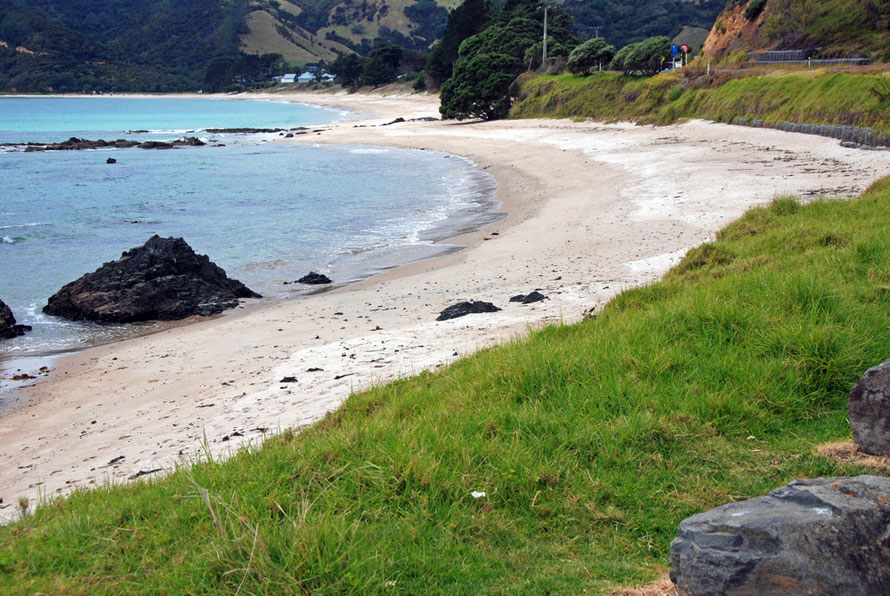
I stopped by a bay near Kuaotunu with some interesting tidal rocks where a lot of boatie pickups and trailers were parked. I had a bit to eat and wandered around on the rocks. A pinnacle of rock was festooned in epiphytes - something I had never seen before. There was also an very weathered, broken sign that I eventually deciphered. And a red-legged gull.
Although interesting it was turning into something of a lonesome day. The jet lag still rumbled around and I'd not talked to anyone for most of the day. That happens sometimes and the more lonesome you get to feel the harder it becomes to strike up a conversation.
You get to feeling like an outcast, a Billy-no-mates surrounded by a sea of sociability. But what you gonna do? I was at about my maxima from Auckland. It would have been nice to kick back with a beer, some laughter, and a seaside hut for the night. But that wasn't the deal.
I get pretty driven when I'm off by myself and I have been accused of treating it like a job. But for me this was exploration time. And also a time to test myself. My 'Lonesome Traveller' time. My little bit of 'On the Road' time. I'd read the books but this was me actually doing it. In my won small but challenging way. Not that I really realised this at the time. I was too tired.
The white sand beaches, the interesting and safe inlets, the 'interior' and valley bottoms were very attractive. I could see why Auckland's back-to-the-landers and seekers of alternative
lifestyles might have wanted to decamp here although from the mainroad I didn't see a lot of evidence of it.
But the NZ Topo map shows the detail of the coast and hundreds of places to hide away.
I continued skirting round a ria at Whangapoua and then the road jacked up over another range of steep, deeply forested hills clad in dark forbidding pine plantations.
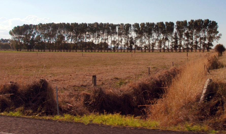
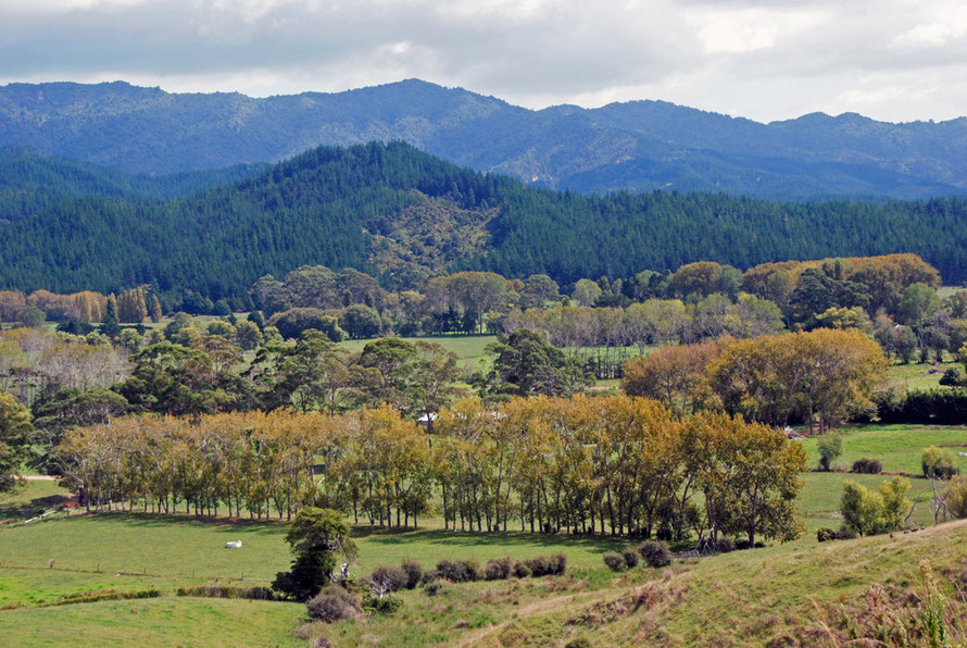
Before that some of the valley bottoms looked like a mixture of rural England and France, with straight lines of poplars beginning to turn to their autumnal colours with neat paddocks and hills of pine climbing behind them .
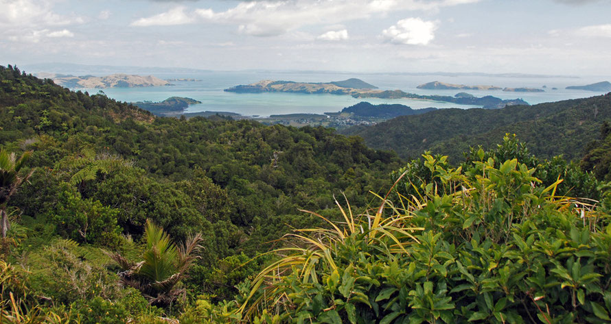
The road climbs swiftly up another high ridge to cross back over the Coromandel Range. The ridge top viewpoint had spectacular views of Coromandel Harbour from the top. I took a brief walk
along a ridge top path enclosed in thick bush and slippery with moisture. I was hoping to see something - what, I can't recall - but I soon came back disappointed.
I got in the car and barreled down the steep incline to Coromandel village.

I walked out on a long breakwater in the dazzling sunlight reflecting from the harbour to look at some fishing boats.
The Harbour is beautifully sheltered and opens out into the protected waters of the Hauruki Gulf which eventually joins the Pacific Ocean. But it is remote and seems to only support a small fleet
of day boats and mussel farming.

Mangrove swamps edge into the harbour and houses are scattered along the harbour arms. The village itself is set back from the water's edge and is little more than a main street of shops, cafes, touristy galleries and a pub or two. It would be hard to call it buzzing but it had a quiet hum of late season couples at cafe tables and locals doing their errands.

There was a well-manicured park and a 'Coromandel Office' with Maori carvings in bright red and black and a War Memorial commemorating the thirty seven Coromandel men who gave their lives in the
Great War. That seemed an awful lot of men from such a small town (pop. 1,610 2014). On the reverse of the memorial was another stone for the twelve men who gave their lives in the IIWW and on a
side stone the name of the one man - L M Tarrant - who died in the South African War (1899-1902).

I bought more coffee and wandered into a well appointed hardware store. There after some deliberation I bought a frying pan with some kind of eco credentials and a rubber-handled wooden spatula. This was to supplement our woefully equipped kitchenette in the hotel. I figured it would easily pack into my suitcase at the end of the holiday - as it did - and would replace the frying pan I had bought in New York two years earlier.
Why is it that self-catering places always have such crap, scratched frying pans that stick as soon as you put anything other than onions in them?

I said to the cashier that I'd come all the way from Dover in England to buy a frying pan in Coromandel but my lame wit fell on deaf ears. I asked how long it would take to drive to Auckland and
I got a response of two and a half to three hours depending on the traffic.
My heart sank.
I would have loved to press on up the peninsula to Cape Colville on more gravel roads but it was already gone three o'clock and reluctantly I made my way back to the car and the long drive to Auckland.

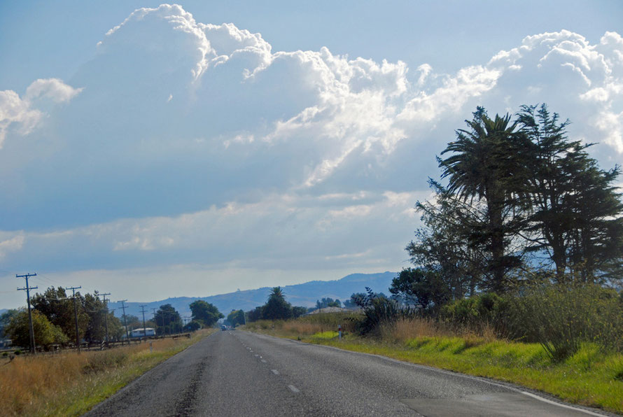
The road at first skirts more flooded river valleys and then climbs over a spur of the Coromandel Range before settling down along the very edge of the Firth of Thames. The clouds that had
earlier gathered turned whispy in the clear blue sky and piercing light as I left the mountains.
It was gloriously driving weather and there was little traffic on the road. Every now and then I'd pull over to let a local in a pickup on their way back from work charge by.

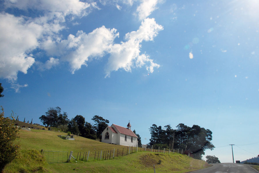
I passed the beautiful elongated Manaia Harbour, a wayside white clapboard church and wended my way by the sparkling waters of the Firth and the overhanging pohutukawa trees to
Thames.
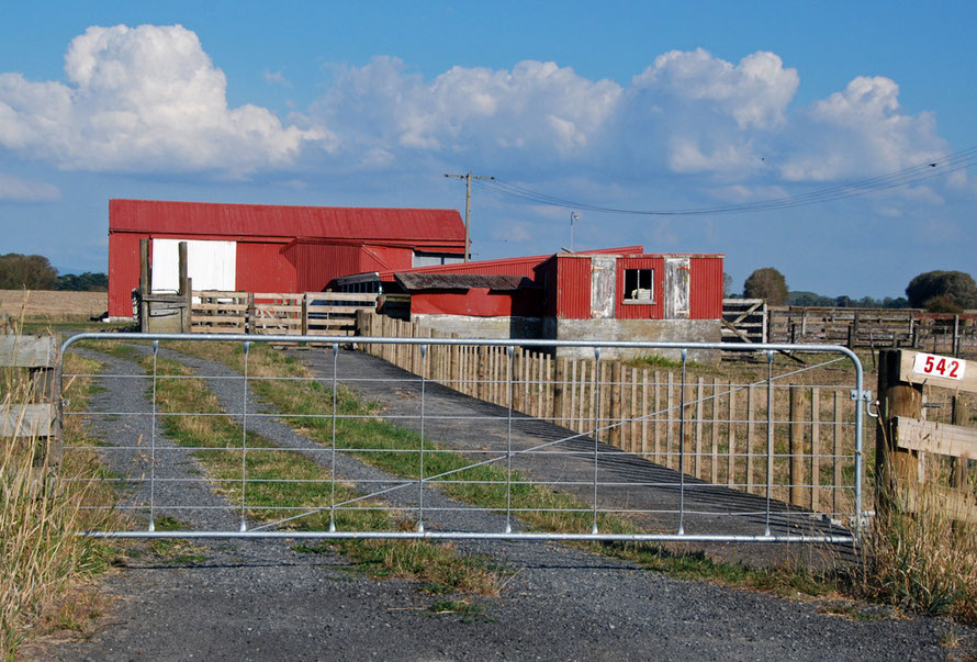
I stopped for petrol on the outskirts and headed out across the dead flat and dead straight road over the Hauruki Plains. The lowering sun picked out the detail of the country: rows of poplars,
red tin barns, dried out golden paddocks, date palms and roadside farmhouses.
I soon rejoined the NH2 and put my foot down as much as I could with the country's low speed limits and pushed on back to Auckland.