
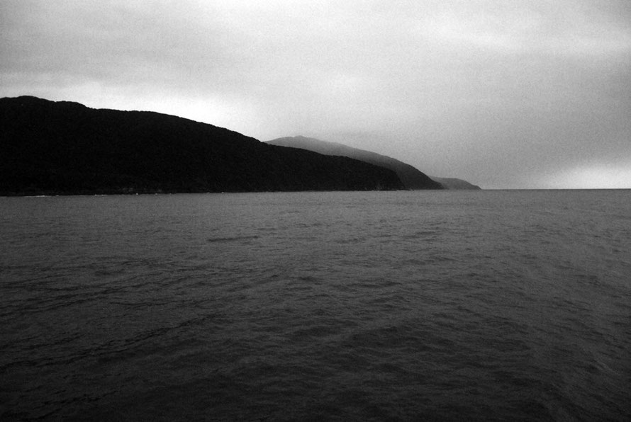
VII. Milford Sound: Some History

Maori had settled and lived at the Sound since 1,200/1,300 AD. Warfare between iwi saw most Maori move away but for a remnant 'lost tribe' that was small in number and rarely seen.
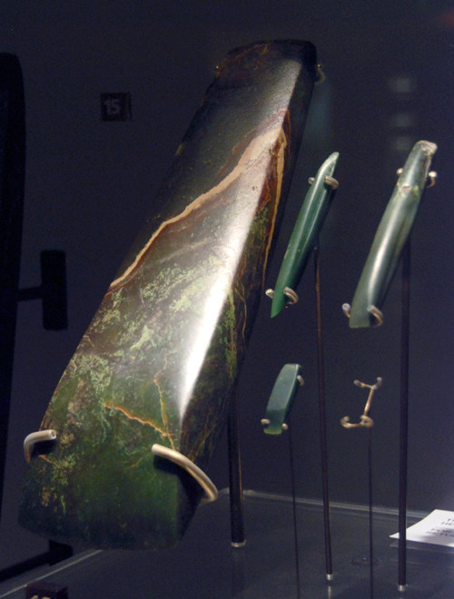
However, as elsewhere on the West Coast of the South Island, there were important deposits of pounamu - greenstone. A particular pounamu - tangiwai (bowenite)- was found at the mouth of Milford Sound.
Maori traders came huge distances over the mountains to find and transport the sacred stone that served as iron and marble for the Maori. (See this useful National Georgraphic article).
The Maori named the sound 'Piopiotahi' after the thrush-like piopio bird, which is now extinct.
Tangiwai - the tear-water stone - is a bowenite rock and the most ancient form of pounamu. It takes its name from the tears that come from a deep sorrow that is never completely healed (see Te Papa Pounamu Exhibition). It occurs at Anita Bay on the south side of the Milford Sound entrance.
An archeological survey in the 1970s of Anita Bay revealed disappointingly little about Maori visits and habitation at the site which it turns out had rather poor quality and flaky bowenite (unless landslips had covered previously accessible deposits).
It has been suggested on the basis of our present knowledge of prehistory in Otago-Southland, that the artefacts for the Milford Sound-Anita Bay areas notably do not belong to a single phase, but are representative of several phases. One concludes that the area has probably been visited sporadically over a long period of time.
(Coutts, P., 1971, Greenstone: The prehistoric exploitation of bowenite from Anita Bay, Milford Sound, The Journal of the Polynesian Society p.62.)
Although a bloody inhospitable place there was plenty of fish in the sea to sustain would be, albeit temporary, settlers. Marine edibles included blue cod (Parapencis colias), groper (Polyprion oxygeneios) sharks, crayfish, penguins, fur seals and limited shellfish. Edible birds included kaka, woodhen, pigeons and muttonbirds.
Although Maori knew of an overland route to Anita Bay it is more likely they arrived by canoe from Martin's Bay 18 miles to the north where there was an active community into the 19th century (Coutts, 1971 p.66)
Pakeha attempts to find a source of bowenite at Anita Bay in the 19th century were largely unsuccessful and there is speculation that landslips may have covered richer beds previously on the surface.
The pakeha story of Milford Sound is similar to many areas of wild coastal New Zealand.
After Captain Cook's five week stay in Dusky Sound, further to the south, in 1773 one of his crew returned and set up a sealing enterprise in 1791. When the abundant fur seal were all but wiped out whaling and logging took over. A very short-lived gold rush yielded neither much 'dust' nor joy.
Captain Cook's voyage had overlooked Milford Sound thinking that its narrow entrance was but a shallow bay at Dale Point.
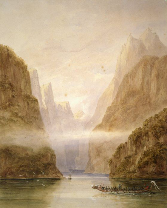
The South Island was surveyed by the Royal Navy through the survey ship, the HMS Acheron 1848-51. The surveyor, Frederick John Owen Evans, also painted watercolours like the one above of Milford Sound. It is likely the waka/canoe was added by Evans.
The fjord was named by a Captain John Grono who claims to have discovered it in 1812. It was named after Milford Haven in his homeland of Wales. Milford Haven is a flooded valley system (a ria) and could not be less like a fiord.
Grono was from Newport in Pembrokeshire, east of Milford Haven. He became an Australian-based sealer and transported huge cargoes of 10,000 fur seal skins from New Zealand to Australia in the early 19th century.

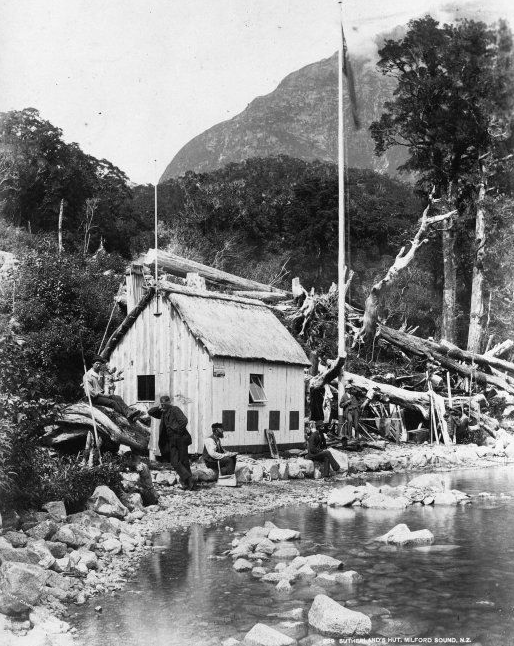
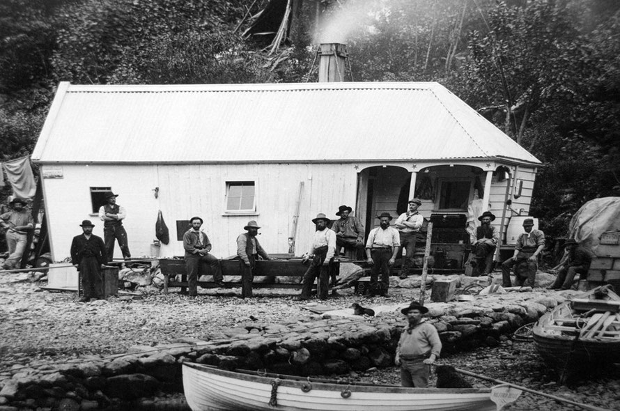
Donald Sutherland, the so-called 'Hermit of Milford', made the Sound his home for 40 years.
Sutherland was a Scot from Wick in Caithness and a restless spirit in a restless age. He joined British volunteers fighting with Giuseppe Garibaldi for Italian unification, sailed for New Zealand and had various posts in the militia and Armed Constabulary.
Te Ara notes that, 'after the fall of Tauranga-ika [Sutherland] served as a scout, and took part in the decapitation of fugitives resulting from the misinterpretation of a bounty offer for prisoners.'
Nevertheless, he was made a corporal and received the New Zealand War Medal.
Never far from trouble he had a few forays into the goldfields in Otago and on the West Coast with little luck. In 1877 he set sail with his dog, John O'Groats, in a small open boat from Dunedin and journeyed until he reached Milford Sound (a voyage of some 600-700km in incredibly exposed seas).
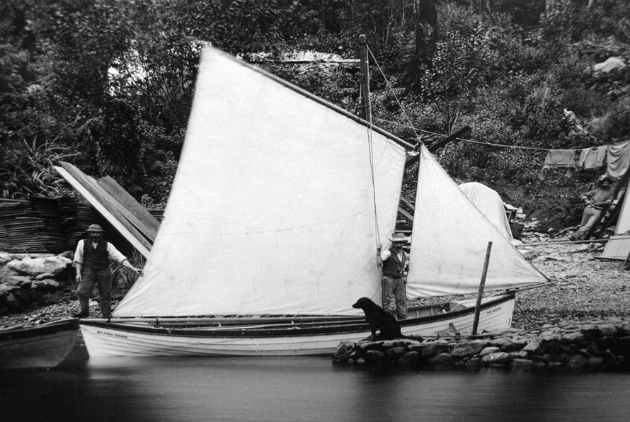
Here he set up camp and planned a 'Milford City', prospected with other explorers and found the Sutherland Falls (1904ft) which were subsequently named after him. In the 1880s he was pretty much on his own but for the six-monthly steamer visits. When these called he guided visitors and shared his passion for bird watching.
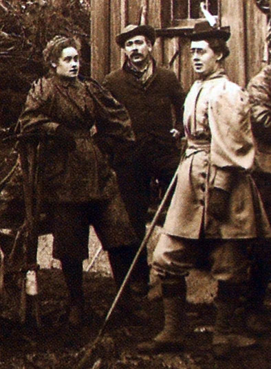
He married Elizabeth Samuel on 7th August 1890 in Dunedin. Samuel was, 'a woman of vision, determination and some financial means' and the daughter of a Bedfordshire farmer in England (Te Ara: Donald Sutherland).
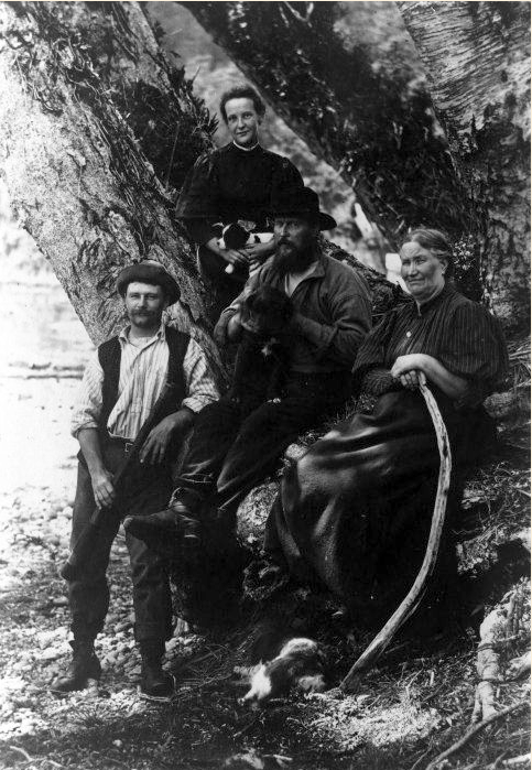
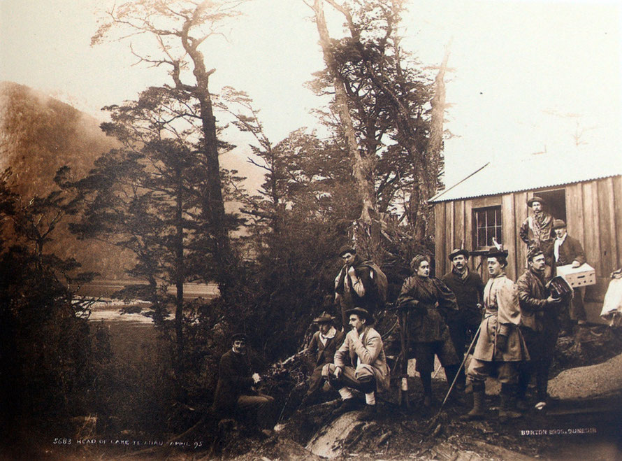
Together they built a twelve bedroom hotel, The Chalet, that catered for 40 visitors in 1888-9 and 70 the next season. Visitors arrived by foot via the newly opened Milford Track rather than the yet to be built Milford Road.
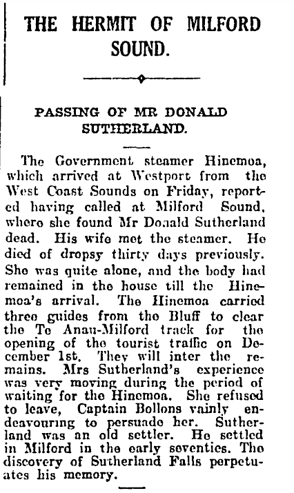
Donald died in 1919 of 'dropsy' (edema - his obituary is here) and his wife had to wait for the steamer, Hinemoa, to call five weeks later so that he could be buried as he was a man 'big enough to fill a doorway'.
Elizabeth died in 1923 at Milford having sold The Chalet to the government in 1922 for £1,000 (see Te Ara: Donald Sutherland).
In passing the steamer that arrived to find Sutherland dead had brought three men to clear the Milford Track, even then in 1919 described as 'the finest walk in the world' for the start of the 1919 tourist season on December 1st (see Obituary above).
Sutherland was described as,
A big, gruff, hard man, who had been a sailor, soldier, bush-scout, gold-digger, for many years before he came to an anchor for good in the towering gloom of Milford Sound, to enjoy what he described as “the quiet life.” Most people would call it anything but enjoyment, set down there with dog and tent and gun and a few stores, in that terrific solitude. But Sutherland was no ordinary man.

He believed he would find gold and, more outlandishly, diamonds in the Milford Sound area. The latter he reckoned might occur up the Sinbad Gully (which he named from The Arabian Nights, which he had read) to the side of Mitre Peak.
(See The New Zealand Railways Magazine, n.9 April, 1933 for an article on Sutherland and Quinton McKinnon - who 'discovered' an overland route from Te Anau to Milford Sound.)
Others settled in the Sound and at its entrance. A Mr. and Mrs C. H. Long lived at Anita Bay for a number of years. 'They had a garden which was tended by Hugh McKenzie. The latter dug up many adzes and other stones, most of which are still in the possession of Mrs Long, of Riverton.'
(Coutts, P. (1971), Greenstone: The prehistoric exploitation of bowenite from Anita Bay, Milford Sound, The Journal of the Polynesian Society p.53.)