Auckland/Tāmaki Makaurau

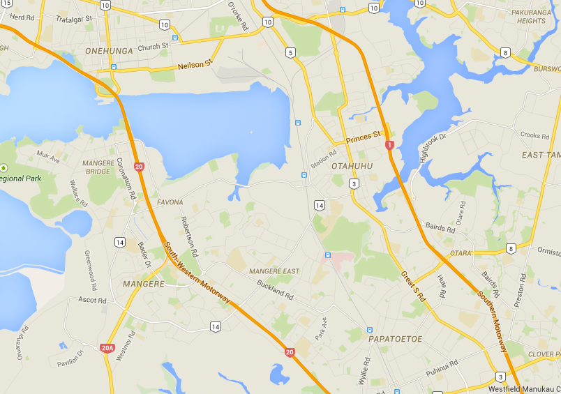
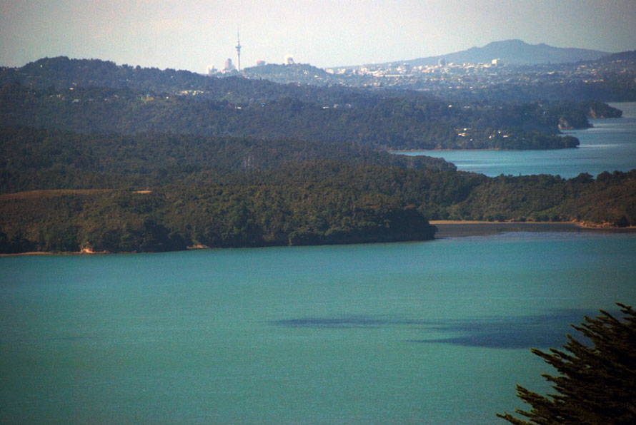
Auckland is located about two thirds up the North Island at a point where the North Island is very nearly split asunder. From the west there is the huge, narrow entranced, Manukau Harbour that
stretches from the Tasman Sea across three quarters of the width of the island. From the east and slightly to the north is the Waitemata Harbour that cuts nearly halfway across the island.This in
turn is connected to the Hauraki Gulf and Firth of Thames with its many islands and the protective shield from the full force of the Pacific Ocean by the Coromandel Peninsula and the Great and
Little Barrier Islands.

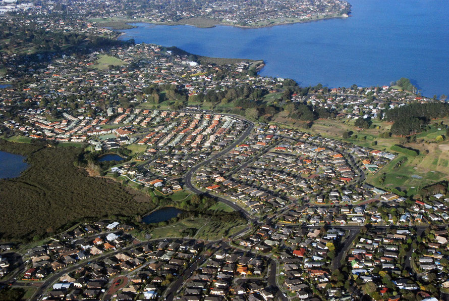
Between the Manukau and the Waitemata harbours is an 'almost peninsula' just connected to the southern part of the North Island by a narrow isthmus (1.2km-wide) of land between the Manukau Harbour and Tamaki River inlet. This almost peninsula is the location for the bulk of Auckland's settlement.
It is almost as if some giant hands took hold of the North Island when it was still wet clay and tried to wrench it apart. From a small scale map the area looks like a confusion of land and water with little rhyme or reason which make land-based travel difficult - at least until modern times.
However, for seafarers - both Maori and European - the sheltered shallow harbours and relatively fertile soils formed an ideal place to settle. It became pre-European New Zealand's most populous area.
And particularly after the IIWW the population of the Auckland region grew rapidly as Maori moved to urban areas, as Pacific and British migration to New Zealand increased, and as Korean and
Chinese immigrants arrived from Asia in the later years of the 20th century.
The inlets that push so far into the body of the North Island at Auckland were formed by river valleys and fault line sinkage that were then flooded by rising sea levels 10,000 years ago.
Modern Auckland (pop. 1.44m) is now home to a third of New Zealand's population and a gateway for new immigration - one third of its population was born overseas and central Auckland is one third Asian (Te Ara: Auckland).
The geology of the area is a base rock of sedimentary slit and mudstones on a layer of the ubiquitous greywacke. Overlying these are more
sedimentary rocks formed from volcanic ash and more recent flows of localised lava. Soils are particularly fertile in the east west strip to the south of the Manukau Harbour.
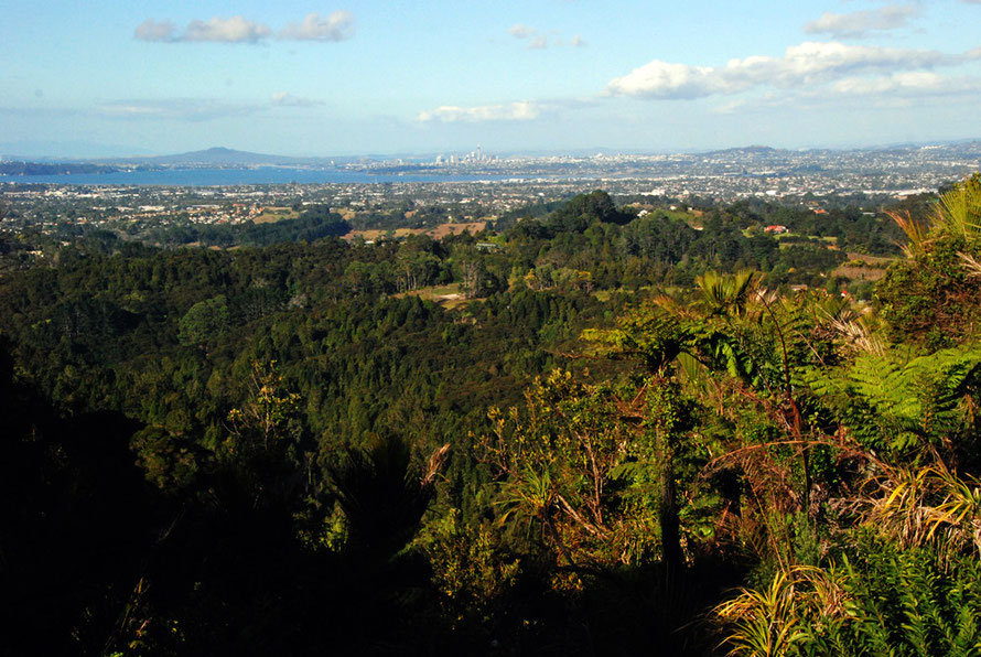
Recent volcanic activity 150,000 to 600 years ago created the many volcanci cones in the Auckland city boundaries with the last addition being Rangitoto Island.
Auckland sits at the transition zone between the temperate and sub-tropical climate zones and has warm humid summers (average temp 24 degrees) and mild and wet
winters.
In 1840 New Zealand's first governor, William Hobson, declared the Tamaki isthmus to be Auckland, named after his patron, Lord Auckland, first lord of the Admiralty. Apparently the dominant Maori iwi at the time, the Ngati Whatua, weclome this development for the trade it was expected to bring and the
protection it would afford them from the other iwi with whom they had been at war with for some time.
Maori were initially well represented in local trading communities but increasing immigration, a shift from sail to steam, and pressure on land led to European hostility to Maori and during the New Zealand Wars Maori were beaten by superior forces (12,500 imperial troops were garrisoned
in Auckland).

Auckland stagnated in the mid 1800s as troops left and the capital was transferred to Wellington. Revival came with the discovery of gold at Thames in the 1860s and the massive exploitation of
the region's kauri forests. In 1900 the Melbourne-based Kauri Timber Company shipped 37,760 cubic metres of kauri from Kaipara Harbour 50km north-west of Auckland city.
After a land crash in the 1880s Auckland rode the rise of the family farm-based dairy and meat industry and associated marine activities - shipbuilding and maritime engineering. New Zealand's
infrastructure improved with the linking of Wellington and Auckland by railway and new road building.

The post war period saw the rise of a range of manufacturing and light industries from the steel plant at Glenbrook to the southern hemispheres biggest pottery factory. Deregulation and the
removal of tariffs hit many industries and their dominance was replaced by financial and other services.
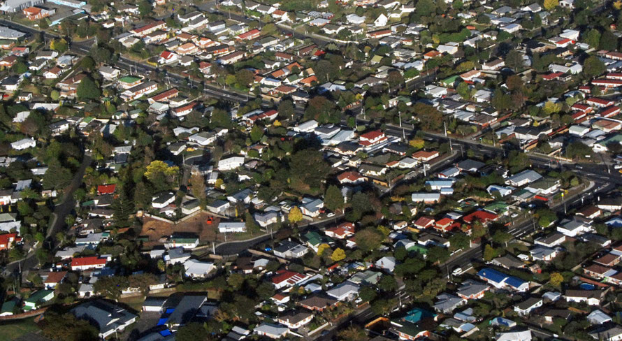
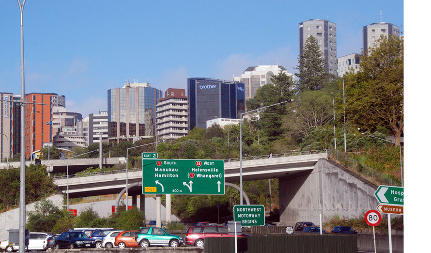
The town sprawled outwards and little public transport infrascturcture was put in place other than a small network of north-south motorways. Car ownership surged and chronic congestion ensued.
The building of the harbour bridge in the 1950s gave rise to the further development of the North Shore.
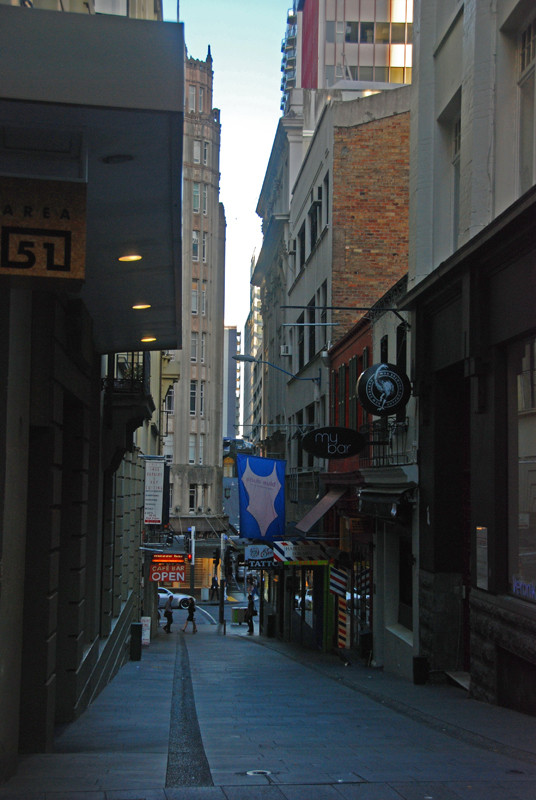
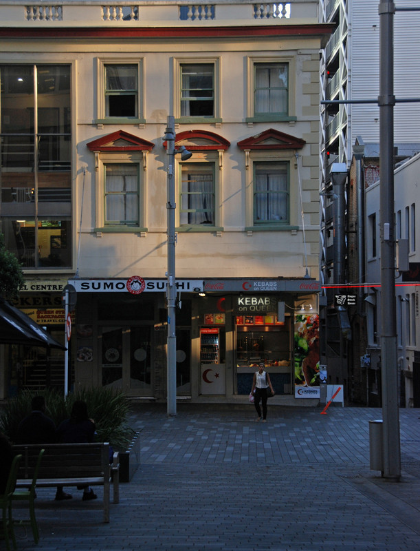
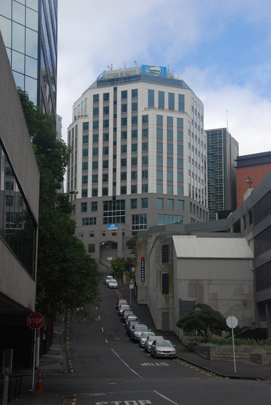
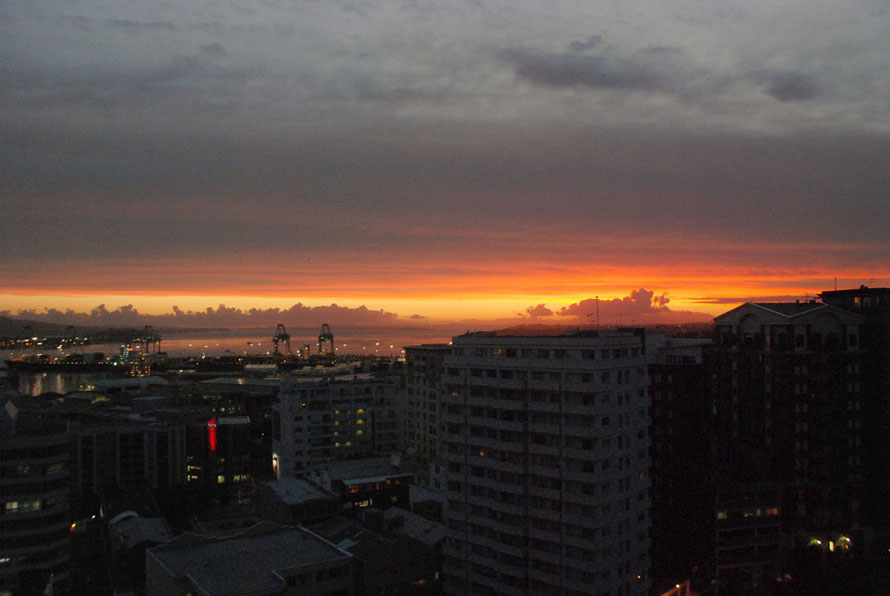
The sun was still low in the late summer sky and casting deep shadows. I snapped away as I walked down the step hill of Bowen Avenue into the dark alleys of the CBD that run parallel to Queens
St. It was quiet with early workers drinking coffee at little pavement cafes and buses and cars moving around. For a working day it felt pretty relaxed compared to say the City of
London.

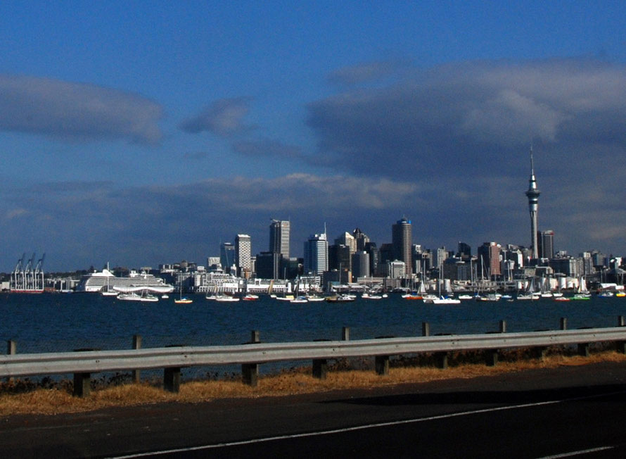
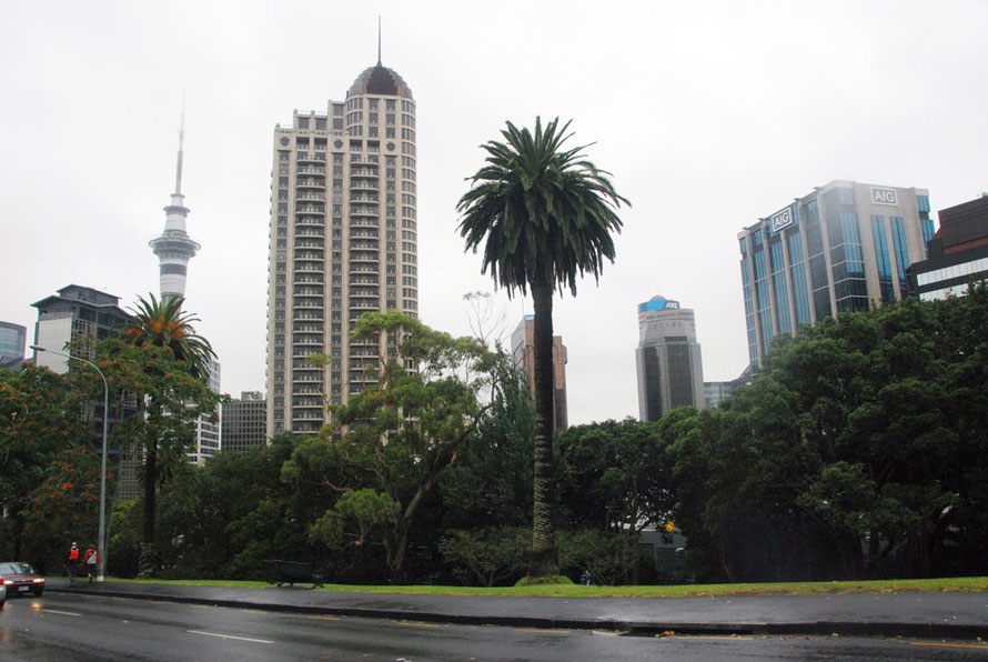
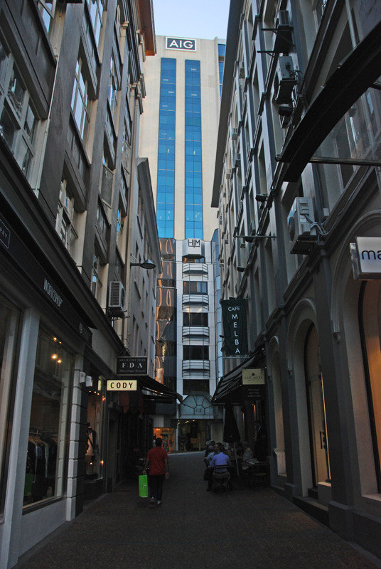
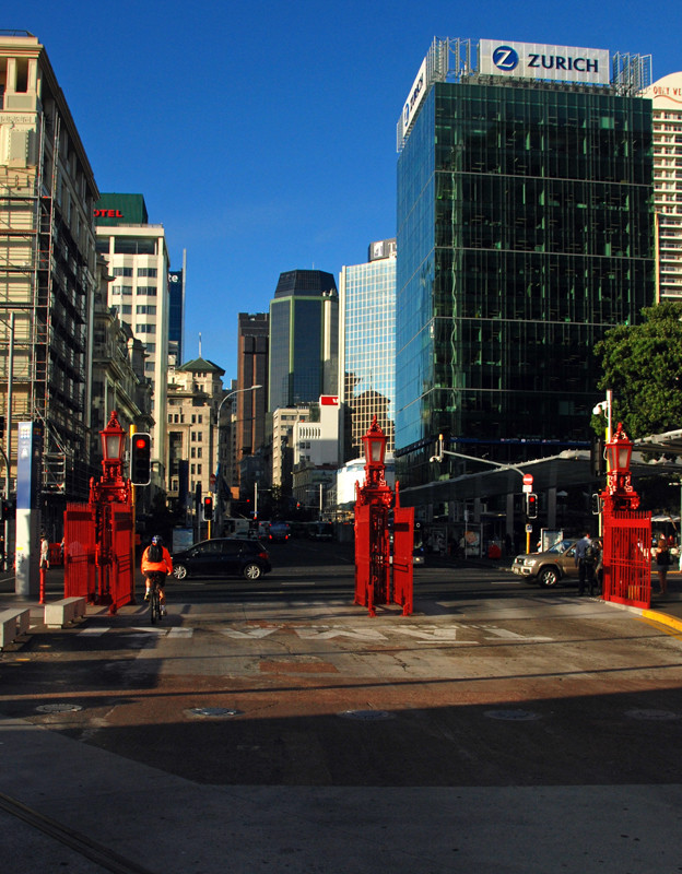
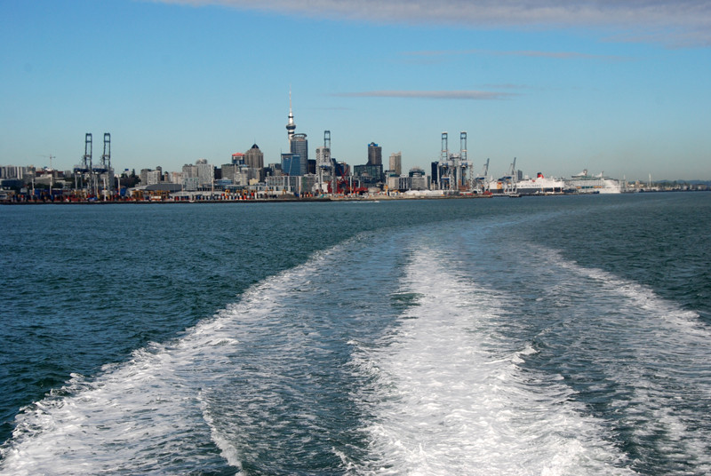
The Central Business District is a pretty soulless place with big glass and concrete towers with little architectural appeal. The Sky Tower rises above all looking like a machined piece of metal. As you walk down closer to the water front there are a few old colonial and 19th century buildings that have been nicely painted up.
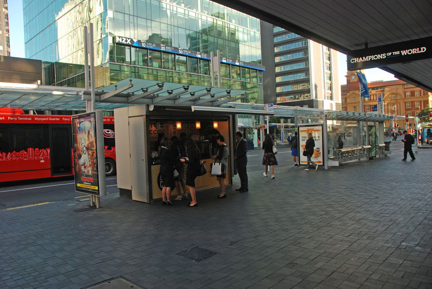
What was my impression of Auckland? Queen Street, the central drag in the Business District felt pretty tacky to me, busy, but not particularly interesting. Being squashed into a narrow valley
running down to the port didn't help. I read somewhere that it had been pretty much abandoned by old time Aucklanders (ie white and well-to-do Aucklanders) and now is a focus for young people
from newly arrived families and communities to Auckland.
The Central Business District felt a bit like a branch economy. Lots of undistinguished formulaic steel and glass towers with no real prestige celebrity architect-led developments. The Sky Tower
looked like a vanity project to me. They say the views from the restaurant are great.
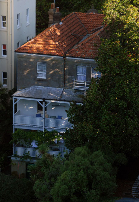
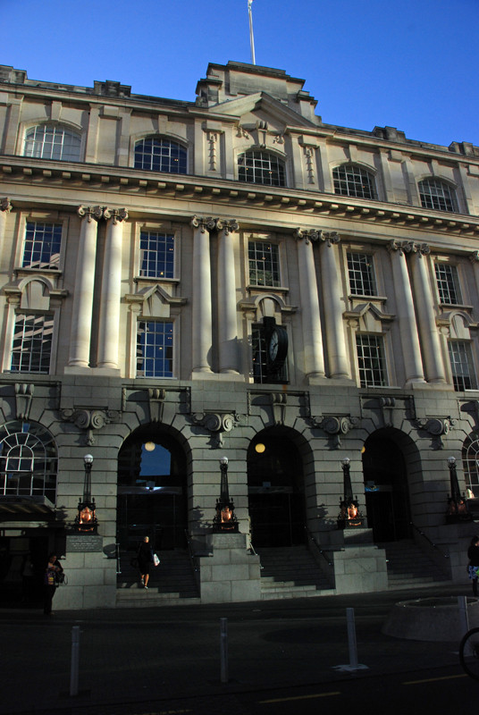
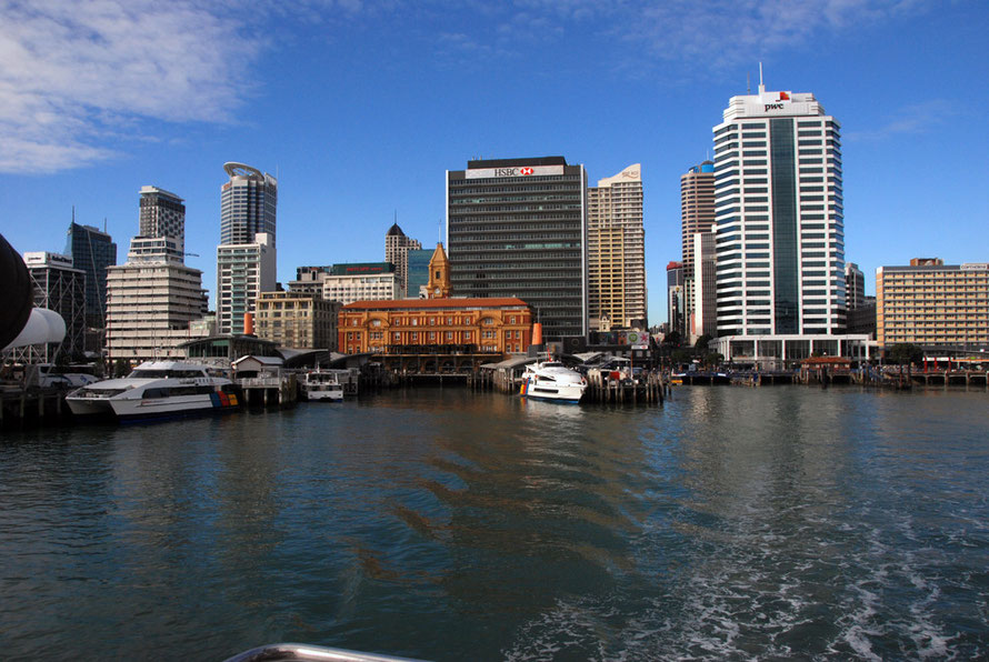
The waterfront again lacked distinction. The Ferry Terminal building is nice as is the old Post Office. The trouble for a Brit is that they just feel provincial in comparison with Dublin or
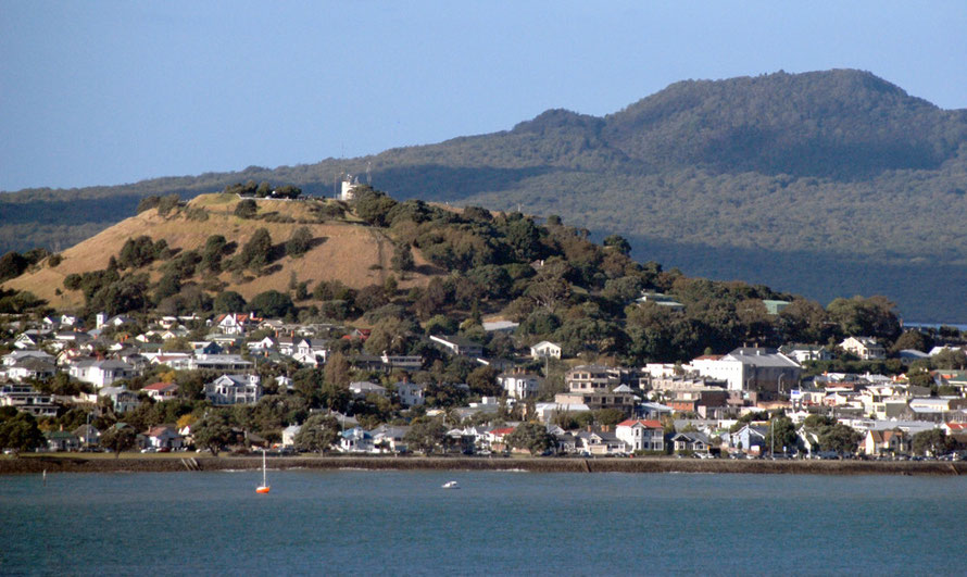
Liverpool or Glasgow or Bristol There is just not a lot of history to get your teeth into and what history there is is overtopped by brash hotel and office developments. I have to say Devonport
looked quaint with its hotels and low-rise buildings but I never got there.
We were driven out to a low-key get together under the slopes of Mount Eden and on my way to the Wallace Collection I drove along the main shopping street. They say it is the yuppie place to
be but it felt a bit sparse and diffuse to me. As did I guess, the whole of Auckland.

Driving south you run through some factory belts around Otahuhu which had a grittier feel (from the State Highway). South Auckland is where the Polynesian and Maori communities live but I didn't
venture off the main road except at one spot as I left the Botanical Gardens and seemed to be shunted into an area of detached housing that had a very different feel - less kempt and with more
people around in the middle of the day.
It would have been interesting to see more but other than the big market at Otara (18km south of the centre) and the Pacifika Festival at Manukau there was not much to draw me to southern
Auckland.
I di drive into one part of south Auckland to go to the Wallace Arts Centre, which is housed in the Pah Homestead, a late 19th century Italianate residence of the businessman James Williamson
which is set in the Monte Cecilia Park. This was the largest house in the Auckland region. I sat outside on the terrace after seeing the collection and had a cup of coffee and something to eat
from the delicious cafe. Rather well-heeled couples and yummy-mummies were also eating and watching their kids run around. But I will do another page on this.
And I drove through the western and north western suburbs of Auckland as I headed out to Whatipu on one day, Bethells Beach on another and way up north on a third trip through Helensville
on my way to the Trounson Kauri Reserve. My memory is of rolling hills of single storey houses that seemed perfectly decent but terribly boring with little esplanades of shops every now and then.
Further out the far western suburbs that perch and nestle in he Waitakare Ranges are delightful.
On a friends in the UK's request I also drove along the South Shore and out east to try and find the Parewa Cemetery - one of the largest Church of England cemeteries from the early settler
days. My mission was to try and find the gravestone of a long lost relative of his but when I arrived the office was closed and the cemetery was massive. I wandered around in the Sunday evening
sunshine reading names and dates and recognising so many names from different parts of the UK. But I did not find my target.
On another day The Principal and I drove out along the South Shore past the different famous beaches and some giant /// fig trees. Strangely enough towards the end of the shore road here the
houses are perched up above the Beginnings of the Hauraki Gulf we bumped into Gary and Renicka who pointed out the house of the coach of the All Blacks.
One bright blazing crystaline blue morning I walked from out hotel i=on the edge of Albert Park down past the University of Auckland Maori marae and over the traffic jammed up and heading for the
port to go to the Auckland Domain and museum. I found a cool shady, almost alarmingly deserted sunken trackway festooned with tree ferns and taller growth of nickau palms that seemed to swallow
me up in a bush experience on the edge of Parnell. It was delightful and I loved the specimen trees in the more open part of the park, the glasshouses with their spectacular flowers. And as I
walked across the greensward to the Museum on its mount a film set of a recruitment base for soldiers in the First World War was in full swing with blokes togged up in civvie and military
uniforms which I found fascinating and poignant.
The Museum was superb - particularly the Maori and Polynesian areas. But I also found the exhibits about warfare and the sombre and hugely moving memorial to the fallen in the First and Second
World Wars very moving. And the coffee and food was delicious.
I also loved the whole drama of approaching Cyclone Lusi which smacked into Auckland oin maybe a less terrifying way than I might have hoped. I had driven my gargantuan day to Dargaville and
Trounson the day before and on the Saturday I ventured out into Albert Park and to the brilliant Auckland Art gallery. The gallery was great in the wind and the rain, as was the park. The
highlight for me - in terms of shocking events - was the massive crash as a huge branch fell from a conifer without warning as I prowled around taking photos of dripping greenery and convoluted
aerial roots and trunk buttresses.
Later that day we drove out to the airport to pick up Karen and John from their long flight from Blighty. The wind was careening around building corners but it was really no more dramatic than a
good south westerly blow in Cornwall. On the Sunday we took the ferry out to Waiheke with Gary and Renicke that was strangely empty. Halfway there the catamaran steel-hulled boat started to bang
into a substantial swell running in from the Pacific. The pilot/captain/driver took not a blind bit of notice of the hammering to the hull and the rapid and devastating impallidment that took
place on the once cheery passengers faces. I think we all felt that it was only a question of time before upchucking would commence. And when all seemed but lost we rounded a headland into a calm
bay and in minutes were disembarking onto dry, solid land.


Auckland is, of course a much smaller city in population - 1.4m (2014) - than say London although its does sprawl outwards with its low density, often single story, housing. Auckland doesn't make it into the top 200 cities by size of population but it is 183rd by urban area - 531 square kilometres in 2010. In fact it is about a third of the urban area of London but only has about a seventh of London's population (using 2010 data here).
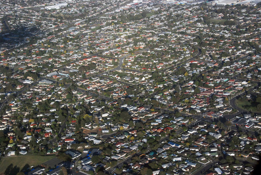
However, Auckland's population density is not outlandishly low: it is higher than Australia's big cities - perhaps because the lot sizes in Auckland are relatively small. (There are also issues about how you measure urban areas and what you include and exclude.)