
III. Fox Glacier/Te Moeka o Tuawe

Erosion, Icefields and Rainfall
So if this is the timescale - say a minimum of half a million years of glacier and ice cap erosion - what about the forces at work upstream of the terminus of the Fox Glacier?
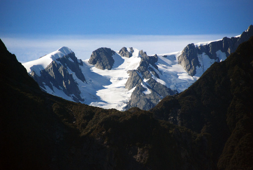
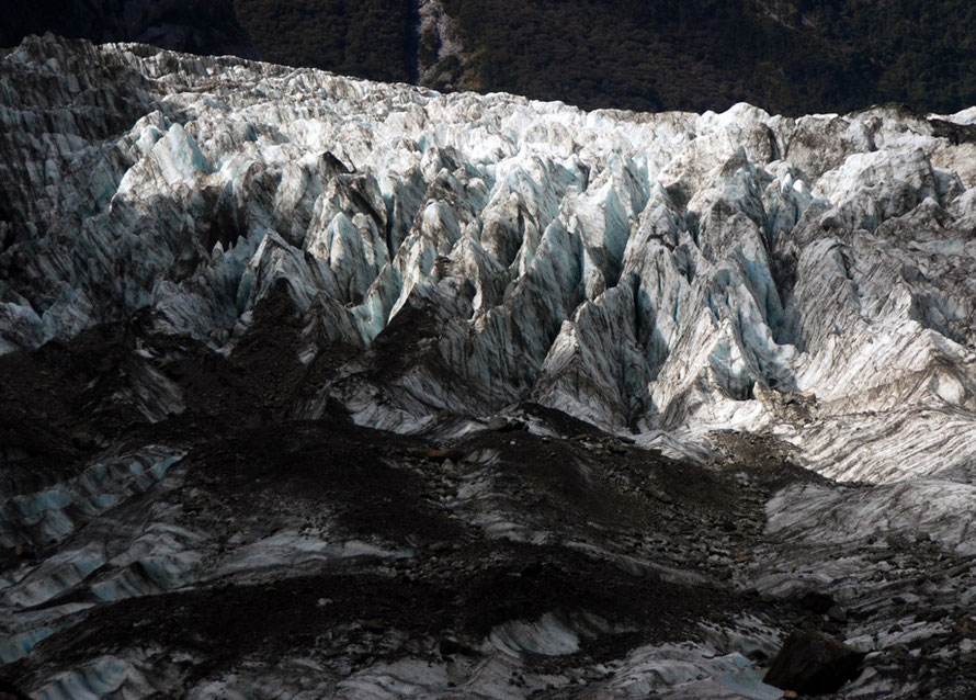
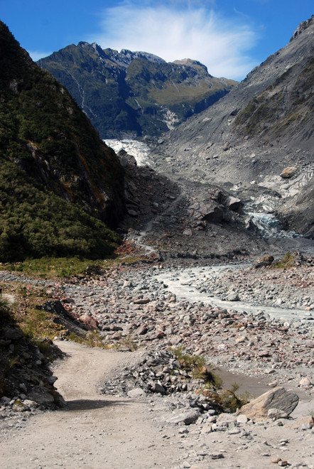
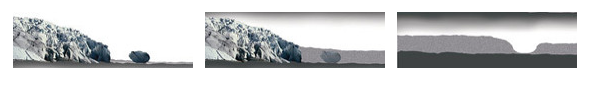
It's really easy to be fooled by the size of the glacier. Surrounded by massive mountains the ice river can look slightly tame from a distance and in photos.
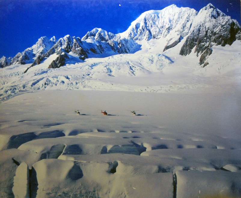
The Fox Glacier is actually is 13km (8.1 miles) long and is fed by a 32 sq km snowfield (accumulation basin) and its constituent glaciers at an altitude of 2,700m. It has an estimated mean depth of 100m.
The glaciers that are connected to the Fox/Te Moeka o Tuawe are from the south to north the Castries, the Gem, the Jewel, the mighty Abel Janszoon, the Heemskerck, the Albert, the Cleeves and the Explorer.
The Fox differs from many of the West Coast glaciers in that it has broken through the lower mountain ranges to reach the coastal plain - even though it has subsequently retreated.
It and the Franz Josef flow out of the biggest and highest snowfield in the Southern Alps - with Aoraki/Mt Cook and Mt Tasman at its centre.
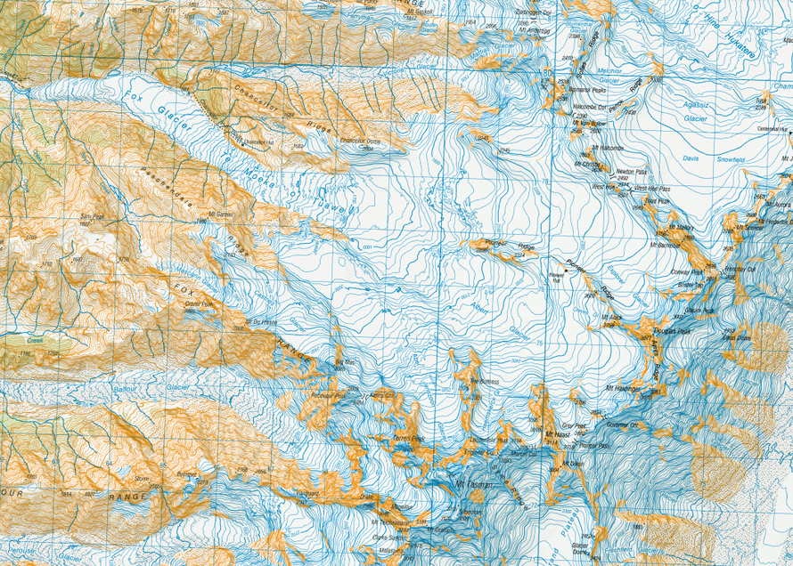
Big glaciers flow east and south from the other side of the watershed - the Tasman and Murchison - but from the map these look broader and flatter than the Fox and Franz Joseph. (The Tasman Glacier is credited with being the biggest in New Zealand.)
This is not surprising as rainfall maxima occur to the west of the east-west divide (see my Hokitika page) and quickly reduce moving eastwards.
Further, the slope from the west side of the divide to sea level is much more acute than the eastward - piedmont - slope.
This is due to the position of the Alpine Fault, the zone of maximum uplift sitting adjacent to it and the proximity of the Tasman Sea (again see The Shaky Isles).
The Fox Glacier falls 2,600 m (8,500 ft) on its 13 km journey from the Southern Alps down to the coast. That is an average gradient of 1:4.6 which is pretty steep in a car.
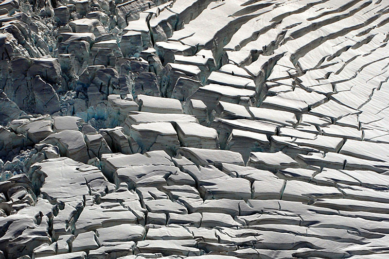
From the map excerpt (see top page) it can be seen that this gradient of descent steepens markedly in the tongue of the Fox/Te Moeka o Tuawe.

The Fox and Franz Josef are particulary sensitive to changes in snowfall in the icefield, where more than 20m of snow can fall in a year. These changes in snowfall that take 5 to 6 years to work their way through to the advance or retreat of the glacier's terminus.
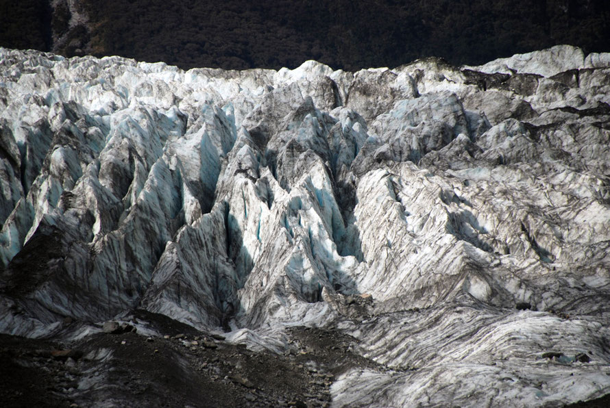
The Fox moves up to 'several metres a day' (see below for average winter and summer movement). This keeps the ice moving down the valley, with the huge pressure behind it of the accumulated snowfied. Such is the thickness of the ice and the speed of movement that the ambient temperature and rainfall simply cannot melt the ice fast enough even though it is well above freezing point.
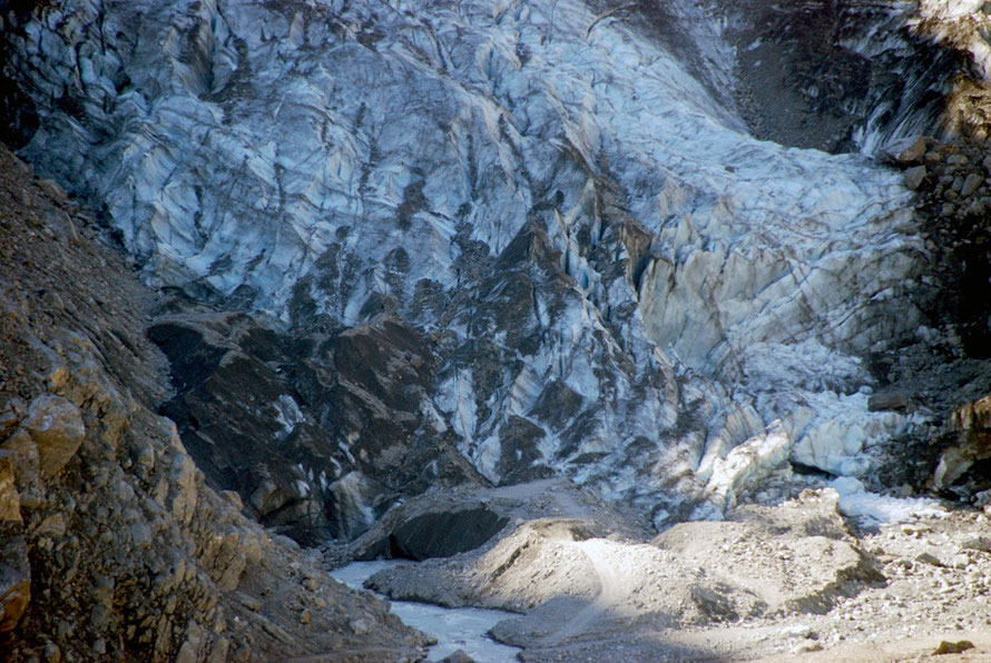
There are large amounts of ice in front of the apparent terminus of the glacier that have lain buried after retreats for half a century. These are slowly melted out by underground streams causing collapses and the formation of ponds.
Both the Fox and Franz Josef are also subject to jökulhlaups or outbreak floods which can amass water in blocked underground tunnels and channels only for it to eventually build up the sufficient pressure to burst out in a flood (see Te Ara Glaciers).
New Zealand's biggest glacier is the Tasman at 29km long and in places 600m thick - although the depth of ice on the slow moving final part of the glacier has thinned markedly.
So we have a picture of truly massive forces at work. The mountains being pushed upwards by tectonic movement and the mountains being ground down by the massive accumulation and movement of ice occassioned by the South Island's phenomenal annual rainfall.
And yet the glacial landscape looks so new, so pristine (in an apocalyptic fashion), the thousands of acres of bare rock looking like they were new-laid as of yesterday.
But every now and then I'd note plants growing in what seemed the most inhospitable terrain. I wondered how that process of colonisation worked as the sun beat down and rockfall signs told us to get a move on.
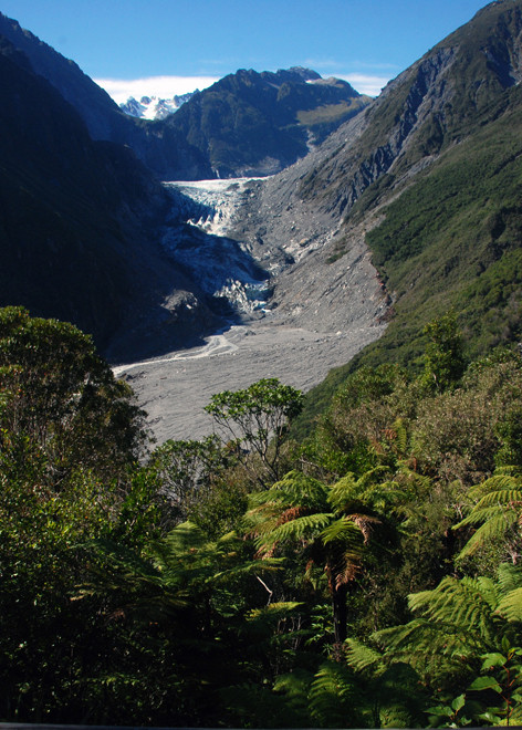
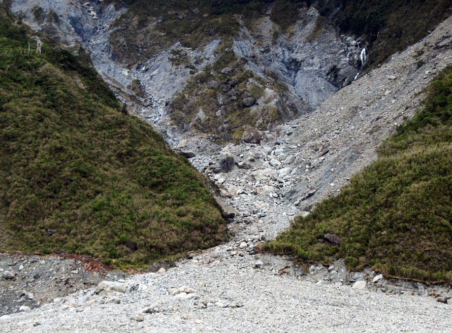
The views from the Chalet Lookout point are spectacular, especially as the lookout is surrounded by rain forest. When we were there part of the path has just been washed out by the innocuous sounding Mill's Creek.

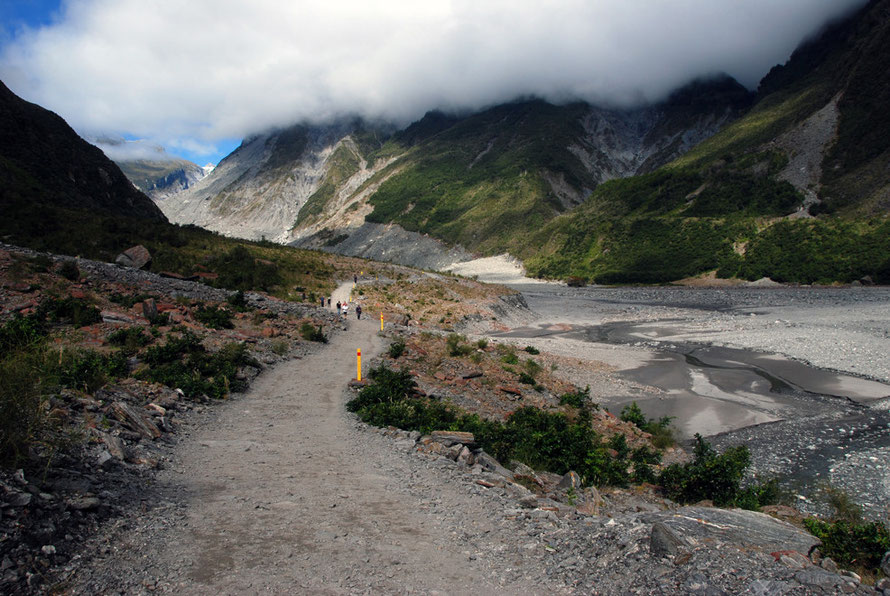
The wardens of the National Park take the risks of guiding unwary tourists to the glacier terminus with great seriousness.
Signs and sectioned-off paths are intended to keep people out of harms way and we saw a group of men with long steel crowbars levering teetering rocks down the valley side.
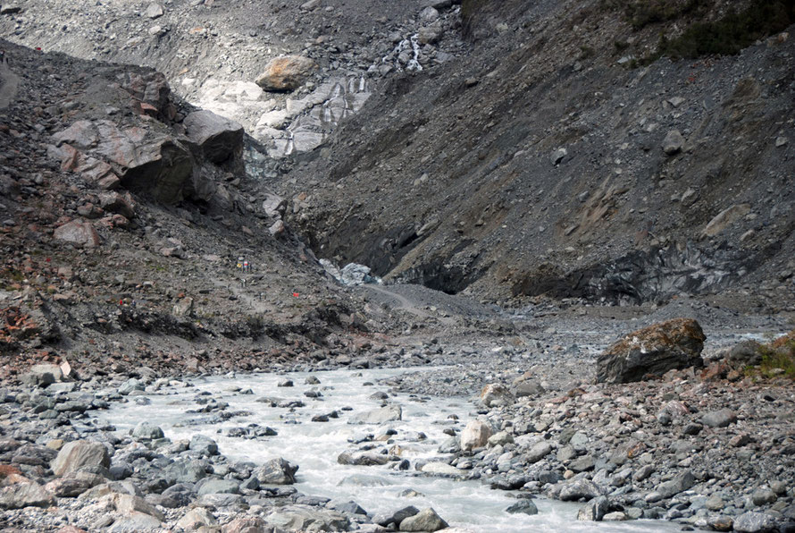
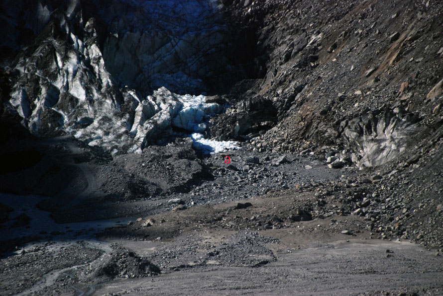
The photo below is taken from the Chalet lookout point above and back from the Fox Glacier.
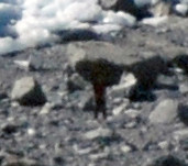
As I was taking it I saw something about the size of an ant moving about through my telephoto lens. It turned out to be a person walking in front of the glacier terminus. He or she is marked with an 'a' on the photograph.
Two Australian tourists were buried alive here in 2009 under hundreds of tons of ice that collapsed off the front of the glacier. Needless to say they did not survive.
How much does it weigh?
I couldn’t get to sleep recently and began thinking about glaciers. I wondered how much a glacier weighs, how it really carves out solid rock, what happens at the boundary between ice and the rock bed.
With regard to weight I did the following calculation. The névé (snow and ice field) of the Fox Glacier is about 32 sq km and it has a depth of up to 100m.
There are one million square metres in a square kilometre. So in 32 sq km you have 32 million sq m. Multiply that by say half the max depth of the neve (i.e. 50m) and you get 1.6 billion cubic metres of ice.
Glacial ice (as opposed to snow or the top 'firn' layers of a glacier) has a density of 850kg (0.85 tonnes) to the cu m.
So the Fox Glacier could weigh something like 1.6bn x 0.85 which equals 1.36 billion tonnes.
Where the glacier is 100m thick the weight exerted on a square metre is something like 85 tonnes.
The downward stress can be much more concentrated because contact between the glacier and bedrock is often discontinuous due to ice cavities that form along the bottom of the glacier. This is particularly so when a glacier is moving quickly and basal water pressure is low (see Harbour 2011 p. 333 below).
But a lot of the Fox glacier runs at a steep angle. It drops 1,400m from 1700m to 300m above sea level in 5.83 km. That is an angle of just over 25% (1 In 4). This increases the vertical column of snow to 125 metres and the weight per metre to 106 tonnes.
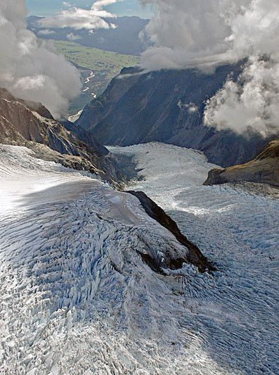
Due to the effects of friction glaciers move fastest in the middle – relative to the valley walls – and at the top – relative to the valley bottom. As the ice flows from the broad névé into the narrow confines of the glacier convergence causes compression in the central section of the glacier. In the Fox Glacier this is also where the ice starts to flow faster as the gradient steepens.
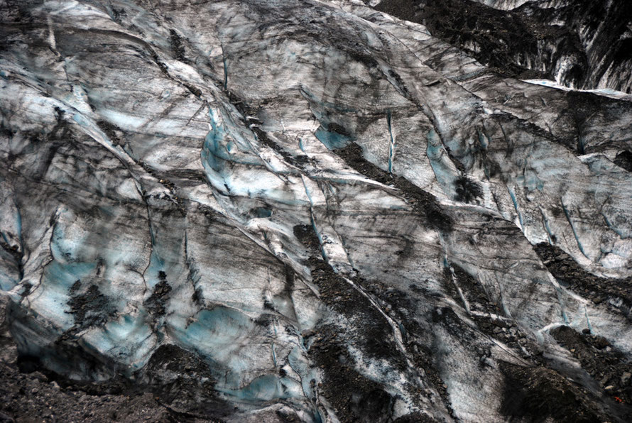
The top 50m of a glacier is known as the fracture zone. Here the ice tends to move in one piece and subsequently is quick to crack into crevasses as gradients change and underlying bedrock features cause stress fractures.
Below 50m the pressure on the ice allows it to move with a plastic flow like a very viscous liquid.
The glacier's movement in most temperate glaciers is enhanced by a process known as basal sliding. Here ‘the immense pressure caused by the weight of the overlying glacial mass causes the ice making contact with the ground to melt because of pressure, despite subzero temperatures, through a process called pressure melting'.
This is an uneven process – melting occurs at the points of most friction – on the ‘stoss’ or up-glacier side of a protuberance. The melt then runs to the leeside of the bump (down-glacier) and
refreezes in joints and fractures (see www.physicalgeography.net).
The forward motion and movement of the Fox Glacier is regulated by the seasons and weather as well as overall climate and climatic changes.
In the summer the glacier moves more per day - averaging 0.87m a day - while in the winter this is reduced to 0.64m a day.
So called 'short term velocity peaks' also occur due to heavy rainfall. Heavy rain in the winter can cause the glacier to speed up by 44% twenty four hours after the rainfall.
If we take the midpoint between these two rates the hypothetical advance over a year is 275.5m (903ft). This does not result in a corresponding advance of the nose of the glacier due to 'net radiation and sensible heat contributing energy for surface melt' (Purdie et al. 2008 p.140).
Not surprisingly ablation (surface melting) rates also vary with the seasons. In summer they average 129mm a day and in winter just 22mm.
Overall the Fox Glacier terminus position is currently relatively stable after rapid retreat in the first three-quarters of 20th century.
Purdie, HL., Brook, MS., and Fuller, IC (2008) Seasonal Variation in Ablation and Surface Velocity on a Temperate Maritime Glacier: Fox Glacier, New Zealand Arctic, Antarctic, and Alpine Research Vol. 40, No. 1

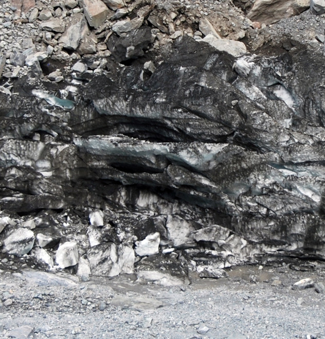
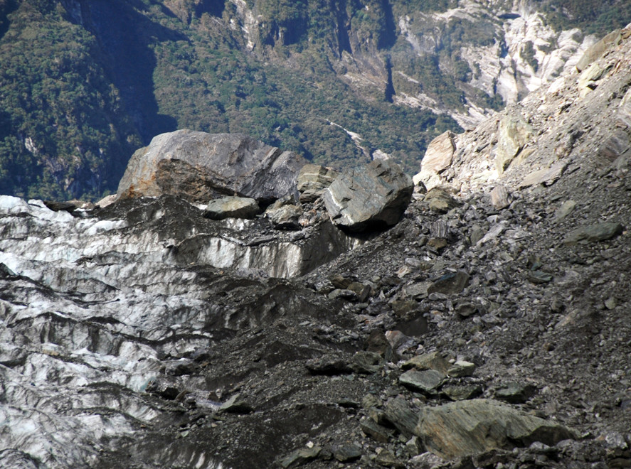
Two major erosion processes occur at the base of a glacier. The first is ‘scouring’. Here the glacier, incorporates large amounts of loose rock and sediment by partial melting and refreezing. This creates a potent ‘scouring cloth’ or more accurately a very coarse grade of sandpaper.
Scouring creates features like striations and glacial polishing and produces a fine clay-like sediment that when carried by meltwater is known as 'glacial milk'.
The second erosion process is ‘plucking’ or ‘quarrying’ where basal ice freezes in rock surface cracks and as the main body of the glacier moves the attached rock is pulled and plucked out.
The freezing and thawing action of the ice causes cracks in the bedrock through hydraulic wedging. This loosens and levers blocks up into the flow of the glacier.
Often the rock is plucked from the downside of bedrock protuberance into the glacier giving rise to roche moutonées (literally 'sheeped rock') - a smooth protruding rock on the upstream side of the glacier flow and a gap-toothed, plucked hole in the rock on the downstream side, rather like a sheep sheltering on the ground from the wind, its broad rounded back into the wind and and its legs and head away from it.
The rocks can then become embedded in the bottom of the glacier through 'regelation' - refreezing.
The rocks so refrozen into the glacier act rather like the ploughshare on a plough and can leave so-called ‘chatter marks’ - wedge shaped indentations on bedrock or other rocks as they are dragged across or gouged into them by the glacier.
The more fragmented, fractured, jointed and faulted the bedrock the easier it is for water to infiltrate and start the hydraulic wedging process.
And the more rock entrained in the glacier the heavier the glacier gets as it chugs downhill. This gives it more downward force on the subsequent bedrock it crosses.
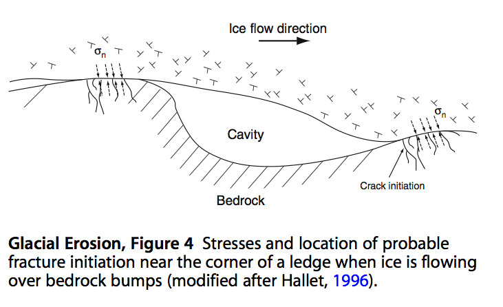
‘Subglacial fracture of bedrock occurs when the pattern of stress induced by the ice and by any clasts embedded in the basal ice causes a tensile stress component in the rock that exceeds the fracture strength of the rock, usually at the tip of a microcrack.’
For the above see Ping, F. and Harbor, J. (2011) 'Glacial Erosion' in . Encyclopedia of Snow, Ice and Glaciers. Springer. pp. 332.
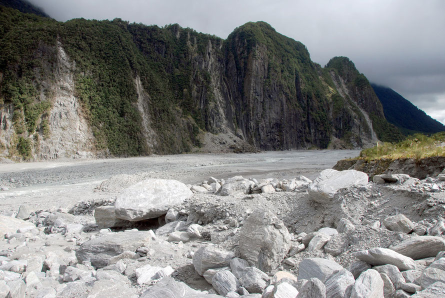
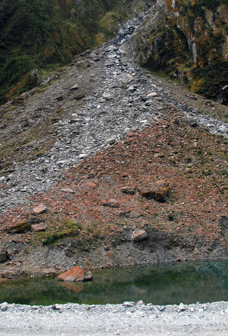
Of course, it is not only glaciers that are effecting the rapid erosion of the Southern Alps. The annual 10 metres of rainfall delivered in torrential downpours rapidly fills mountain torrents that descend with alarming speed to the valley floor and nearby Tasman Sea.
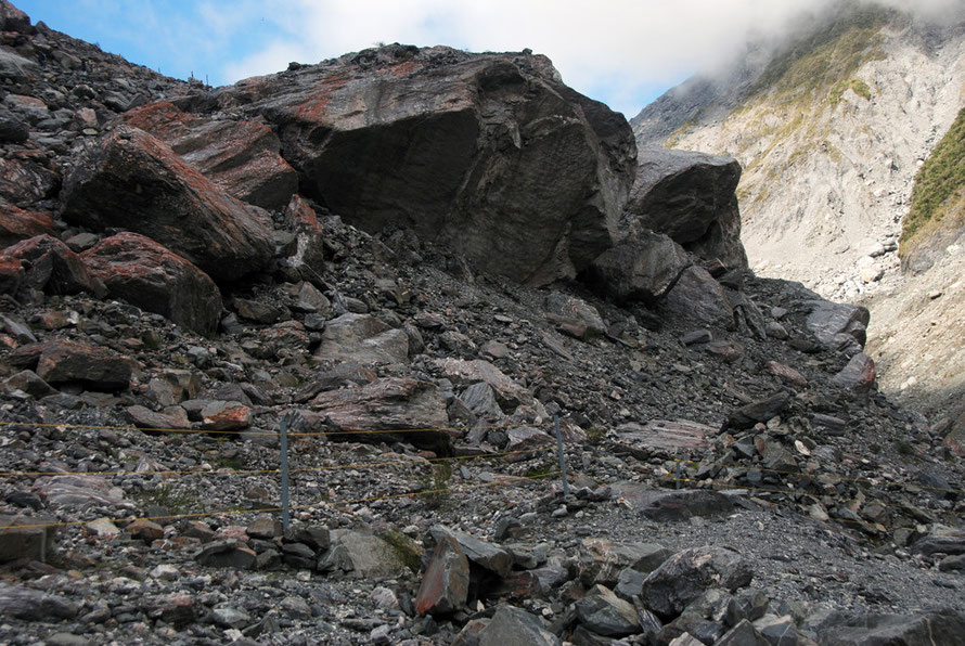
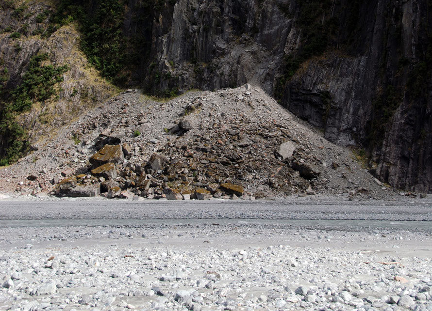
These carry vast quantities of debris down the mountains. The biblical rains also loosen the shallow vegetation mat that clings to the steep rock faces and tree-falls and rock-falls are common as can be seen in the photograph of the rockfall scars on Cone Point below.
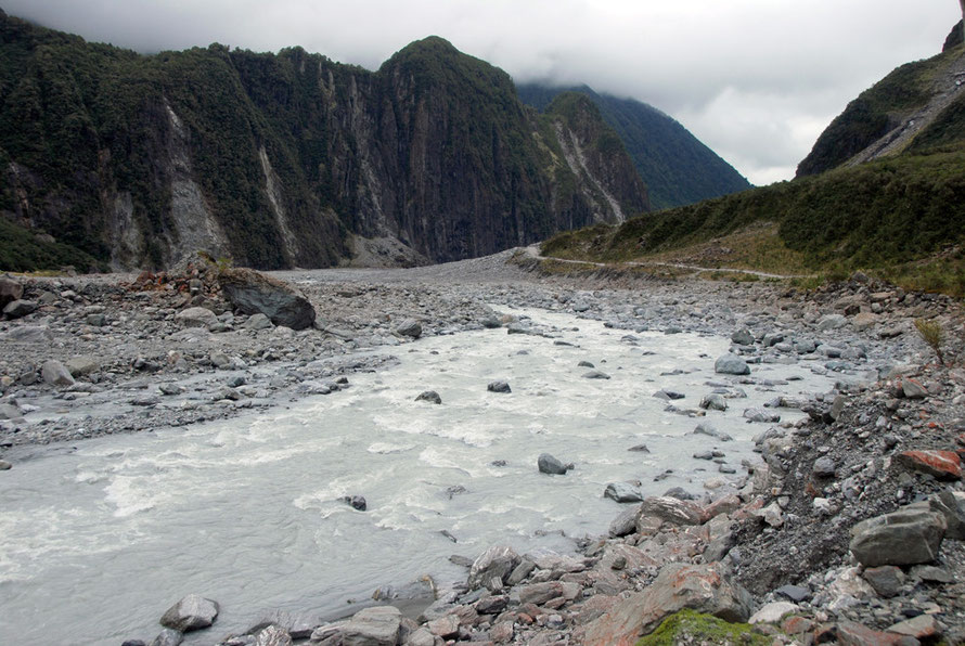
The huge debris and sediment load of the torrents and rivers, including those that emerge from underneath the glaciers, cause more problems when they hit the flat plain to the Tasman Sea.
At this point they start to drop some of their sediment and rubble, abrading and raising the river bed. This can create a severe flood hazard (see the example of the Waiho River at the Franz Josef Glacier on my page, To Hokitika).
A kettle hole lake is formed when a retreating glacier leaves a huge - I mean like massive - block of ice as an outlier.
Gradually debris washed from the glacier and down the valley sides fills the valley floor around and over the block of ice. Over the years and years the block of buried ice - insulated from the heat of the sun - gradually melts leaving a steep-sided hole in the valley floor which fills up with water.
The video below gives a good guide to the pronunciation of kettle hole when lying down in the rain in New Zealand - it's 'kittle hole'.
DOC ranger, Lorraine Smith, talks about the ephemeral plants and turfs that grow in New Zealand 'kittle holes' - strangely called 'knife, fork and spoon' plants on account of their different shaped leaves specially adapted to deal with changing water levels.

Climate Change Implications
Who would want to talk about the climate change implications for the Fox and Franz Josef glaciers? They are on of the top ten if not top three sites of New Zealand tourism and are vital, in particular, for West Coast tourism and the communities this industry supports.
One 2003 detailed study of the Franz Josef glacier came to some shocking conclusions:
On a local scale, the retreat of Franz Josef Glacier will have a drastic effect on tourism. Guided walking and recreation on the glacier will become increasingly difficult and parts of the glacier may become impassable.
Guided walks without helicopter support will be impossible after about 2015, when the glacier retreats back over two bedrock steps. The entire area of the glacier currently used for guided walks will have disappeared by 2100 (Figure 5.11).
As the Franz Josef Glacier is a major drawcard for tourists to the entire West Coast region, a significant effect on the local economy can be expected (Anderson 2003, p. 104).

Fox Glacier web cams
You can check out real time conditions on the Fox glacier with these handy web cams - if it looks black that'll be because it's night time in New Zealand.
Postscript 21 November 2015
Tragically a laden helicopter crashed on Fox Glacier on November 20th 2015 with the loss of seven lives. Weather had been bad.
At the same time the video clip below showed up on You Tube showing a serac collapse up near Aoraki/Mt Cook. It's worth watching all the way through.