Glaciers 6: To Hokitika - Floods and Mountains
The Road to Hokitika
The next day was the crispest, most beautiful morning. We packed our ridiculous amount of gear and in blazing sunshine hit the road for Hokitika. After a blazing row about something so
inconsequential. Eh?
We followed the snaking route around bluffs and spurs jutting out into the coastal plain. We darted through deep shadows cast by a sun still low in the sky, pressaging a distant but tangible winter.
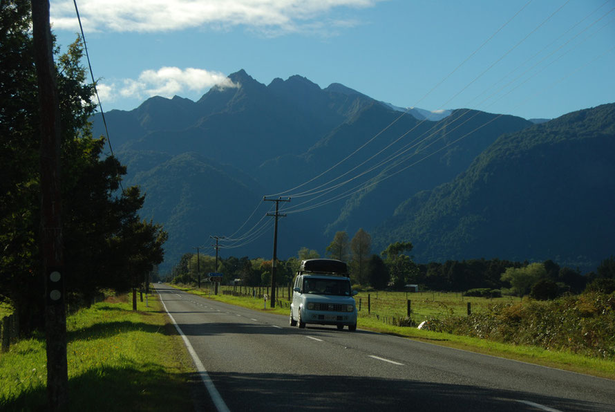
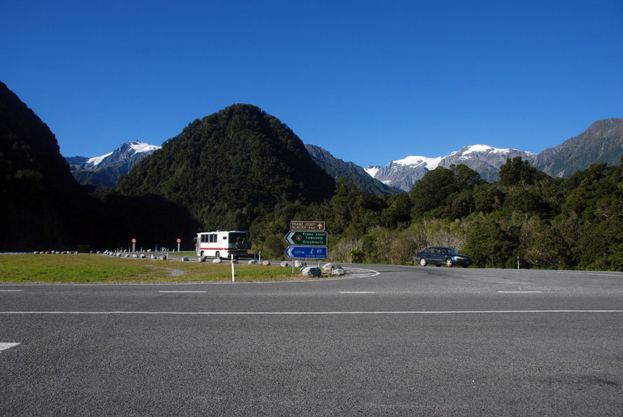
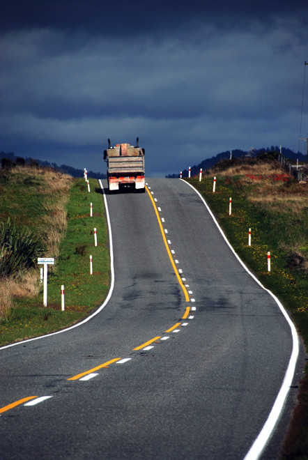
The road to Hokitika was an absolute joy to drive along. Traffic was light, the country was delightful with one river crossing after another and stunning views up to the snowfields of the Southern Alps.
On the other side we had long views over the outwash plains laid down by millions of years of glaciers and rivers transporting unimaginable amounts of debris and sediment from the mountains to the sea.
It was not quite how I'd painted the West Coast in my head. I had visions of a sort of wilder Californian Big Sur with a road snaking over promontories above pounding surf and barking seals. That was to come but this was different.
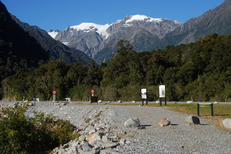
The contrast between the dazzling blue sky, the glittering glaciers and snowfields, the dark sombre forested hills and the shimmering paddocks of pumped-up green was invigorating.
Of all the places this seemed to be the place for me. It seemed to sing with possibility after the harshness of the road from Haast to Fox.
What a difference a few houses and a friendly smile make. The weather could not have been better and the morning had a Laurie-Lee-like spring in its step.
Pick-ups drove along the roads with their farm supplies and dogs standing in the back. Drivers raised a friendly finger off the steering wheel, an acknowledgement of our common bonds and purpose. Or so it seemed.
Nothing was too big or ostentatious. Indeed, modesty ruled the roost. No brash houses hogged the view and no giant farm or logging scars broke the ever changing beauty of the road.
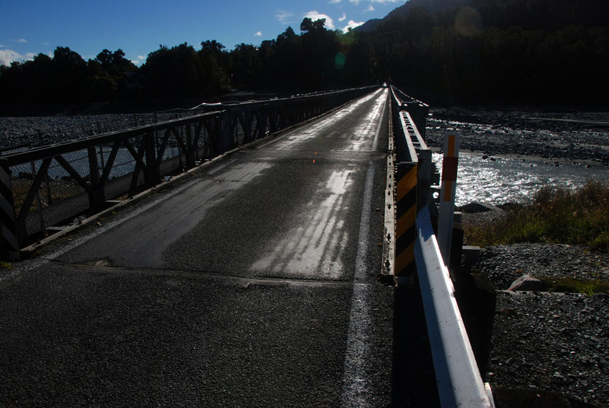
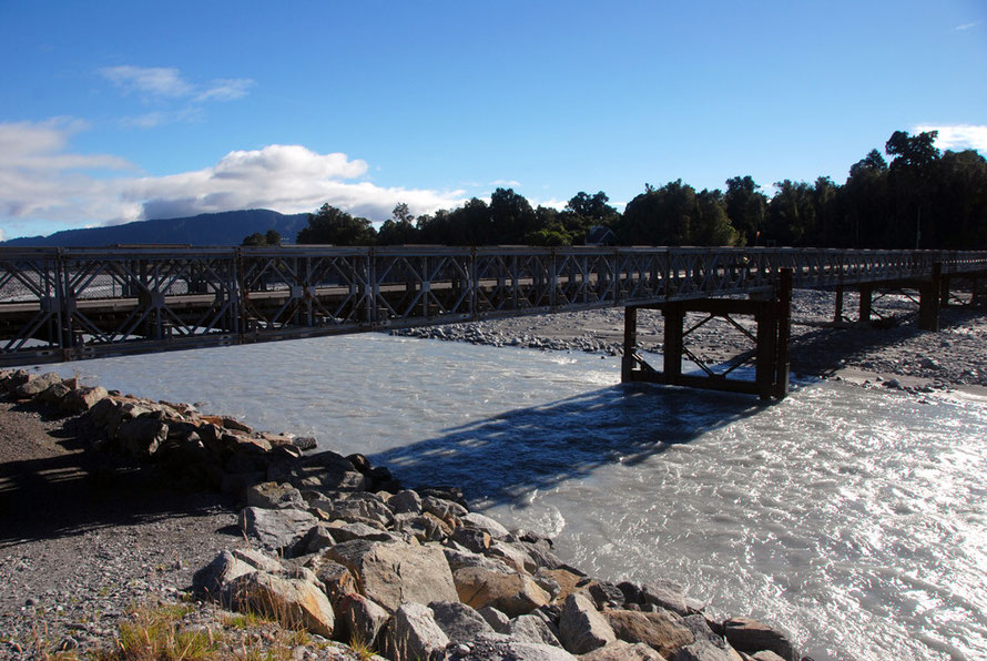
Bridges steered the road over one after another river, the sun glinting off the worn tarmac surface.
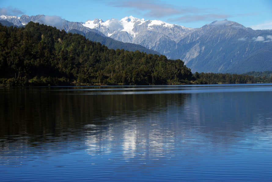
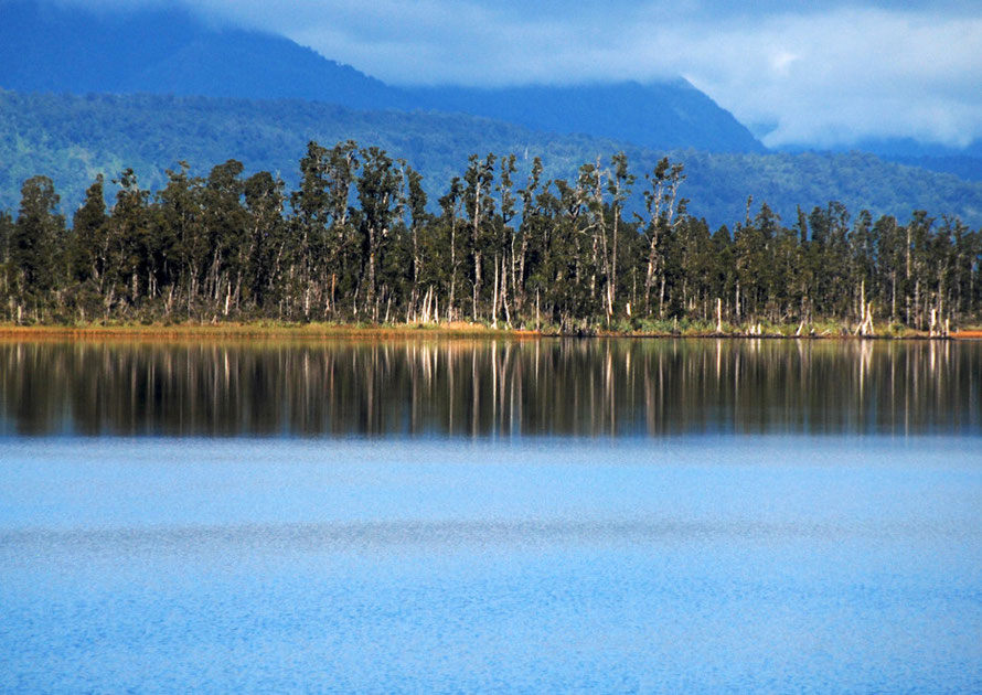
The lakes were stunning.
Mapourika almost completely still with Mt Tasman towering above and reflected in it. Ianthe/Matahi with its beautiful kahikatea forest rising up from the far end, the ramrod straight trunks of the rare and endangered trees parched white in the sun.
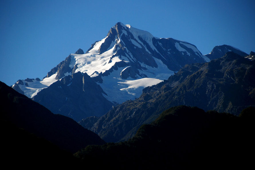
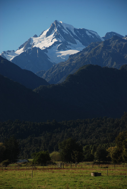
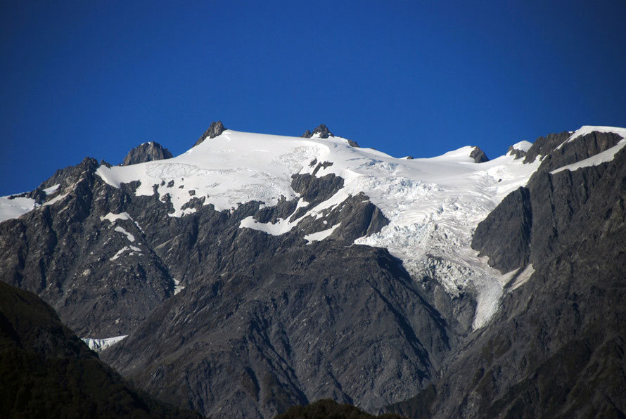
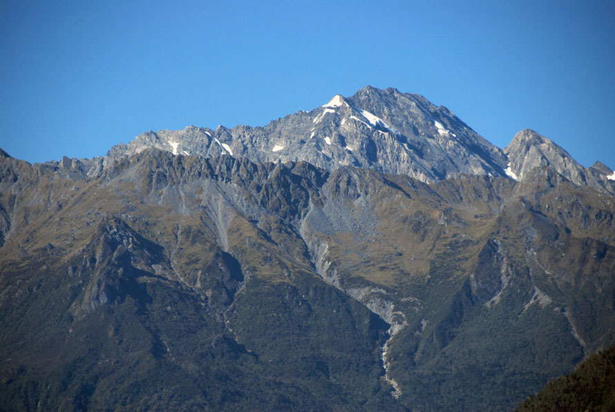
And the peaks of the mountains just soared and soared up from the coastal plain, their mountain top glaciers crystal clear in the brilliant light.
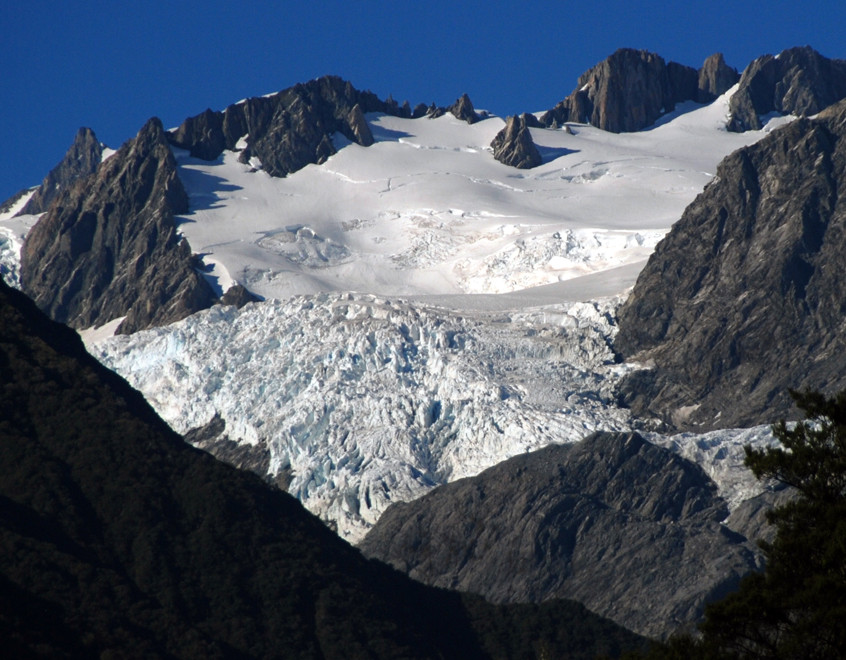
Mt Tasman at 3,498 metres. Elie de Beaumont at 3117m. Mt Anderegg (2,362m) with its tumbling Andermatten Glacier and Mt Fletcher (2,467m) rising up above the deeply incised Butler Range.
At Whataroa we stopped for petrol on a tight right hand bend. A sign pointed down 'Scally Road' towards the distant sea and heron colonies.
As I filled the tank a most elegant dog regarded us from his battered armchair on the balcony of a tin-roofed hut. He wandered over to say hello.
I paid the woman serving in the dark interior of the garage and made some small talk about the winter and the quiet. But it seemed to hold no terrors for her.
We pressed on, always aware of the clock ticking and the miles to go.
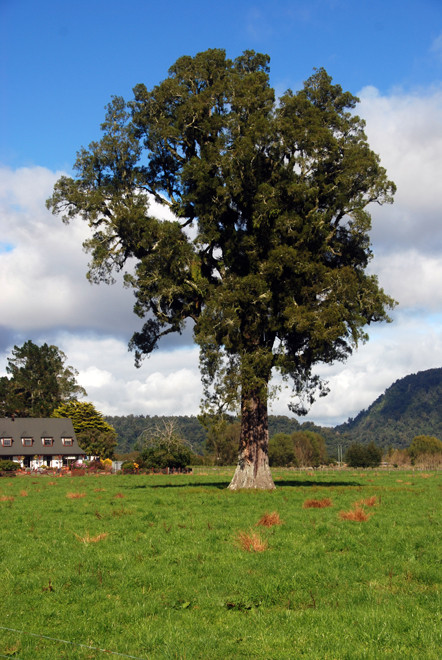
But the Whataroa River demanded I stop with its staggering backdrop of mountains. And then a huge beautiful Matai tree had to be photographed.
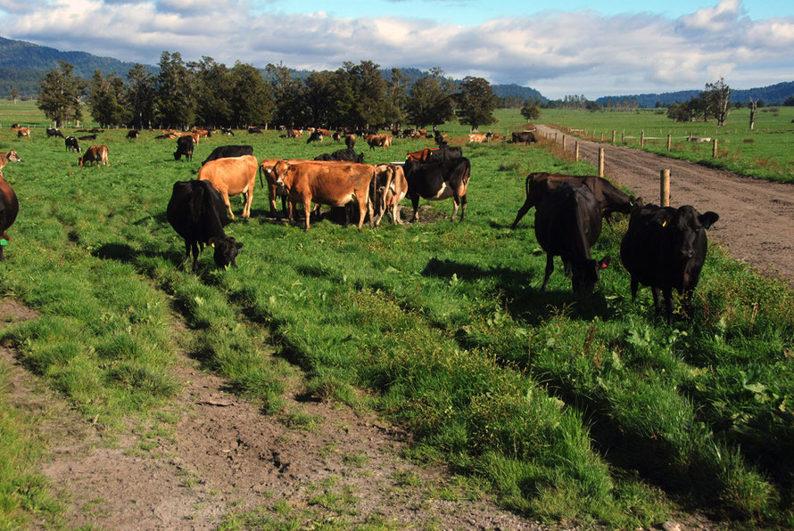
And a herd of cows curious in the corner of the field by the road begged to have its picture taken.
And then when things seemed to be calming down after Lake Ianthe/Matahi we passed a sign that said, 'Fergusons Bush Development' and later another that said 'Ferguson Farms'.
It was as if God Almighty himself had stepped down off a drifting white cloud and had spoken directly to me.
(For the significance of this go to my page 'Fergusons Farms: a names a name for that').
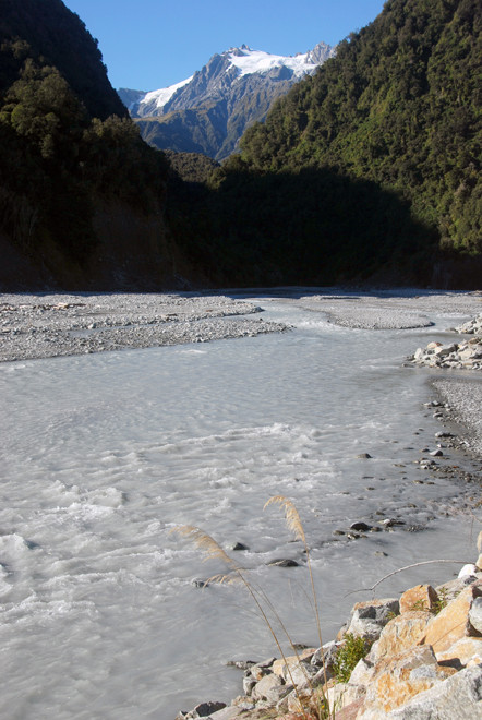
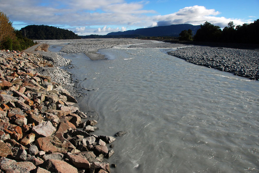
The Waiho River: a catastrophe waiting to happen?
So as not to get too carreid away here I later read about the problem with the short Waiho River that drains the Franz Josef Glacier. It is aggrading (that is dropping more debris than it can carry) at a rate of 300mm/year and the riverbed now stands some two metres above the surrounding land.
Current flood defences are 'unlikely to provide protection today from a 1-in-10-year event' and the township is 'very vulnerable to a failure in the current flood protection systems'. A large
loss of life could occur with an early morning flood in the tourist season when 2000 tourists can be staying in the village (MFE.og.nz)
The breaking of ice dams in the glacier adds to the flood risk. There is also a 1-2% chance per annum that a landslip could block the Callery Gorge upriver and then subsequently break releasing a deluge of water onto Franz Josef Township (NZ CivilDefence).
This sounds like a catastrophic disaster waiting to happen. The Westland District Council's Waiho River Severe Flood Hazard Policy Unit says,
the only secure solution to the problem is to remove the risk by not populating the area. The Waiho Flood Management Committee has consulted with the community and affected parties and plans are underway for relocation or vacation of existing residences and businesses
It seems that earlier attempts at flood defence through the building of control or stop-banks have restricted the spread of the alluvial flan of the river and this has caused it to build up on the river bed. (Davies, RH et al. 2003 Anthropic aggradation of the Waiho River, Westland, New Zealand: microscale modelling, Earth Surface Processes and Landforms,Vol 28, Issue 2).
The video below is of the river in flood on 2 January 2013.

Rates of erosion in the Southern Alps of New Zealand are phenomenal and amongst the highest in the world. The combined action of glaciers, earthquakes and rainfall that defies description carve
out and carry millions of tons of relatively soft schist and greywacke downhill each year (for rates see comparisons in my Milford Sound: Geology and Glaciation page).
The stone and dust has to go somewhere and as the raging mountain torrents hit the flat coastal plains built up from the Alps over two and half million years of glaciation they slow down and start to drop their loads, so to speak. Flooding and river course changes are an ever-present danger and were at one time the great killer in New Zealand.
On a sunny day it is all very peachy and perfect. We were lucky not to have to battle through the torrential downpours that can turn the West Coast into a death trap for the
unwary.