
VI. Milford Sound/Piopiotah: Geology and Glaciation
The Preserved Glaciation of the Ice Age
One of the very striking things about the Milford Road and Sound is the particular character of its glaciation. I have looked at glaciation through the example of the Fox Glacier, 220km north-east of Milford Sound, in some detail (here).
The glaciation of the Fox Glacier is very impressive and very active but it nowhere reaches the sheer vertical audacity of Milford Sound.

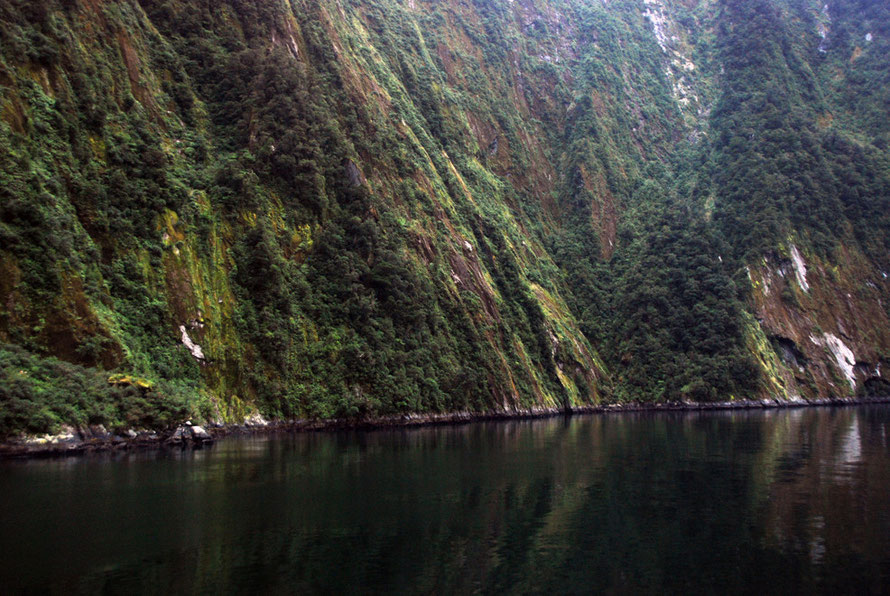
The valleys of the Fox Glacier are U-shaped to an extent, but water and other forms of erosion soon chip away at that signature of recent glaciation. In Fiordland the U-shape of the valley is more pronounced and extreme and the depth of the valleys themselves outstrips anything the Fox Glacier has done.
Why is this? Clearly the rocks are different - Fox is uplifted and upturned greywacke and schists. Fiordland is primarily granites, diorites and gneiss.
Fiordland is also not as high as the Alpine massif and consequently does not have the extensive permanent snowfields (névé) that are the source and sustenance of the great Southern Alps glaciers.
The Southern Alps snowfieds top out at Mts Aoraki/Cook (3764m), Tasman (3498m), Malte Brun (3155m) and Elie de Beaumont (3117m) and 20 other 3000m-plus peaks. The highest mountain in Fiordland is Mt Tutoko at 2723m. That is a thousand metres less than Aoraki/Mt Cook. In southern Fiordland the mountains are between 1000m and 1500m high.
In Fiordland there is consequently much less active glaciation than further north. Instead what remains are the valleys carved out of the harder rock by the super-glaciers of the successive Ice Ages.
As such Fiordland preserves spectacular examples of the relict geomorphology of the Last Glacial Maximum which was about 28-18,000 years ago in Fiordland (Dykstra 2012 PhD thesis above p. 71).
Description of Milford Sound
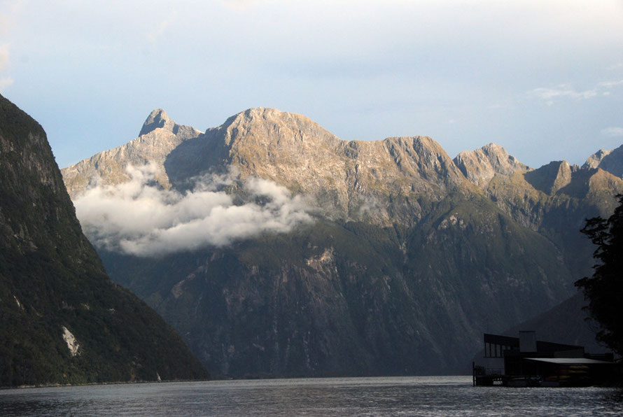
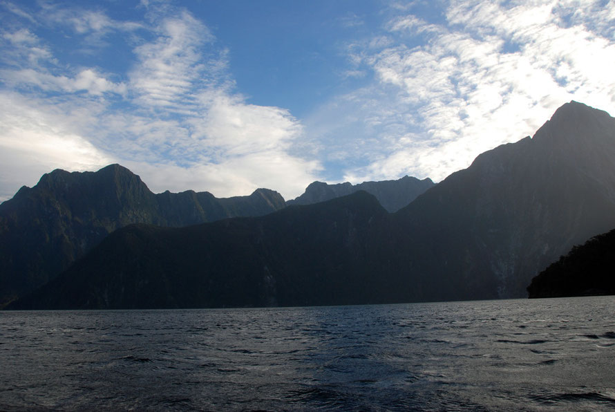
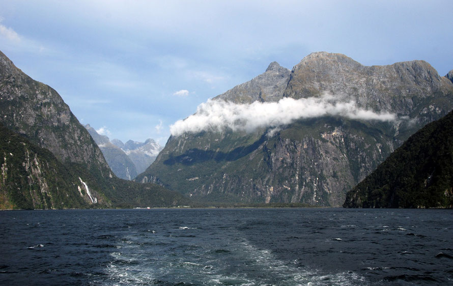
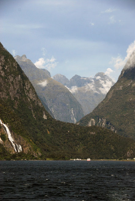
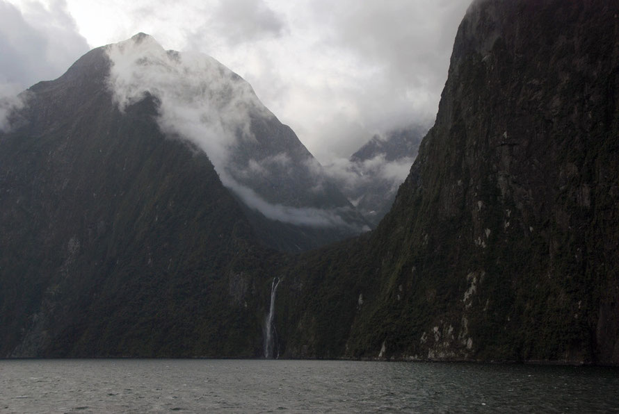
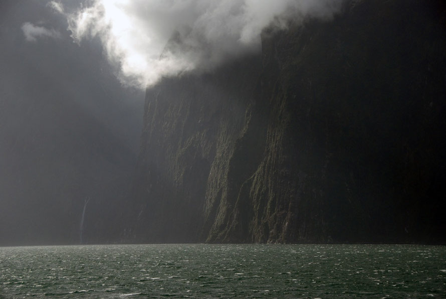
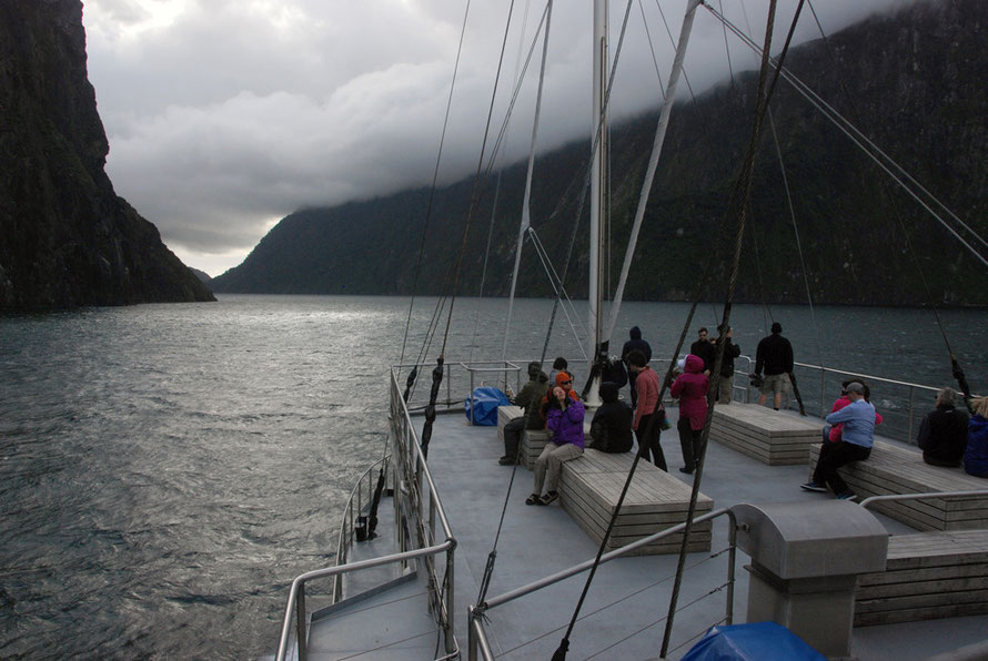
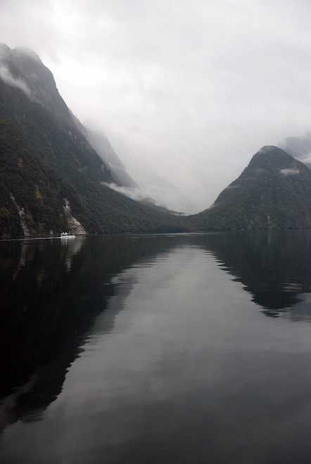
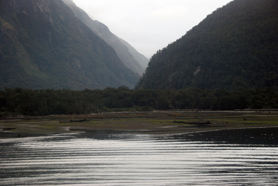
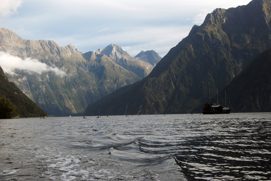
Milford Sound is a 17 km long glacial fiord with extremely steep bedrock walls extending up to two thousand meters above sea level, and dropping to nearly 300 metres below sea level.
Its dimensions are as follows: width at sea level 1940m, total depth (summit to sea floor) 2170m, depth below sea level 291m, sill depth 71m, length 15100m, fiord surface area 25sq km and catchment area 540 sq km, (Dykstra 2012 p.77).
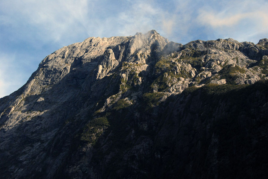
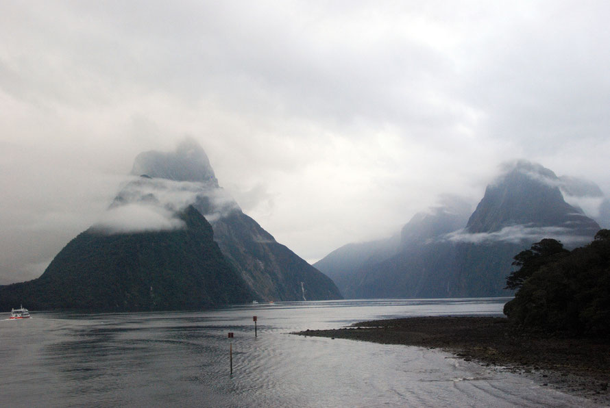
The fiord is backed Mts. Pembroke (2015m) and Grave (2225m) to the north. Other peaks - Mitre (1720m), Rover (1524m), the Elephant (1508m), Mt. Philipps (1446m), the Lion (1302m), and Cascade Peak (1209m), form steep (>45◦) sea cliffs that plunge directly into the fiord.
The north face of Mitre Peak towers 1680m above the south shoreline of Milford Sound, contending for the title of highest sea cliff in the world, as it falls directly to the fiord in a horizontal distance of approximately 1000m..
See Dykstra, J.L., (2012) The Post-LGM Evolution of Milford Sound, Fiordland, New Zealand PhD Thesis, University of Canterbury pp. 25-6.

The Volume of Rock Removed
The volume of rock removed to create Milford Sound is astoundingly large if difficult to calculate.
If we say the Sound is on average 1.5km wide at the level of its surrounding peaks and 1.75km deep from peaks to the bottom of the Sound and is 17km long from its head to the sill under the Tasman Sea this would give a volume of 44.6 cubic km.
That is 44.6 billion cubic metres of rock.
The specific gravity of granite is 2.7 which means a cubic metre of granite weighs 2700kg or 2.7 metric tonnes. The weight of the volume of rock removed to create Milford Sound would be in the region of 120 billion tonnes.
That is over 400 times the total weight of humanity (according to the New Scientist at 2005 values and excluding children.)
And that is just for the main Sound itself and does not include the huge tributary glacial valleys that join it.

An open cast quarrying equivalent
One of largest open cast iron mines in the world is the Hull-Rust-Mohoning mine near Hibbing, Minnesota. In operation since 1895 the total ore and waste extracted is estimated at 1.02bn tonnes.
That is a pretty impressive rate of extraction at 1.02bn tonnes per 119 year period.
To excavate my approximation of the volume of Milford Sound at that rate would take 120/1.02=117.6 x 119 years = 14,000 years.
(This, of course, does not take into account differences of rock hardness between the iron ore bearing Mesabi Range in Minnesota where soft ore lay close to the surface and could be scooped from open pit mines and the Plutonic granites, diorites and gneisses of Milford Sound).
Blasting explosive quantities and costs
With harder rocks the rate of extraction slows while its expense rises as blasting operations become necessary. A paper on explosives used in Nigerian hard rock mines gives a ratio of about 0.34kg of explosives per ton of rock fragmented. That would be in the region of 40.8 billion kg (or 40 million tonnes) of explosive to remove Milford Sound.
(See Shehu, S. and Jethro, M., 2012 Preliminary Investigation into the Explosive Utilization of Selected Quarries in Kogi State, Research Journal in Engineering and Applied Sciences pp. 408-412.)
In 1990, 2.1 million tonnes of commercial explosives were consumed in the US, at an estimated expenditure of 3.5 to 4 billion 1993 dollars on blasting. Multiplied up by the 40 million tonnes of explosive required to carve out the Milford Sound gives a total explosives cost of US$71 billion.
Australia used about 2.5 million tons of explosives a year in its 2013 operations.
The amazing thing about Fiordland and the massive excavations achieved in its deep U-shaped valleys and sounds is that this was all done by ice, water and gravity.
The Glacial Periods
The glaciers of New Zealand are estimated to have begun their work around 2.5 million years ago with the Ross Glaciation. Since then there have been up to 20 glacial periods with nine in the last 700,000 years. The most recent glacial period was the Otira which took place between 75,000 and 14,000 years ago (see Te Ara: Glaciation).
The huge amounts of rock removed are in reality almost impossible to estimate because during this time the Alpine Fault was very active giving a rate of mountain uplift of 10mm a year in the Southern Alps - which over 2.5 million years adds up to an uplift of 25000 metres (25km).
Rates of uplift in Fiordland are slower at 0.5-0.6mm a year but even this amounts to 1250m over 2.5m years.
The Shape of Fiordland's Glaciation
The pattern of glacial formation and erosion in Fiordland is thought to have come from the existing drainage patterns of Fiorldand.
Previous to glaciation Fiordland had a domed 'planation surface'.
Geologists deduce this from the summit-level 'accordance' (the summits are more or less the same height) of the Fiordland peaks at between 1000 and 1,500m) and the radial nature of the glacial drainage from the upland peaks.
(See Augustinus, P.C., (1992), Outlet glacier trough size-drainage area relationships, Fiordland, New Zealand Geomorphology, (4), p. 348).
Pleistocene glaciers probably developed along pre-existing river valleys radiating from local topographic highs (Augustinus 1992). Few valleys were fault-controlled although the Te Anau/Manapouri/Lake Hauroko lake system follows the major Te Anau fault.
The first part of the Milford Road also follows the continuation of this major north-south fault system (The Hauroko/Te Anau/Darran faults) that defines the eastern edge of the uplifted Fiordland massif.
Glacial over-deepening is typical of most fiords and lakes in Fiordland but at Lake Hauroko it reaches its most extreme at 462m below sea level.
A network of convergent ice rivers
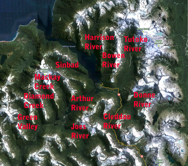
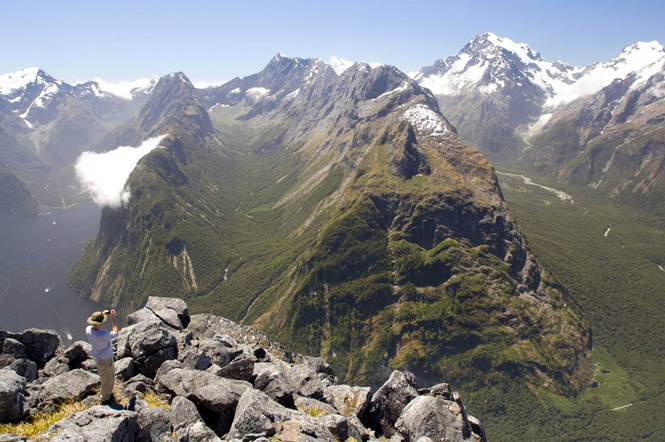
Milford Sound was not just a single glacier but a network of glaciers with a possibly overlying ice sheet. The map below shows the major glacial valley systems that joined the Milford Sound.
From the north east these include the Stirling valley, the Harrison valley system, the Bowen valley, the Tutoko Valley, the Cleddau Valley system, the Arthur River valley and its seven tributaries from the north and the Joes River valley system from the south, and Sinbad Gully.
In total the current day catchment is 540 sq km and many of these valleys start in cirques at 1,500m in the west and 1,500m to 2,000m in the higher Darran Mountains to the east.

View down the Talbot River from unnamed peak at 1655m. Lloyd Peak is on the far left; Castle Mount and Mt Elliot dominate the skyline at centre image. The Talbot River is a tributary of Joes River in aerial view above. Note the incredible steepness of valley slopes and striped patterning from tree avalanches. Also note the uniformity of peak heights. (From Danilo Hegg at Southern Alps Photography - click for link).

Mt Christina from the south. Note the distinct series of terraced cuts into the shoulder of Mt Christina suggesting the successive passage of glaciers of different heights and sizes. (from Danilo Hegg at Southern Alps Photography - click for full screen version at his site)

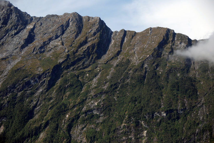
The waves of fractured and shattered aretes that lead to Castle Mount in Fiordland. (From Danilo Hegg at Southern Alps Photography - click for full screen version at his site)

The beautifully formed glacial horns of Mt Wilmur and Mt Elliot in north western Fiordland. (From Danilo Hegg at Southern Alps Photography - click for full screen version at his site)
The coming together of the glaciers of the Bowen, Tutoko, Cleddau and Authur valleys at the head of the Milford Sound with the addition of the Sinbad and large Harrison valley glaciers a couple of kilometres further on would have created a massive convergence of ice that perhaps explains the overdeepening of the Stirling Basin to a depth below current sea level of nearly 300 metres.
Not that this network of glacial valleys was carved out in one fell swoop or scrape. Rather the process of gouging and plucking took place over successive glacial advances and retreats through the different glacial periods over two and a half million years.
The amazing thing is that when you look at Milford Sound and the surrounding mountains and valleys the glaciation seems so recent and so fresh.
Successive glaciations
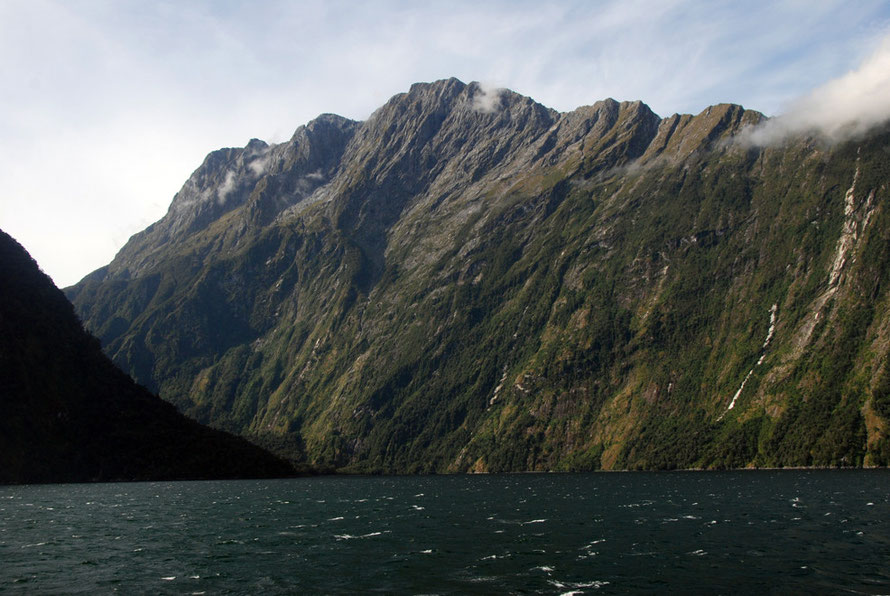
Each successive advance of valley glaciers progressively deepened and widened the valleys, lakes and fiords of Fiordland (Turnbull et al. 2010, Geology of the Fiordland Area, GNS p.5).
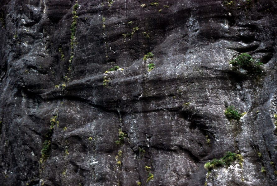
These produced the range of glacial features that are preserved in the hard rocks of the region - narrow aretes, armchair cirques and tarns, U-shaped valleys, fiords, glacial striations, roches moutonées, hanging valleys, striations, cavettos and the wonderfully named 'stichelwannen' - curved grooves formed by water under immense pressure underneath and at the sides of a glacier.

Other features associated with the hard-rock glaciation of Fiordland are the existence of glacial horns, mammillation of mountain top relief (the rounding of peaks and ridge tops - from the Latin mammilla for nipple - and the existence of remnant cirque glaciers, particularly in the Darran Mountains.
Fiordland appears to have developed an extensive ice cap, as the glaciers have rounded off the mountain summits, as well as scouring deep valleys westward to well below today’s sea level (Te Ara Glaciation).
Who knows how thick the ice was at the different glacial maximums?The Tasman Glacier, the biggest in the Southern Alps, is 600m thick in places in our current interglacial period. Was Milford Sound completely full of glacier - which would imply an ice thickness of nearly 2km - or did successive glaciers ride lower in the already gouged out valley?
Backwards eating glaciers
Recent work on Fiordland glaciation has come to some surprising conclusions. Using a technique called thermochronometry a team of University of Berkeley geologists have concluded,
that ... the rock currently on the surface [at Fiordland locations like Milford Sound] was about 1.5 miles (2 kilometers) underground when the glaciers began forming about 2.5 million years ago.
This work suggests that over the course of the successive glacial periods rock to the thickness of one and half miles/two kilometres has been removed. This can be seen to be the case in Milford Sound in as much as the Sound - from mountain top to undersea bottom is 2km deep.
Since then, the mountains rose as a result of tectonic activity, while the glaciers flowed downhill, scouring the landscape and gouging U-shaped valleys on their way to the sea.
They have also concluded that the fiord glaciers formed initially at their downstream mouths and that 'most of the valley-making occurred at the downstream mouths of glaciers' for 1m to 1.5m years'. After this the glaciers advanced up the valleys eating into their headwalls for another million years.
Shuster et al (2011) suggest that 'major changes to the mountain topography [of Fiordland] essentially stopped about half a million years ago.'
(See D.Shuster ,K, Cuffey, J.Sanders, G. Balco (2011) Thermochronometry Reveals Headward Propagation of Erosion in an Alpine Landscape Science 1st April 2011 p. 88.)
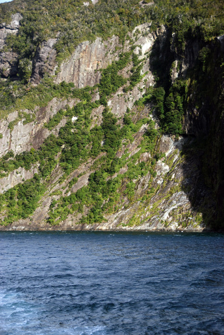
Because of the hardness of the plutonic igneous rocks of Fiordland (and perhaps due to less fragmentary subduction faulting - the Alpine Fault lies to the west of Fiordland) subsequent erosion by wind, water, winter snow and freeze-thaw action has not substantially altered the landscape left behind by the last glaciation.
In particular, the lower loads of gravels and sediments have not filled in the deep fiords and lakes of Fiordland (which have an average depth of 440m).
In the Fox Glacier region side valleys are eroded out by torrential streams and creeks. In Milford Sound and along the Milford Road those same torrents and streams pitch out into open air as spectacular waterfalls that cascade over the lips of cirques and cwms left by long-disappeared glaciers.

Geology
Fiordland is a distinctive geographical region: it is the largest area of very strong crystalline rocks in New Zealand - plutonic rocks such as granite and diorite, and high grade metamorphic gneisses. These were uplifted as a single block and subsequently heavily glaciated. It is a huge, broadly domed mountain mass.
Milford Sound is part of the Authur River complex of Mesozoic plutonic rocks. The Milford Road from the head of Lake Te Anau goes through the Darran I-type volcanic suite.
These rocks were intruded over millions of years in different episodes between 500 and 150 million years ago (MYA) when this section of the Zealandia sub-continent formed the eastern edge of Gondwanaland (GNS, 2010, p.28.)
Intrusion took place as individual and related groups of plutons that make up the different suites of plutonic rock in the region.
(Plutons are 'a body of intrusive igneous rock ... that is crystallized from magma slowly cooling below the surface of the Earth' Wikipedia.)

The intrusions along the Milford Road took place in two distinct periods (see summary diagram below from NZ GNS 2010).
The Authur River complex is part of the second oldest intrusion in Fiordland and took place some 350 MYA. The later Darran Suite was intruded 150 MYA.
The Authur River complex is formed of 'dioritic, gabbroic and minor granitic orthogneisses, metamorphosed in the Cretaceous to high-pressure amphibolite and granulite facies.' Just so you know.
'Orthogneiss' is gneiss - a metamorphic rock - that is derived from igneous, as opposed to sedimentary, rock.
Gneisses are rocks that have been recrystalised due to immense pressure and temperature deep underground. Some gneisses are so old they make Fiordland's 350MYA tag seem 'young'.
The Lewisian gneiss that forms most of the Outer Hebrides of Scotland contains rocks that are among the oldest in the world having been formed in the Precambrian period up to three billion years ago (see Wikipedia).
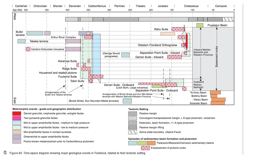
At Milford the complex is formed from Milford Orthogneiss which contains 'banded gabbroic, dioritic and quartz dioritic orthogneisses, with subordinate ultramafic orthogneiss bodies' (GNS 42). These were intruded in the Paleozoic and Mesozoic eras.
The Darran suite was emplaced in the 140 million year period spanning the Late Triassic and Cretaceous during a renewed period of Gondwana margin subduction.
The suite comprises ... gabbros and diorites with subordinate granitoids and minor ultramafic rocks, typical of Phanerozoic convergent margin magmatic arcs' (GNS, 2010 p.34).
('Ultramafic' in effect means rocks from the Earth's mantle - that part of the Earth between the crust and the inner core.)
From an engineering perspective the geology of Fiordland is critical - for road builders and dam constructors and tunnel borers for example. It can be summed up thus:
Fiordland [rock-types] are in general strong to very strong ... capable of supporting very steep slopes. Quaternary glacial erosion and present-day erosion processes ... of steep slopes and high rainfall have removed most surficial weathered material, so [exposed] plutonic rocks tend to be fresh and hard. (GNS, 2010).
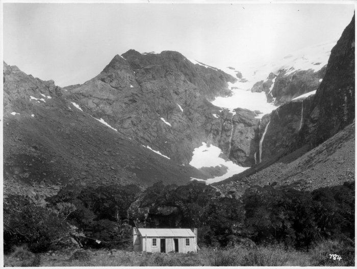
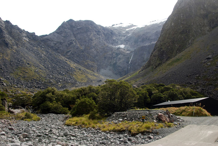
Spot the Difference: 1920s and 2010s
The sheer hardness of the Fiordland rocks was brought home to me by a strange coincidence. As we drove down the Milford Road in March 2014 I took as many photos as I could. One of these was of the Homer Hut near the eastern portal of the Homer Tunnel.
Months later as I was working on these web pages I came across a black and white photograph from the 1920s that was almost exactly the same. (See the Alexander Turnbull Library).
I was surprised just how little the scene has changed in nearly a hundred years.
The details of the rocks on the ridge lines are remarkably similar attesting to the slow pace of erosion in this area with over six metres of rainfall a year, much of which falls as snow above 1000m.
I was also interested to compare the colonisation of vegetation on the scree slopes in both photographs. This looks like it has changed little and again attests to the slow pace at this altitude at which the progression of plant species on the bare, hard-rock screes develops (see photos below).
To return to the main geological narrative, landslips are common on steep and over-steep slopes in Fiordland and facilitated by earthquake shaking. Rock weakness is increased where foliation (repetitive layering caused by differential shear pressure) and faulting are present.
Faulting was a particular issue in the Homer Tunnel because the faults allowed the ingress of thousands of litres per hour of freezing snowmelt water from above (see my Milford Road page).
Tectonic activity in Fiordland
Tectonic activity has taken place in Fiordland at varying intensities for over 400 million years as part of both the margins of the Gondwanaland supercontinent and much later as the Zealandia mini-continent were carried eastwards on the edges of the Pacific and Australian plates.
The Alpine Fault is the major area of tectonic activity in the modern era. Here the major forces are very oblique with dextral (right-lateral) strike-slip movement at rates up to 31mm/year.
That means that the Australian plate is slipping north-eastwards against the Pacific plate's south-westward slippage. At the same time the Australian plate is being subducted (forced under, submerged) underneath the Pacific plate.

In contrast to the Southern Alps where there is 10mm a year uplift and 10mm year denudation, the Fiordland Mountains are characterized by relatively low rates of uplift at 0.5-6mm a year (less than a tenth of the rate of the Southern Alps) and low rates of erosion.
Sediment yields of the Cleddau River near Milford Sound are approximately 600 tonnes per square kilometre per year compared to yields of over 30,000 t/km2/y in the areas of active glaciation further north on the West Coast.
(See Dykstra, J.L., (2012) The Post-LGM Evolution of Milford Sound, Fiordland, New Zealand, PhD Thesis, University of Canterbury p.13-17.)

This in effect means that New Zealand's fiords are not filling up quickly with sediment:
'Basin sedimentation rates for all the mature fiords of Fiordland (including Milford Sound) are extremely low by global standards, even compared to the fiords of Norway ... despite similar resilient bedrock geology, and little contemporary glacier cover,' (Dykstra, p.78).

This slow to very slow rate of infilling is largely accounted for by the fiords, 'relatively small catchments, lush forest growth, sediment traps in upstream lakes [Lake Ada on the Authur River, for example] and erosion-resistant bedrock' (Dykstra p.90).
However while water-borne sediment yields are low earthquakes develop different 'sedimentation processes', namely rock and landslips.
The influence of a tectonically active plate boundary on fiord sedimentation is clearly evident in the Fiordland landslide record, particularly at Milford Sound, where extreme topography combines with seismic activity to cause mass wasting; at least 30 very large (...) post-glacial landslides are preserved in the Milford catchment (Dykstra p.94).
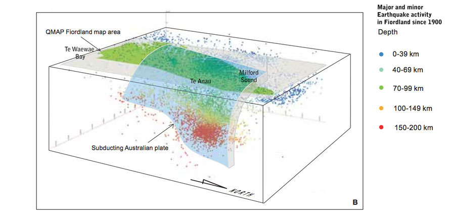
The presence offshore of the Alpine Fault creates large amounts of earthquake activity. Major Fiordland earthquakes occurred in 1938 at Charles Sound (Magnitude 7), in 1988 at Te Anau (M6.7), in 1976 off Milford Sound (M6.5), and in 2009 at Dusky Sound (M7.8). There was a 'strong' magnitude 4.3 earthquake off Milford Sound the month before we went there.
A pictorial image of the process of subduction and seismic activity is presented below from GNS 2010.
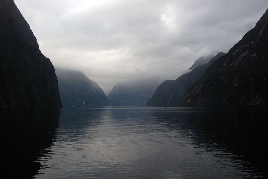
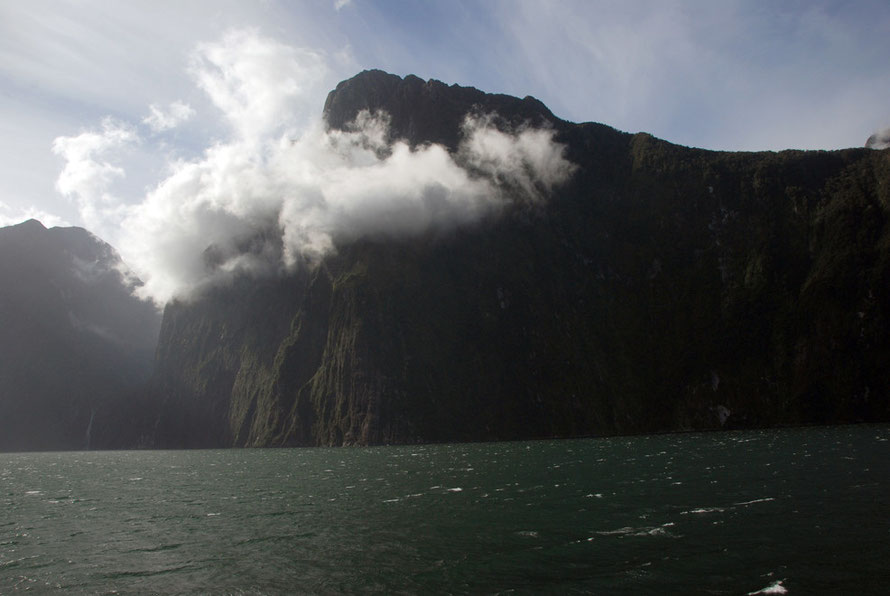
Looking at Milford Sound cast in deep shadow and wreathed in cloud the rock formations and topography look implacably resistant to change. Its brutal geography feels like an end point, a full stop after a titanic battle.
But the world around it is in a state of processual flux. Fiords are but a stage of a process that leads inexorably to another stage.
The dry valley ground out by successive glaciers and over-riding ice-sheets over millions of years becomes a lake or saltwater inlet in the inter-glacial periods as the ice melts and the sea level rises. In the inter-glacial periods and after the last glacial maximum (and who's to say another Ice Age is not on the way) the lake or fiord begins to fill up with sediment.
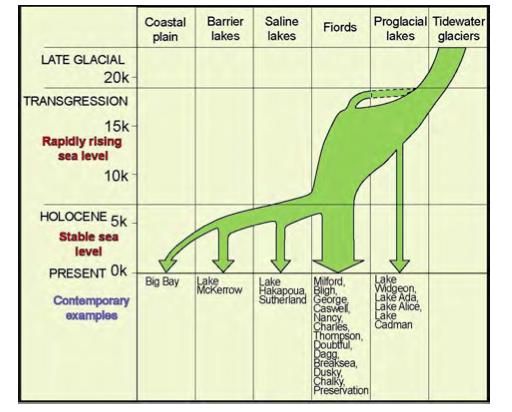
The retreating glacier itself leaves terminal and lateral moraines at various stages, depending on the speed of, and halts in, the retreat. Winter freeze thaw and year round water erosion do their bit. And in areas of seismic activity great landslides are loosed by earthquakes.
New Zealand's biggest documented landslide is the Green Lake slide that took place 13,000 years ago. This shifted 27 cubic kilometres of hard rock and covered an area of over 45 square kilometres (Te Ara).
Eventually fiords get filled in to become flat valley bottoms and coastal plains (see Dykstra's 2012 conceptual New Zealand evolution fiord model above). It's just a matter of time, of the development of the next stage in the constant flux and change on and below the Earth's surface.
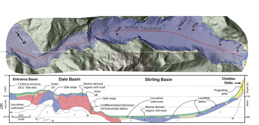
Dykstra's work for me is fabulous because it provides such clear images of the profile of Milford Sound underwater - something I had searched for without success on the Internet.
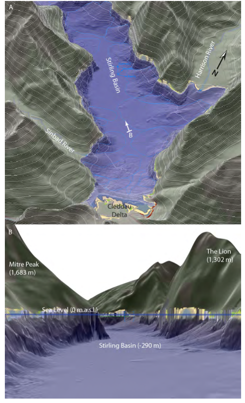
It shows the huge Stirling Basin which stretches from the head of the Sound northwards for 8km reaching a depth of nearly 300m. The bottom at the southern end slopes upwards to the Cleddau River delta with thick layers of landslide debris.

On either side of the Stirling Basin the mountains and their steep to oversteep to vertical walls tower over the fiord. The rock walls plunge down nearly 300m in places (see the vertical wall on the buttress of Mitre Peak and the wall of The Lion opposite in the bathymetric digital elevation model above).
The Stirling Basin comes to an abrupt halt at the inner sill which is made up of landslide debris and glacial till. Dykstra speculates that the retreating glacier came to a temporary halt at this point. Beyond this seaward the fiord is around 130m deep.
The Shape of the Milford Glacier
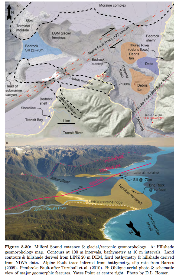
Dykstra's (2012) work on Milford Sound shows the extent - 4km approx - to which the glacier that formed the Sound reached out beyond the current entrance to the Sound (see diagram below) to the edge of the narrow continental shelf on the Fiordland coast.
This was possible because the sea level was 120m lower than its current level and the glacier's tongue was advancing over ground above sea level. The glacier left a massive terminal moraine complex that is now 55m under the Tasman Sea and lateral moraines that make up the seaward end of Yates Point. These have been aged at approx 18,000 YA (see p.170).

As the glacier retreated from its last glacial maximum 4km west of the Sound's mouth a pro-glacial freshwater lake was probably formed in the Entrance Basin.
As the glacier retreated further and the massive pressure of ice was removed from the towering walls of the Sound these became 'more susceptible to failure, with landslides contributing to thick units of diamicton [poorly sorted muddy/sandy sediments] which were left to blanket the underlying bedrock' (Dykstra p.174) .
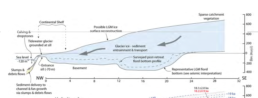

The glacier retreated further and left the sill that is apparent midway down the Sound between the Dale and the Stirling Basins. This would have been caused by a temporary halt in the glacier's retreat allowing the accumulation of a mid-point terminal moraine.
The early part of the retreat to Dale Basin probably occurred at a minimum rate of 2.4km per thousand years. Thereafter the rising sea level in the deep Stirling Basin would have created buoyancy-driven iceberg calving and a rate of retreat in the region of 8km in 500 years.

The landslide generated tsunami threat at Milford
Dykstra's study ultimately attempts to assess the risk of a landslide generated tsunami in Milford Sound. He suggests that the risks of a big earthquake causing a 4m high tsunami are real enough to undertake proper risk assessment of such an event. In Norway in 1934 41 people were killed by just such an event in Tafjord (p.249).
Using the example of a Norwegian fjord that is likely to experience a large landslip-generated tsunami (the Aknes mountain at Storfjorden) Dykstra argues for the development of sophisticated mathematical modelling and physical model based simulation of landslide and tsunami effects in Milford Sound.

A large Alpine Fault earthquake is due - it hasn't ruptured in 295 years and the recurrence cycle is approximately 330 years (p.260).
Due to the short distances between tsunami generation and centres of habitation such an event would leave almost no room for warnings, particularly as it is estimated waves could travel down the Sound at speeds of up to 190km/hour.
A quick search of the Internet suggests that not much has been put in place to meet Dykstra's recommendations.
These concerns are echoed in the Geology New Zealand report on Fiordland.
Tsunamis and more localised seiche are a high risk in Fiordland. 'A major rock fall into any Fiordland lake could have potentially disastrous results for lakeshore constructions and their occupants.'
(A seiche is a standing wave oscillating in a body of water - water sloshing in a bucket is a mini-seiche - National Ocean Service.)
Similarly underwater earthquakes along the Puysegur subduction zone could trigger rapid 4m high tsunamis. Catastrophic damage would only be likely where the fiord coast is settled - places like Milford Sound, West Arm and Deep Cove (Turnbull et al. 2010 Geology of the Fiordland Area, GNS Science pp.83-4).


Deepwater Emergence
The fiords of Fiordland were carved out some 20,000 years ago. As the ice melted and the glaciers warmed at their seaward ends they deposited vast quantities of moraine at the entrance of each fiord. These terminal moraines have formed a partial barrier to the ingress of saltwater. In most of the thirty fiords in Fiordland the circulation of water is confined to the top 20–40 metres. Below that the water can remain undisturbed for years.
Rainfall (up to 7.5 metres annually) is stained by tannins as it passes through the hanging forests and rotting leaf litter until it is the colour of strong tea. This discoloured and opaque freshwater forms a layer on top of the saltwater of the fiords.

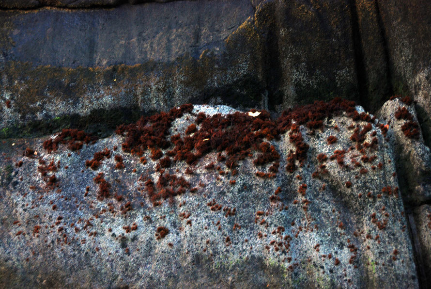
At times of heavy rain this can be 30ft deep. The discoloured water filters out light and constrains the growth of seaweeds. This allows encrusting and sessile animals like sponges and corals to flourish on the underwater walls.
These would normally need to live at deeper depths to thrive. One of these are black coral trees. There are reckoned to be some seven million colonies in the Fiordland area and some are 200 years old. Others are gorgonian fans and sea pens—strange, quill-shaped corals.
This is a phenomenon called ‘deep water emergence’.
'In the lower zone (15–40 metres) large sponges, sea squirts, corals, hydrocorals and lampshells (brachiopods) dominate the gloomy rock walls. Black coral grows in abundance in colonies up to 5 metres tall. Two sea cucumbers, the white (Ocnus species) and strawberry (Ocnus brevidentis) are found although the former is more common than the latter. Lampshells are ubiquitous and in some areas it is they can reach densities of 1,000 per square metre.'
'The large deep ocean and polar glass sponge (Symplectella rowei) is found at depths of 30–50 metres. Below this life thins out dramatically to 450 metres. Heart urchins and tube worms predominate to depths of 200 metres; below this, shellfish, heart urchins and crabs live in a muddy ooze like that at depths of 1,000 metres in the open ocean.'
(See Te Ara: Fiords).
Life in the fiords is governed by light, depth, the salinity of the water and the availability of rock walls.
'In the upper zone between the surface and 15 metres fresh water restricts marine life to that which is capable of living in brackish water down to 5 metres. This impoverished zone is dominated by green seaweeds (Ulva species), mussels, barnacles (Eliminius species), shrimps (Palaemon affinis) and the small cushion star Patiriella regularis.'
'Between depths of 5 and 15 metres the rock walls are encrusted with a diverse community of tube worms, sponges, soft corals, sea squirts and molluscs. A variety of starfish, urchins, sea snails and sea slugs predate on these. If rainfall is low and the freshwater layer thins big big 11-armed starfish (Coscinasterias calamaria) move up the rock walls to feast on mussels.'
There are over 150 species of fish in the fiords.
A species of brotula, a muddy brown, pin tailed, live-bearing fish has been named 'Fiordichthys slartibartfasti' in a nod to Douglas Adams’ 1978 radio series, The Hitchhiker’s Guide to the Galaxy.
Blue cod (Parapercis colias) and other fish have in many parts not learned to fear humans and will swim up to divers. The Jock Stewart/Red Gurnard Perch (Helicolenus percoides) and scorpion fish (Scorpaena papillosa) hang around on the bottom of the fiords occasionally in black coral trees.
The former is good to eat and caught as a bycatch in some fisheries or through bottom longlining (see Forest and Bird).
Quite why the Red Gurnard Perch is known as the 'Jock Stewart' fish is not clear. Robert Leslie Stewart was one of the last executioners in the UK in the 1950s and known as 'Jock Stewart'. Perhaps the bulging eyes of the perch are supposed to resemble the hangman's victims?

Conservation of the unique mix of marine life in the fiords has been hampered because the jurisdiction of the national park ends at the highwater mark. Threats come from commercial fishing in the fiords and growing pressures from diving and tourism.
Small marine reserves have been established and a group, The Guardians of Fiordland Fisheries and Marine Environment, was formed in 1995.
Made up of local people, the fishing industry and charter operators the group has been instrumental in creating the Sutherland Sound Marine Reserve, (recognised in the Fiordland Marine Management Act 2005), which ensures that 928,000 hectares were set aside as a special management area, and created eight new marine reserves.
It turns out the Sutherland Sound/Te Hapua Reserve is in a fiord with an entrance shelf that is too narrow to cross safely in a boat. To my cynical eye it's designation as a reserve of 449 hectares looks opportunistic as it was rarely visited, little studied and not a source of commercial fishing.
T
here is concern about the killing the golden Milford Sound goose but thus far it seems to be outweighed by commercial imperatives.
A report on 'The effects of commercial sea-surface activity in Milford Sound' was produced for Environment Southland by the University of Otago in 2006. It calls for a fuller research programme whilst noting some concerns to do with black coral die-back and sewage disposal, ship safety and the general pressure of numbers on Milford Sound.