
Whatipu and the West Coast Beaches

To Whatipu
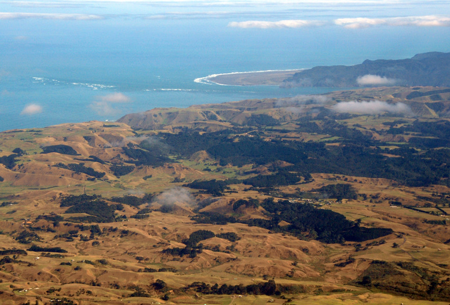
This was my first day of exploring around Auckland as the Principal prepared her classes at the University. I set out for Whatipu on the north-western edge of Auckland's Manukau Habour - a huge enclosed bay. I drove out through endless bungalows set in softly rolling hills and went through places like Avondale and West Lynn, the Titirangis, Woodlands Park and Parau.
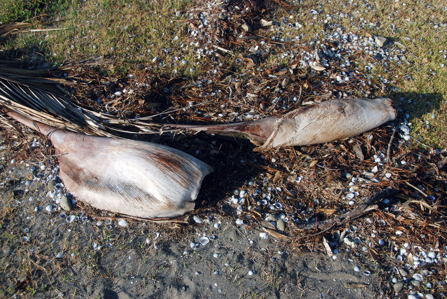
The roads got more winding and I plunged through deep shade and dazzling sunlight. I began to catch glimpses of the Manukau Harbour. I pulled off the road after half an hour into a little country park type place with the sun blazing and the air jam packed with cicadas calling. I stumbled around drinking it in - the dark bush, the blue water, the intensity of the light and sound, the dark sand and husks of Nikau palm leaves.
It was exhilarating to be out on my own, so far from home, in the exotic beauty on Auckland's doorstep. I had a few provisions, my camera and a tank full of petrol. And the sun was
shining.
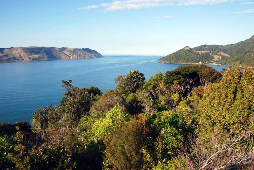
I drove own following side turnings when they appealed. I ended up high on a spur near the Spragg Monument with fabulous views over the Manukau Harbour's narrowing entrance to the South Head at
the end of the southern arm of the massive inlet.

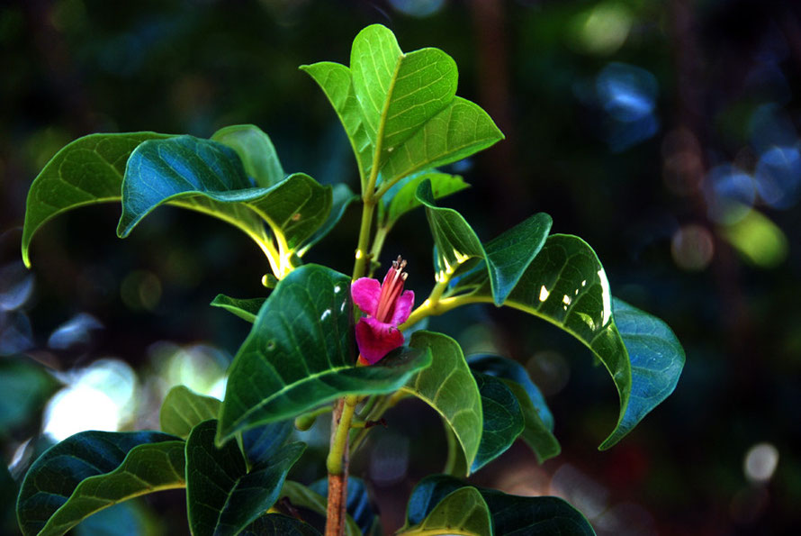
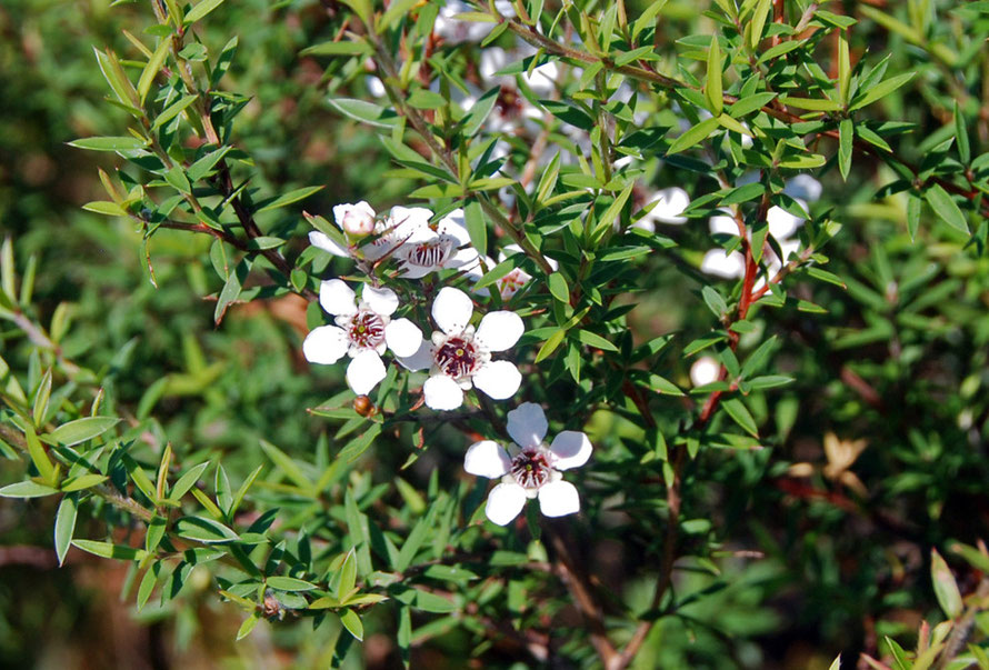
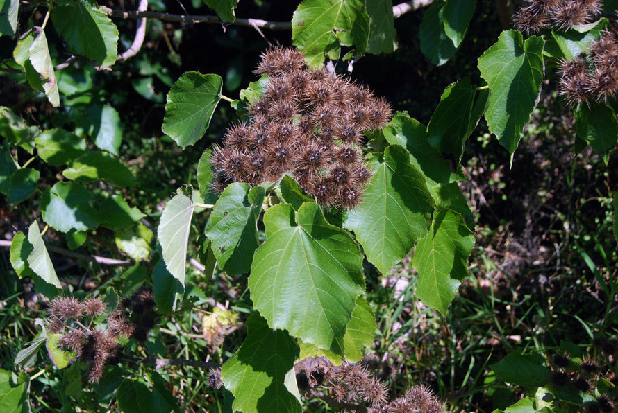
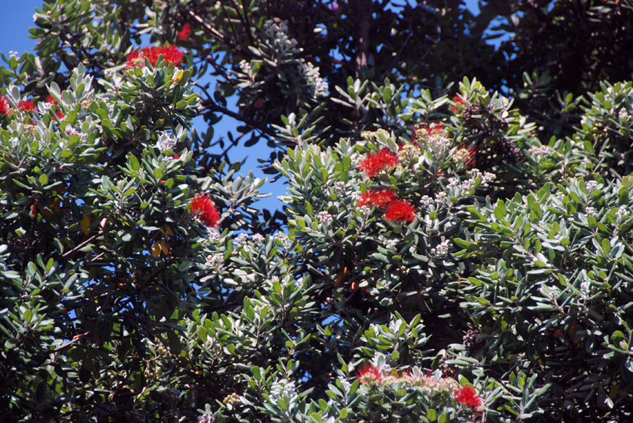
I stopped above Huia Bay - one of the last outposts on the northern shore of the harbour. Below the dense bush the water looked crystal clear. A delicious coolness lingered in the air. Some
exotic plant with a late blossom caught my attention. I snapped away overwhelmed by it all.
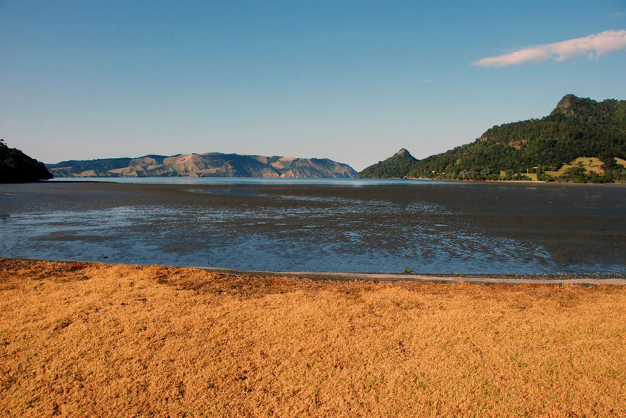
I drove down into Huia Bay which seemed idyllic. The calm blue waters, the exposed mud flats, the bush and hills rising behind and not a soul about. The tended brown grass frontage of the bay
spoke to a lack of rain but peace reigned after the bustle and brashness of Auckland's downtown streets.
I was relishing the thought of the next part of the drive out to Whatipu - 10kms of winding gravel road through the Waitakere Ranges that climbs past Mt Donald McClean (389m), the Puriri Ridge
and Destruction Gully. I didin't disappoint as a first small taste of the beguiling and at time terrifying emptiness of New Zealand, a country with a landmass bigger than the UK and a population
the size of Scotland.
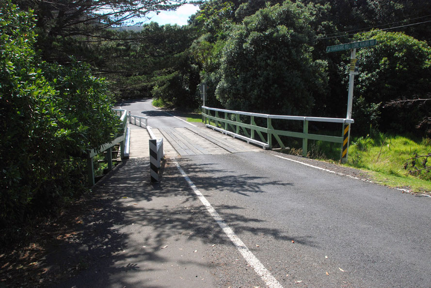
The road skirts, beautiful, tranquil Huia Bay and cuts inland at Kaiteke Point rising through neatly fenced paddocks with solitary Kanuka trees and the enclosing bush. Soon it is climbing in
earnest on a surface that seemed fine to me in the dry without another car or truck on the road. The bush - that is to me the indistinguished mass of trees and shrubs clothing the hills - closes
in on the road. It was, to say the least, absolutely effing brilliant.
The brilliant sun, the deep cool shade, the sound of the wheels crunching on the graded road, glimpses of gnarly purple mountains, a forest of glittering tree ferns, the glint and glisten of Huia
Bay receding and then suddenly a glimpse of the Tasman Sea - the breaking surf etched dazzling white against the deep ultramarine sea stretching away and away to the distant
horizon.
Although the road only climbs 200 metres the enclosing forest and its remoteness make it seem much higher. It runs along Puriri Ridge above Destruction Gully before making its descent down to uninhabited Whatipu and its flats, dunes, beaches, marsh, lagoons and treacherous rocks.
The human
remains of a man were found in Destruction Gully in 2005. He had been missing for four years and was assumed to have had an accident while fishing in the Manukau Harbour.

Whatipu
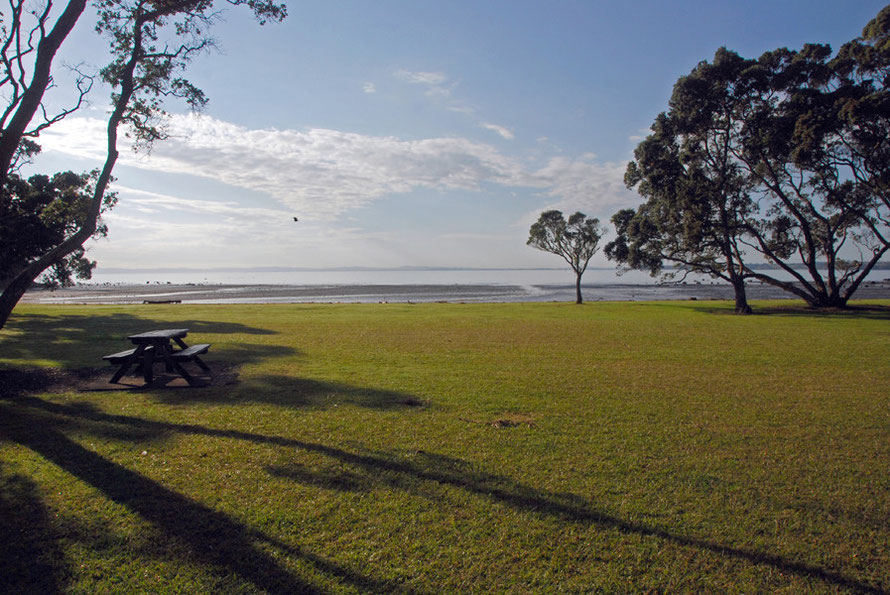
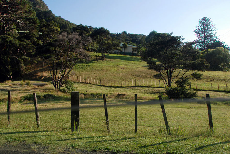
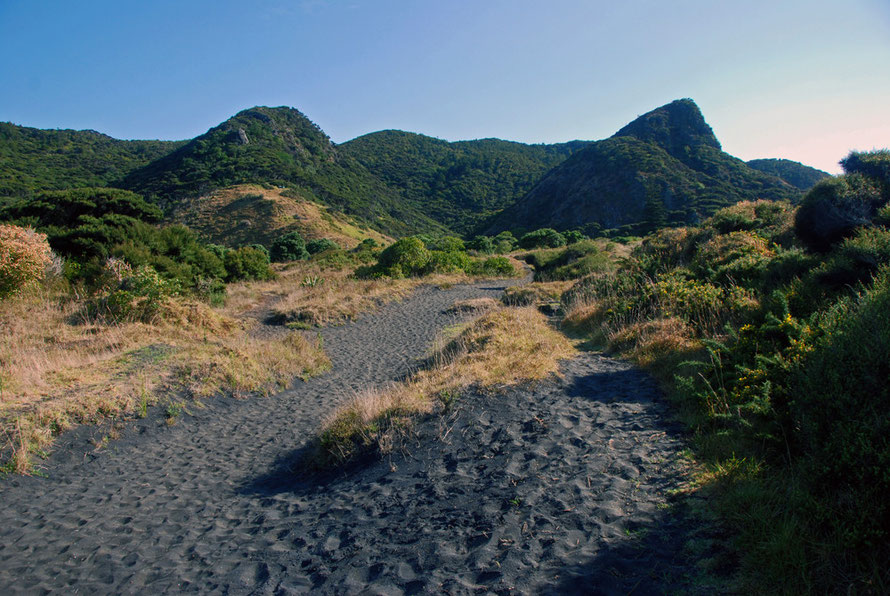
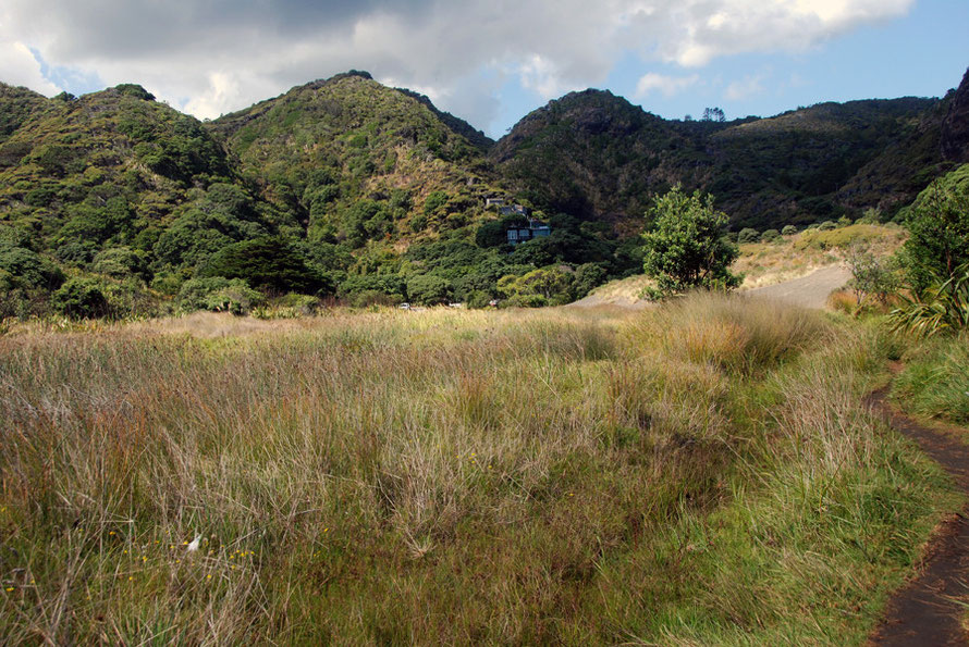
It was much hotter when I clambered out of the Nissan Bluebird in the little car park at Whatipu Lodge. And almost entirely deserted but for two young women packing up a tent on one of the emerald green paddocks that border the extensive marshes.
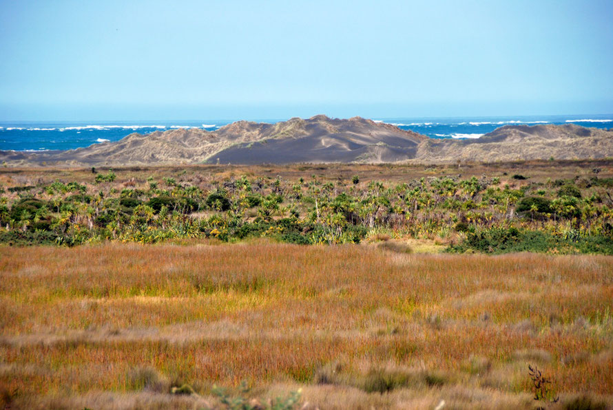
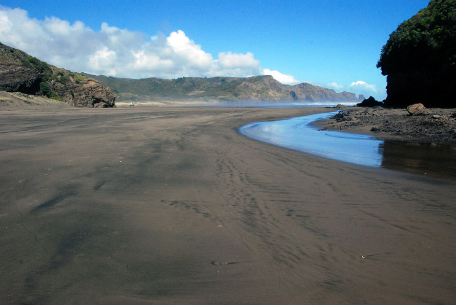
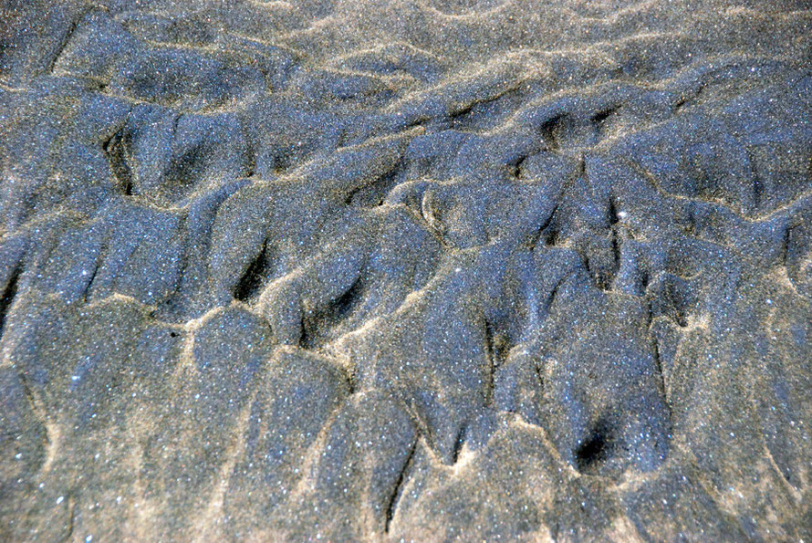
I stuffed a few things into a bag, nudged the car under what shade was going, crossed a bridge over a crystal clear dyke and scuffed my way into the black sand towards a low brow that promised to give a view of the roaring Tasman Sea.
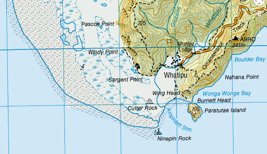
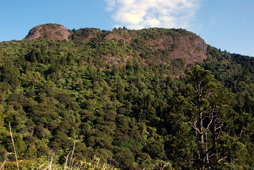
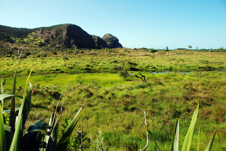
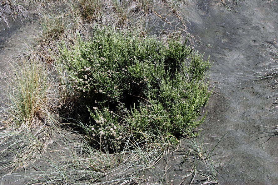
The topography of Whatipu is formed by the accumulation of masses of sand over thousands and thousands of years. Low dunes have built up to block off the streams that flow out of the Waitakere
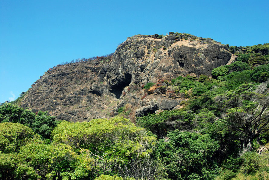
Ranges to form a series of marshes and lagoons. These butt up against the old cliff line of the Ranges which contains some small caves.
The Waitakere Ranges are formed from >>>

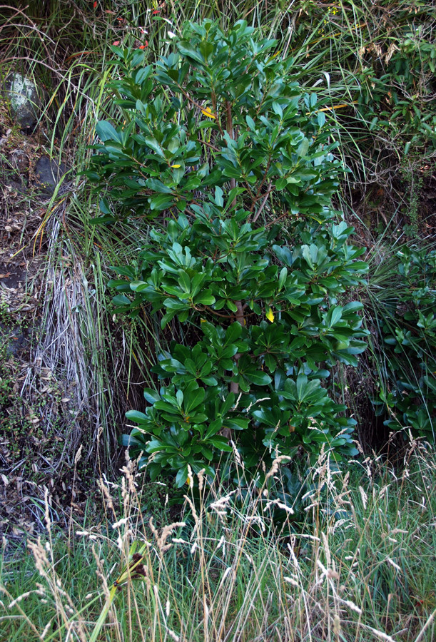
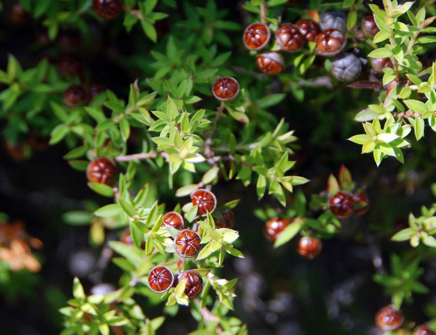
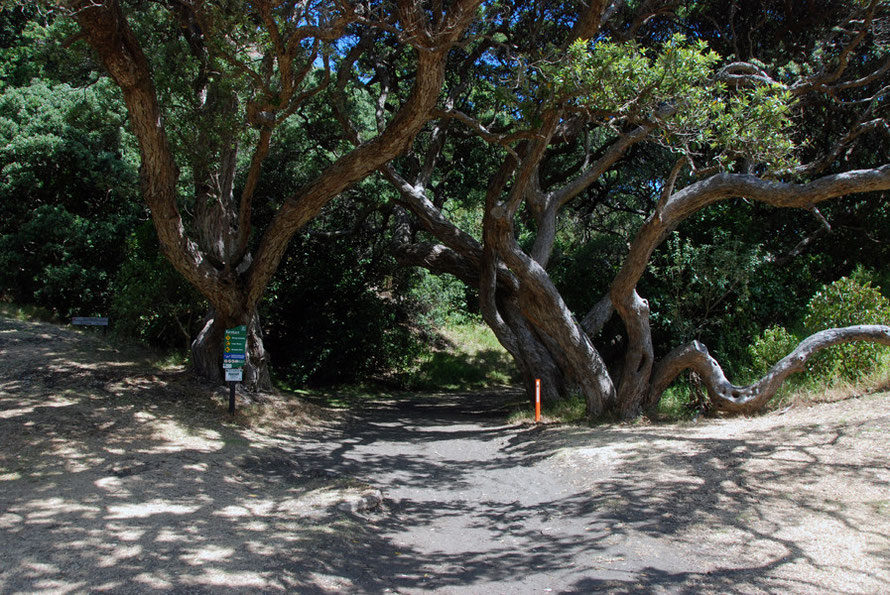
The marshes where on their landward side are drying out and covered in a thick growth of New Zealand Flax Harakeke (Phormium tenax), tī kōuka (cordyline australis - Cabbage Trees), Kanuka
(kunzea ericoides), European Gorse and possibly Puriri (vitex lucens).
The vegetation grows thick and high and would be disorienting but for the well-trodden paths through it.
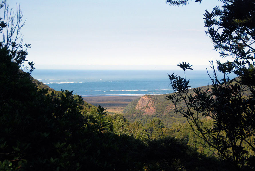
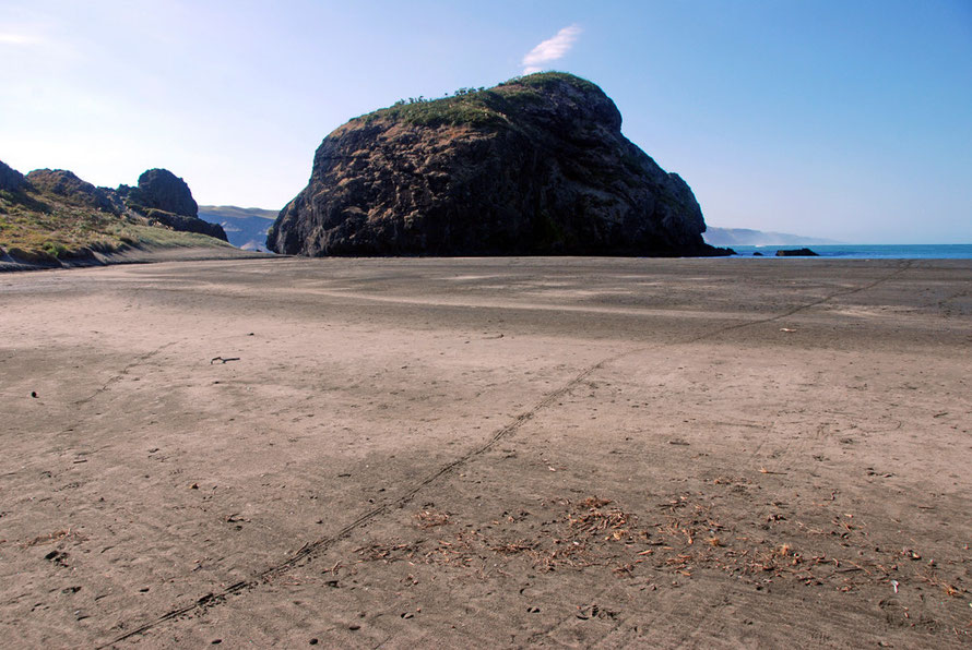
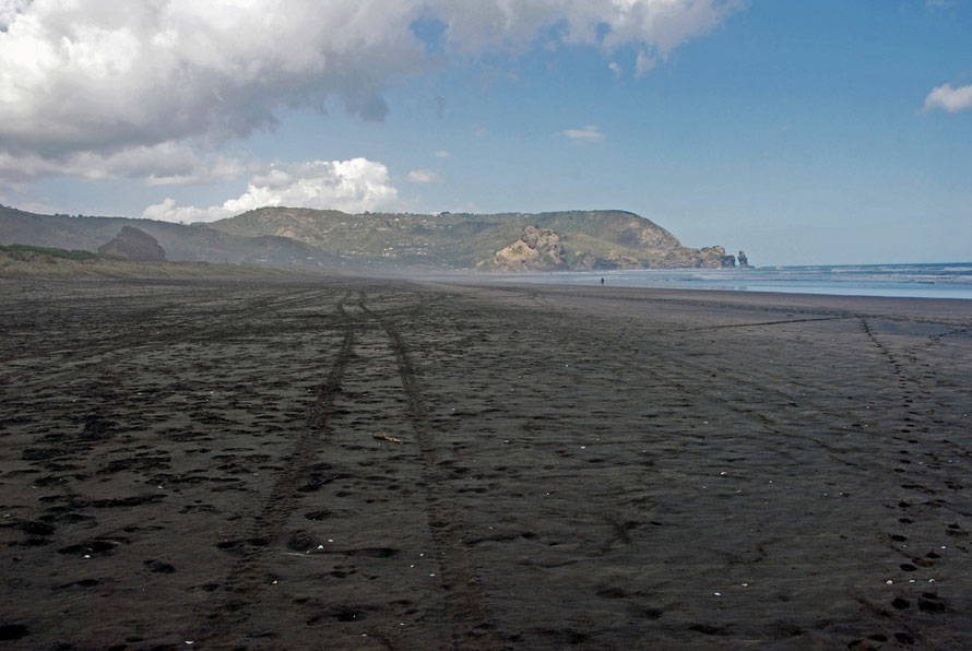
The air was so fresh and clear, the light scintilating, the breeze clacked through the harakeke/flax blades and the path soon opened out onto a vast expanse of black tidal sands. Far off the surf
was booming in.
There is a treacherous bar at the mouth of the Manukau Harbour where it meets the Tasman Sea. Fierce currents are created by tidal flows out of the huge expanse of the 'harbour' and these run into the destructive surf coming in off the 1000 mile wide Tasman Sea. Its a grim place on a bad day and in December 2014 two men drowned and three were rescued when crossing the bar.
New Zealand's greatest maritime disaster also occurred here when HMS Orpheus was sent from Australia to assist in the New Zealand Wars. A mix-up with charts, orders and signals led the ship to ground on one of the sand bars. Turning sideways onto the surf the ship was gradually sunk and stoved in with the crew being washed overboard or taking refuge in the ship's rigging.
A local ship, the Wonga Wonga attempted to rescue the young sailors - the average age of the crew was just 25 - but in all 189 of the 259 crew died. Ironically, given that we had been to the
place named after it the day before, part of the surviving crew was transferred to the HMS
Miranda.

Local Maori claimed that the wreck was caused by a settler felling a nearby and sacred Puriri tree for fence posts. Whether or not this contributed to the disaster it is indisputable that the HMS Orepheus was part of the British military build-up that was used to crush the Maori uprisings of the 'New Zealand Wars.' (Fro more information see Wikipedia: HMS Orpheus).
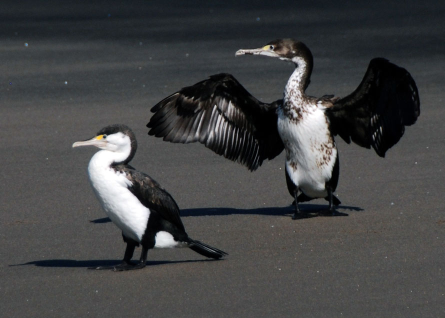
I walked slightly warily out across the big expanse of wet, dark sand. Down by the waters edge a pair of Pied Shags was standing drying their wings and taking in the scene. They let me approach
nearer than I though they would their brilliant white plumage brilliant in the strong sun.
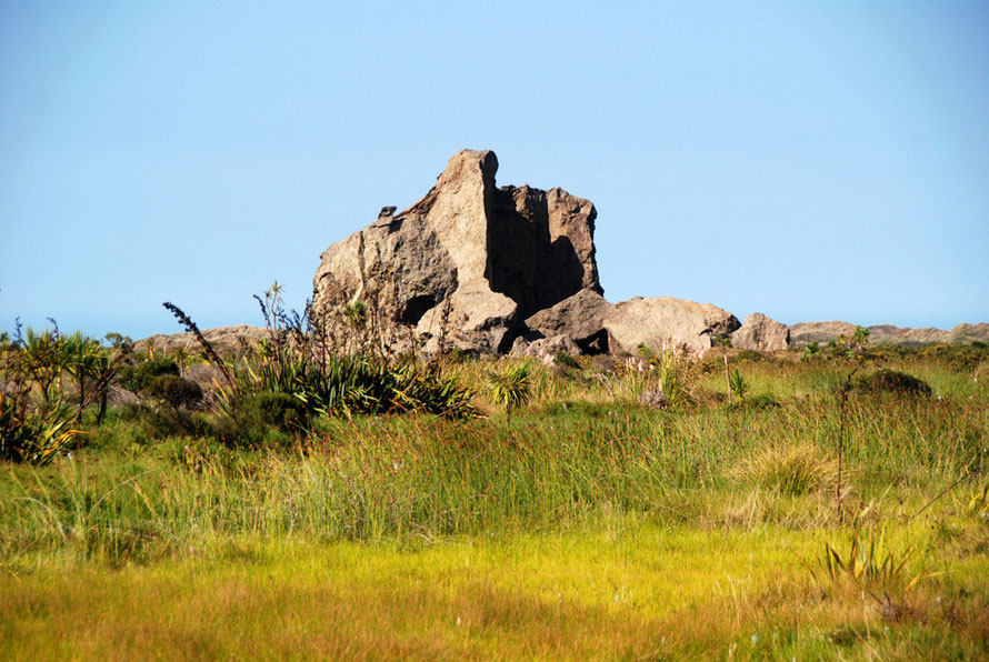
The sand seemed strng and solid and not about to swallow me. However, I later read that when the tide is running a deceptively narrow channel runs between Ninepin Rock and the beach and it is easy to step into holes caused by the fast current that runs through the gap and
be swept out to sea. Apparently the sea around the rock is a great spot for fishing and is also frequented by large sharks.

I strolled back through across the beach to look at some of the large driftwood logs before returning through the lush coastal vegetation and following another path signed to the Gibbons
Track.
This lef through luxurious paddocks edging the deep water channels running through the marshland. A pair of Pukeko, one with chicks, was very vocal as I passed. The Pukeko/Purple swamphen
(Porphyrio porphyrio) is known for living in social groups sharing one nest and the caring for their collective offspring.


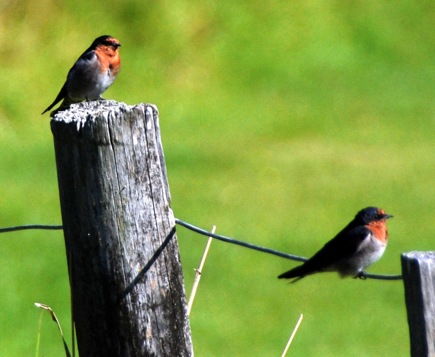
A couple of Welcome Swallows (Hirundo neoxena) were flitting about catching insects over the lush grassland. These birds are self-introduced from
Australia and have grown massively in population since the 1960s. Apparently they were closely closely monitored by bird-watchers and led to 'perhaps the most amusing title ever penned for a New
Zealand bird publication – Barrie Heather’s 1956 short note ‘Welcome swallow at Farewell Spit’ " according to NZ Birds Online.
I followed a path that ran under the old cliff line of the coast with the vast marsh land stretching out on the seaward side. The sun was strong and hot but I wanted to explore a bit further in
this new land.
Most of the time I was sunk down below the marsh vegetation and could see the brilliant greens of the lush marsh grasses but As I neared one of the caves a mound gave me a view across the marsh
to the distant dunes and the distant surf line and the dazzling blue Tasman Sea.
The absence of other people, the dazzling light and the vast expanses of sea, sky and vegetation gave me a sense what it might have been like to have pitched up on the coast of New Zealand back
in the twelfth/thirteenth centuries. Of course it would have looked different then with the Giant Moa roaming around and the absence of the plants and animals that came with Maori and later Europeans.
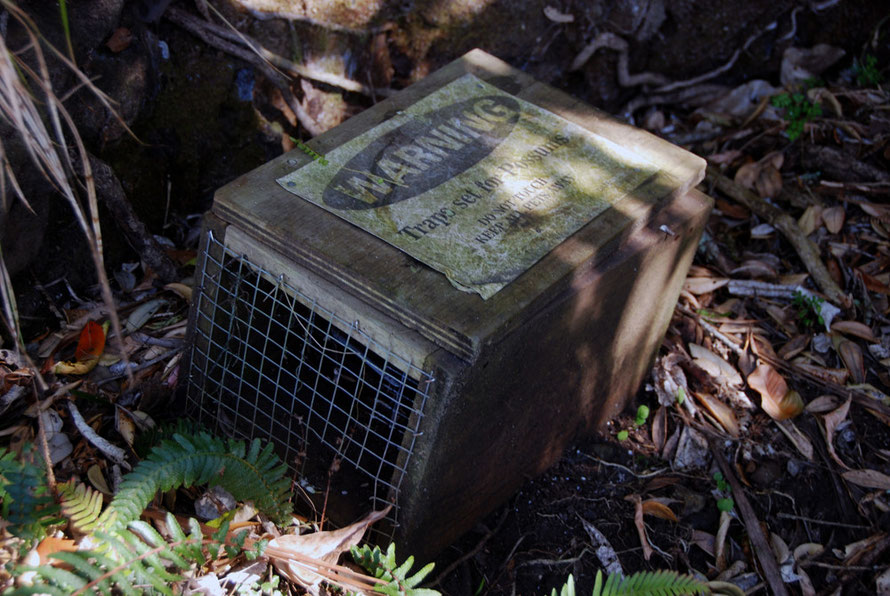
But that feeling didn't last very long. First I came to signs telling me that the area was being protected from Kauri dieback and I dipped and scrubbed my boots in the facility provided. Then I
passed a box trap set for possums and signs telling me to beware of poisons laid for other pests.
Strange as it seems now there was once a timber mill and tramway at Whatipu in 1867 that was used to exploit the endemic Kauri forests of the area. These had been exhausted twenty years later and
the mill closed. The tramway ran from Whatipu north along the coastal flats to Piha and Anawhata beaches.
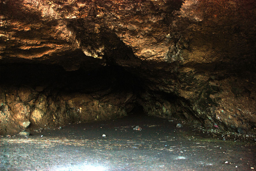
One of the caves of the undercliff was used as a makeshift dance hall with a laid wooden floor. The cave entrances looked pretty dodgy to me with a lot of loose conglomerate rock above
them. Nevertheless I ventured inside to listen to the echo of the distant surf murmuring in them. There is a small camp site at one of the caves with a composting toilet and no water run by
Auckland Council.


To Piha
Anyone normal might have now thought of returning to Auckland to catch up on some sleep and chill out. But not me. As for much of our time in New Zealand I felt driven to pack as much into each day as I possibly could. I just dad the sense that this was probably going to be the one and only time I would be in New Zealand and that I needed to make the most of it.
I drove back along the winding gravel road, through Huia hwere I should have stopped at a nice looking cafe, and along miles more winding roads til I turned off along the Scenic Drive and the
Arataki Visitor's Centre.
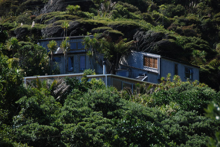
Here the roads run along the ridgetops of the Waitakere Ranges and fabulous looking houses are set back in the semi-cleared bush. Occasionally vistas opened up looking down on the vast sprawl of
Auckland.
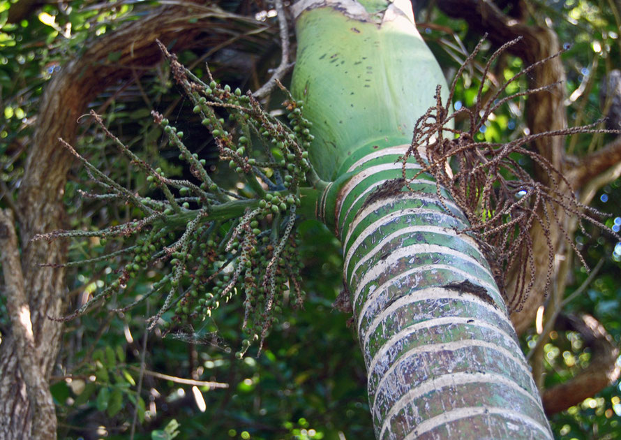
I stopped at the Atakari Visitor Centre feeling in need of some human contact but there seemed precious little on display. I bought a can of fizzy drink from a kiosk and took a few photos of the
native trees growing around the centre. But I was fading and pushed on along more serpentine roads for the beachside settlement of Piha.
The road down to Piha suddenly descends off the edge of the wooded hills in a most precipitous manner. On either side are little holiday homes - baches - cut into the steep slopes. Once it was
probbly far enough from Auckland to be a sleepy little surf shack kind of place but it felt like that was changing.
The views down to the sea and the big beach and its Lion Rock were spectacular but it was tricky to stop. I pulled along a side road but I couldn't get clear views for a photo. I ended up driving
down through the place with its school and cafe to the north end of the beach.
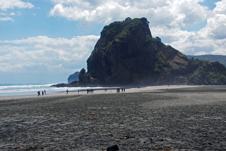
Although it was spectacular it also had for me a rather gloomy feel: hedged in by the hostile mountains, the big expanse of black sand felt utterly exposed to the harshness and perfidy of the
wild Tasman Sea. It was very unlike Cornwall and felt more like some of the wild Portugese surf beaches with their pounding heavy waves.
I drifted around and took a few photos but the beach felt endless and the jet lag was really starting to thrum in my head. I needed coffee and food. I went back to the cafe I had passed and
pulled off along with a lot of other cars.
Now in the mists of time I struggle to remember what I bought but the coffee was good - as it invariably is in New Zealand - and the staff were friendly and and I pushed on to find somewhere with
a view to eat.
This time I went to the southern end of Piha and parked up and took my big steam cleaned walking shoes off. Which was a bloody mistake. With my coffee and brown bags I walked out onto the black
sand. It was glistening in the sun, the quartz and mica shining and dazzling.
At first it seemed OK, warm but not too hot. But then suddenly it felt as if my feet were on fire and that I had sauntered out stupidly onto a hot plate. I rather inelegantly sat down on some
marram grass and pretended nonchalance.
I sat and munched and drank and took a few photos and wondered how I was going to get back to the car. I had this image of having to wait until sundown to cross the boiling sands. I went through the same procedure of ' this ain't to hot' to 'this is bloody agony'. I guess the locals had seen it all before a thousand times but it must raise a wry smile.
The Welcome to Piha website describes the sand thus: 'Black sand, burns your feet in summer, dries to a crunchy biscuit crust, piles up in the crutch of your togs, gets everywhere'.
Karakere Beach (The 'Piano' Beach)
As if I had not had enough I then drove up and over the hill to Karekare Beach which is a much less built up place with a luscious valley of shady high growth leading down to a small river and a sandy path out to the beach where the landing scene from 'The Piano' was filmed. It was hard to imagine Harvey Keitel and Holly Hunter out here but the beach proved fantastically open and desolate and I kept my shoes firmly on.
Huge clouds were piled up in the flawless blue sky. A few people were on the beach but its immensity diminished them into little Giacometti figures blasted by the sun. The surf looked raggedy and strong and the sea seemed to claw at the beach, impatient with the impediment of land. It looked a place of rip currents and danger and I felt no desire to get in it.
I didn't know it at the time but the West Coast ranges had been intensively logged out to provide timber for growing Auckland. I guess that is why the road I left Karakere was called 'Lone Kauri Road' - it was literally the last Kauri standing one assumes.
I also didn't know just how geologically active New Zealand is. In the UK we are a long way from any active fault line - they occur in Iceland and the Mediterranean although the great process of mountain building to the south is relatively dormant. But much of New Zealand straddles a very active meeting of tow of the world's great tectonic plates. Active mountain building is intense along the Alpine Fault in the South Island and seismic activity can be devastating. This is a young country still in turmoil and added to that it is surrounded by a vast, limitless ocean to the north, south, east and west that bring cyclones and some of the heaviest annual rainfall in the world.

Put on top of this geological youth and isolation in great masses of water the very, very late arrival of humans to New Zealand in the twelfth and thirteenth centuries. No wonder it feels raw,
lonely and brutal at times.
So the beaches of the West Coast even close to Auckland have a wildness that I've not experienced before. Even in the hardest parts of Scotland or the most exposed parts of the Cornish cost there
is the sense of a settlement of accounts, of an equilibrium, that sure can produce harsh, destructive and violent forces but even these seem to be contained, known.

In New Zealand the West Coast feels a dangerous place even standing on the beach. The surf crashing in or far out on bars and rocks carries a menace I've not felt before. The beaches with their piles of drift wood ripped from steep forests by tree falls, avalanche and an intensity of rainfall that Europe simply does not know are testament to something on a different scale of 'elemental'.

The Beach at Karekare is patrolled in high season by the volunteer lifesavers of the Karekare Surf Life Saving Club which has a clubhouse above the highwater mark. The
Wikipedia entry for Karekare says,
The rips along this section of coast are very unpredictable and can shift with little warning. They claim many lives despite the efforts of lifeguards. Most of these drownings, however, occur after lifeguards are off duty or after rock fisherman wearing heavy clothing are washed off rocks, out of sight of the lifeguards.

A river runs into Karekare beach and forms a little lagoon on its northern side - I seem to remember this had a sign about sinking sand (this was actually at Bethells Beach further along the
coast). I clambered along the dune edge to get back to the car although I was eventually force by scrub to wade through the lagoon - with no mishap I am pleased to say.
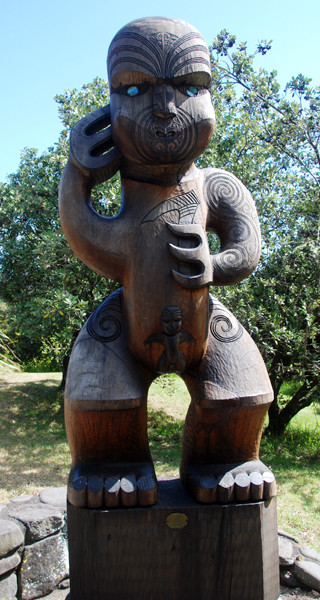
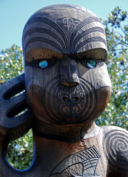
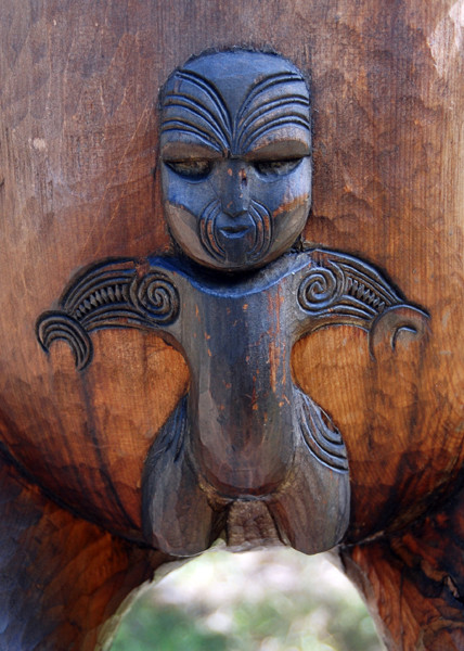
By the river at a picnic site was one of the better contemporary Maori wood carvings that I saw in New Zealand - with its simple but massive body, clean proportions and beautifully incised
lines.
I set off back for central Auckland to catch up The Principal and make her some tea and pour the wine. It had been a long day but I couldn't resist following narrow, steep, winding Lone Kauri
Road back to the main road at the top of the hill. It was then a long drive in rush hour traffic once I'd linked into the motorway leading back to the Central Business District and our
hotel.

Te Henga/Bethells Beach
Later during our stay in Auckland as The Principal's work came to an end I took The Judge and Jury - the Principal's sister and husband - out to Bethell's Beach which lies to the north of Piha. There are a few shots from that trip below.


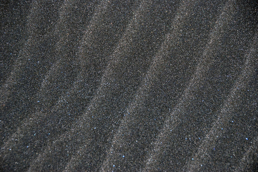
The black sands of the West Coast beaches actually stretch for 480 kilometres from Kaipara Harbour 60 kms north of Auckland down to Whanganui near the bottom of the North Island. To be more
precise the black sands are actually black ironsands and have played a significant part in New Zealand's industrial development as well as filling up the swimming togs of many generations of New
Zealanders.

The ironsands contain a mineral called titanomagnetite that formed as crystals in the volcanic rocks of the North Island's many volcanoes. Once eroded out of the volcanic lavas the titanomagnetite is carried by rivers to the sea as sand where over thousands of years it has accumulated and been carried northward by the winds, tides and predominant swells.

Many attempts were made in the late 19th century to smelt the iron oxides out of the rich black sands but these ran into two problems: firstly, the sand blew around in the furnaces and soon
blocked air holes and, secondly, the smelting process formed a by=-product of sludgy titanium slag that blocked the pour holes in the furnaces.
It was not until the advent of the electric arc furnace that the commercial exploitation of the ironsands became viable. In the mid 1960s a steel mill was set up on the edge of the Manukau
Harbour 60 km south of Auckland at Glenbrook to produce iron and steel from New Zealand's abundant and rich coastal ironsands (see Te Ara: Iron
and Steel).
The main source of sand is the huge quarry on the north side of the Waikato River mouth. According to Te Ara,
Waikato North Head has more than one billion tonnes of ironsand reserves that contain at least 33.8% titanomagnetite, the main iron mineral in the sand, and are estimated at 74 million tonnes. These will yield 19.4 million tonnes of concentrate containing 59% iron.
The iron-rich sand are further concentrated by gravity and magnetic separation. The waste sand is returned to the mined area and re-contoured into dunes and planted in pine forest. While the concentrate is mixed with water and pumped 18 kilometres to the Glenbrook steel mill.
Ironsands are also dredged at Taharoa south of the Waikato River mouth and pumped out to waiting bulk carriers for export ptimarily to Japan.
