Coasts and Oceans (11 pages)
Update February 2013
Some months after putting together a lot of the photos and writing on South Africa I have come back to it. It is nearly a year now since I visited Cape Town and the Western Cape. Looking back on what I have put up on the site I am dissatisfied.
I seem to have chopped and fragmented my experience into a lot of different themed segments – oceans, fynbos, animals, hsitory, townships. I did this in part because I was trying to get away from a ‘diary’ approach that goes ‘and then, and then, and then.’ But I have lost something of the experience of being in the place. I feel this particularly with the sections on the Cape Peninsula and the Cape of Good Hope, or rather the large national park that is now confusingly called Table Mountain National Park, a part of which covers the southern end of the Cape Peninsula.
I’ve gone back to my photos, and reselected and reprocessed them. The light is so strong on the Cape that photos get very ‘contrasty’ between the brilliant clear highs of the blue sky and crashing waves and the dark shadows cast by the sun. I’ve made efforts to reduce that and bring the colours back to the way I remembered them. Then I’ve re-ordered the photos to hopefully give a sense of moving around the park.
I feel torn between presenting individual photos with careful captions and putting them together in a slide show. On the next page I’ve opted for a slide show because I wanted to give a sense of what it was like to be there. Of course, what is not in the slide show is the noise and smell of the place. I’ve gone into some of that elsewhere.

Map of South African Coasts
I have organised this section of the website around the georgraphy of the coast of the Western Cape. The pages of individual locations go from east to west and from the Indian Ocean to the Atlantic Ocean - from the Whale Coast - on the eastern side of False Bay - around the Bay to the Cape in the West and then up the coast north to Cape Town and further north to Langebaan.
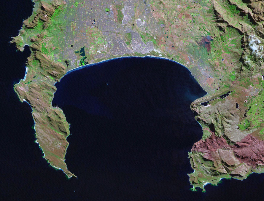
Here are three maps and a Landsat image of the Cape Peninsula and False Bay.
Below this mapThe rather nifty interactive map below shows where these pages are within the geography of the Western Cape. To use it:
- click on a red place marker
- click on the text displayed (which will take you to the page while keeping the map page open)
- or click on the 'x' to close the box
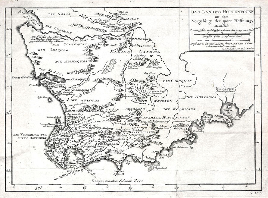
Below this map is a reproduction of the German edition of the 1757 Bellin Map of South Africa and the Cape of Good Hope. And below this a Landsat image of the Cape Peninsula and False Bay.
Interactive map of Coast and Oceans pages on this site
German edition of the 1757 Bellin Map of South Africa and the Cape of Good Hope (Courtesy Wikimedia)
Landsat image of Cape Peninsula and False Bay